Directions to Ponte Rio-Niterói (Rio de Janeiro Region) with public transportation
The following transit lines have routes that pass near Ponte Rio-Niterói
 Bus: 2100D (EXECUTIVO), 2740D (EXECUTIVO), 755D, 775D, VAN M559.
How to get to Ponte Rio-Niterói by bus?
Click on the bus route to see step by step directions with maps, line arrival times and updated time schedules.
Which bus lines stop near Ponte Rio-Niterói?
These bus lines stop near Ponte Rio-Niterói: 2100D (EXECUTIVO), 2740D (EXECUTIVO), 755D, 775D, VAN M559.
What time is the first bus to Ponte Rio-Niterói in Rio de Janeiro Region?
The 520 is the first bus that goes to Ponte Rio-Niterói in Rio de Janeiro Region. It stops nearby at 3:16 AM.
What time is the last bus to Ponte Rio-Niterói in Rio de Janeiro Region?
The 740D is the last bus that goes to Ponte Rio-Niterói in Rio de Janeiro Region. It stops nearby at 2:45 AM.
See Ponte Rio-Niterói, Rio de Janeiro Region, on the map
Public Transit to Ponte Rio-Niterói in Rio de Janeiro Region
Wondering how to get to Ponte Rio-Niterói in Rio de Janeiro Region? Moovit helps you find the best way to get to Ponte Rio-Niterói with step-by-step directions from the nearest public transit station.
Moovit provides free maps and live directions to help you navigate through your city. View schedules, routes, timetables, and find out how long does it take to get to Ponte Rio-Niterói in real time.
Bus: 2100D (EXECUTIVO), 2740D (EXECUTIVO), 755D, 775D, VAN M559.
Want to see if there’s another route that gets you there at an earlier time? Moovit helps you find alternative routes or times. Get directions from and directions to Ponte Rio-Niterói easily from the Moovit App or Website.
We make riding to Ponte Rio-Niterói easy, which is why over 1.7 billion users, including users in Rio de Janeiro Region, trust Moovit as the best app for public transit. You don’t need to download an individual bus app or train app, Moovit is your all-in-one transit app that helps you find the best bus time or train time available.
For information on prices of bus, costs and ride fares to Ponte Rio-Niterói, please check the Moovit app.
Use the app to navigate to popular places including to the airport, hospital, stadium, grocery store, mall, coffee shop, school, college, and university.
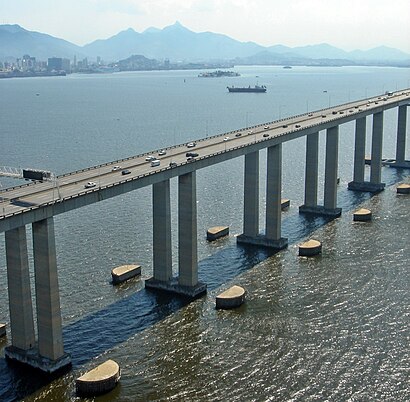
Ponte Rio-Niterói Address: Pte. Rio-Niterói, Niterói - RJ, Brasil street in Rio de Janeiro Region
- marinha,
- Base Naval do Rio de Janeiro,
- Ponto de Ônibus - Mocanguê,
- Rodovia Governador Mário Covas Próximo ao 303-313,
- Ilha Do Mocanguê,
- Banca de Jornal BNRJ,
- Complexo Naval do Mocanguê,
- Ilha Mocangue Grande,
- Base Almirante Castro e Silva - BACS,
- Rua México,
- Ilha de Mocanguê s/n,
- COMENCH,
- Caaml,
- UMEsq - Unidade Médica da Esquadra,
- Barca Niterói,
- NDCC Almirante Saboia,
- Estaleiro Mauá,
- C E Zuleika Raposo Valladares,
- Parque dos Patins,
- Navio Veleiro Cisne Branco
Places Near Ponte Rio-Niterói (Rio de Janeiro Region)
- Feirão De Malhas, Duque De Caxias,
- Museu Do Amanhã, Centro,
- Hospital Municipal Ronaldo Gazolla, Acari,
- Avenida Venezuela 134, Saúde,
- Norte Shopping, Cachambi,
- Niterói, Niterói,
- Shopping RioSul, Botafogo,
- West Shopping, Campo Grande,
- Rua Licínio Cardoso, São Francisco Xavier,
- Shopping Rio Sul, Botafogo,
- Hospital Pedro Ernesto, Vila Isabel,
- Shopping Downtown, Barra Da Tijuca,
- Shopping Nova América, Del Castilho,
- Rodoviária Novo Rio (Rodoviária do Rio de Janeiro), Santo Cristo,
- Praia do Arpoador, Ipanema,
- Rio De Janeiro,
- Avenida Rio Branco, Centro,
- Hospital Federal Cardoso Fontes, Jacarepaguá,
- Feira Livre da Gloria, Glória,
- Hospital Federal Do Andaraí, Andaraí
How to get to popular places in Rio de Janeiro Region with public transit
Get around Rio de Janeiro Region by public transit!
Traveling around Rio de Janeiro Region has never been so easy. See step by step directions as you travel to any attraction, street or major public transit station. View bus and train schedules, arrival times, service alerts and detailed routes on a map, so you know exactly how to get to anywhere in Rio de Janeiro Region.
When traveling to any destination around Rio de Janeiro Region use Moovit's Live Directions with Get Off Notifications to know exactly where and how far to walk, how long to wait for your line, and how many stops are left. Moovit will alert you when it's time to get off — no need to constantly re-check whether yours is the next stop.
Wondering how to use public transit in Rio de Janeiro Region or how to pay for public transit in Rio de Janeiro Region? Moovit public transit app can help you navigate your way with public transit easily, and at minimum cost. It includes public transit fees, ticket prices, and costs. Looking for a map of Rio de Janeiro Region public transit lines? Moovit public transit app shows all public transit maps in Rio de Janeiro Region with all Bus, Train, Metro, Light Rail, Ferry, Cable Car, Gondola and Funicular routes and stops on an interactive map.
Rio de Janeiro Region has 8 transit type(s), including: Bus, Train, Metro, Light Rail, Ferry, Cable Car, Gondola and Funicular, operated by several transit agencies, including TrensRJ, Metrô Rio, VLT Carioca, Barcas Rio, BRT MOBI-Rio, Auto Viação Alpha, Auto Viação Tijuca, Gire Transportes, Transurb, Viação Nossa Senhora das Graças, Consórcio INTERSUL, Braso Lisboa, Caprichosa Auto Ônibus, Auto Viação Três Amigos and Rodoviária Âncora Matias