Vittorio Emanuele Bridge stop - Wednesday schedule
| Line | Direction | Time |
|---|---|---|
| N904 | Bedeschi | 3:14 AM |
| N904 | Bedeschi | 3:14 AM |
| N46 | Monte Mario Station (FS-FL3) | 3:16 AM |
| N46 | Monte Mario Station (FS-FL3) | 3:16 AM |
| N98 | Mazzacurati | 3:39 AM |
| N98 | Mazzacurati | 3:39 AM |
| N46 | Monte Mario Station (FS-FL3) | 3:45 AM |
| N46 | Monte Mario Station (FS-FL3) | 3:45 AM |
| N904 | Bedeschi | 3:59 AM |
| N904 | Bedeschi | 3:59 AM |
| N46 | Monte Mario Station (FS-FL3) | 4:14 AM |
| N46 | Monte Mario Station (FS-FL3) | 4:14 AM |
| N98 | Mazzacurati | 4:19 AM |
| N98 | Mazzacurati | 4:19 AM |
| 46 | Monte Mario Station (FS-FL3) | 4:22 AM |
| 46 | Monte Mario Station (FS-FL3) | 4:35 AM |
| N904 | Bedeschi | 4:44 AM |
| N904 | Bedeschi | 4:44 AM |
| 46 | Monte Mario Station (FS-FL3) | 4:48 AM |
| N46 | Monte Mario Station (FS-FL3) | 4:56 AM |
| N46 | Monte Mario Station (FS-FL3) | 4:56 AM |
| N98 | Mazzacurati | 4:59 AM |
| N98 | Mazzacurati | 4:59 AM |
| 46 | Monte Mario Station (FS-FL3) | 5:01 AM |
| 46 | Monte Mario Station (FS-FL3) | 5:14 AM |
Directions to Vittorio Emanuele Bridge stop (Roma) with public transit
The following transit lines have routes that pass near Vittorio Emanuele Bridge
 Bus: 190F, 280, 40, 46, 62.
- Train: FL3, FL5, R, R, R.
- Metro: A.
How to get to Vittorio Emanuele Bridge stop by bus?
Click on the bus route to see step by step directions with maps, line arrival times and updated time schedules.
How to get to Vittorio Emanuele Bridge stop by train?
Click on the train route to see step by step directions with maps, line arrival times and updated time schedules.
How to get to Vittorio Emanuele Bridge stop by metro?
Click on the metro route to see step by step directions with maps, line arrival times and updated time schedules.
Bus stops near Vittorio Emanuele Bridge stop in Roma
- Traspontina/Conciliazione, 4 min walk,
- Lungotevere Sassia/Santo Spirito (H), 4 min walk,
- Acciaioli, 6 min walk,
- Fiorentini Square, 7 min walk,
Metro stations near Vittorio Emanuele Bridge station in Roma
- Ottaviano, 6 min walk,
Train stations near Vittorio Emanuele Bridge station in Roma
- Roma San Pietro, 14 min walk,
Light Rail stations near Vittorio Emanuele Bridge station in Roma
- Flaminio, 21 min walk,
Bus lines to Vittorio Emanuele Bridge stop in Roma
- N3S, Ostiense Square-Pyramid (Metro-Rail),
- 23, Clodio,
- 280, Mancini,
- 982, Quattro Venti Station,
- 34, Circolare | Via Paola - Monte del Gallo - Via Paola,
- 40, Circolare | Termini (MA-MB-FS) - Ospedale S. Spirito - Termini (MA-MB-FS),
- 46, Monte Mario (FS) - Piazza Venezia,
- N46, Monte Mario (FS) - Termini (MA-MB-FS),
- 62, Tiburtina (MB-FS) - San Pietro (FS),
- 64, Termini (MA-MB-FS) - San Pietro (FS),
- 98, Corviale - Via Paola,
- N98, Corviale - Termini (MA-MB-FS),
- 115, Gianicolo Circular,
- 870, Trullo - Via Paola,
- 881, Via Paola - La Pisana,
- N904, Selva Candida - Piazza Venezia,
- 916, Venezia Square - Primavalle,
- 916F, Venezia Square - Primavalle,
- 190F, Piazza Venezia,
- N3D, Piazzale Ostiense-Piramide (Metro B-Rail Line),
What are the closest stations to Vittorio Emanuele Bridge?
The closest stations to Vittorio Emanuele Bridge are:
- Traspontina/Conciliazione stop is 256 meters away, 4 min walk.
- Lungotevere Sassia/Santo Spirito (H) stop is 271 meters away, 4 min walk.
- Acciaioli stop is 413 meters away, 6 min walk.
- Ottaviano station is 418 meters away, 6 min walk.
- Fiorentini Square stop is 513 meters away, 7 min walk.
- Roma San Pietro station is 1110 meters away, 14 min walk.
- Flaminio station is 1659 meters away, 21 min walk.
Which bus lines stop near Vittorio Emanuele Bridge?
These bus lines stop near Vittorio Emanuele Bridge: 190F, 280, 40, 46, 62, 64, 98.
Which train lines stop near Vittorio Emanuele Bridge?
These train lines stop near Vittorio Emanuele Bridge: FL3, FL5.
Which metro line stops near Vittorio Emanuele Bridge?
A (Battistini)
What’s the nearest light rail station to Vittorio Emanuele Bridge in Roma?
The nearest light rail station to Vittorio Emanuele Bridge in Roma is Flaminio. It’s a 21 min walk away.
What’s the nearest metro station to Vittorio Emanuele Bridge in Roma?
The nearest metro station to Vittorio Emanuele Bridge in Roma is Ottaviano. It’s a 6 min walk away.
What’s the nearest train station to Vittorio Emanuele Bridge in Roma?
The nearest train station to Vittorio Emanuele Bridge in Roma is Roma San Pietro. It’s a 14 min walk away.
What’s the nearest bus station to Vittorio Emanuele Bridge in Roma?
The nearest bus stations to Vittorio Emanuele Bridge in Roma are Traspontina/Conciliazione and Lungotevere Sassia/Santo Spirito (H). The closest one is a 4 min walk away.
What time is the first light rail to Vittorio Emanuele Bridge in Roma?
The 2 is the first light rail that goes to Vittorio Emanuele Bridge in Roma. It stops nearby at 11:17 PM.
What time is the last light rail to Vittorio Emanuele Bridge in Roma?
The 2 is the last light rail that goes to Vittorio Emanuele Bridge in Roma. It stops nearby at 12:28 AM.
What time is the first metro to Vittorio Emanuele Bridge in Roma?
The A is the first metro that goes to Vittorio Emanuele Bridge in Roma. It stops nearby at 5:37 AM.
What time is the last metro to Vittorio Emanuele Bridge in Roma?
The A is the last metro that goes to Vittorio Emanuele Bridge in Roma. It stops nearby at 12:03 AM.
What time is the first train to Vittorio Emanuele Bridge in Roma?
The FL3 is the first train that goes to Vittorio Emanuele Bridge in Roma. It stops nearby at 5:41 AM.
What time is the last train to Vittorio Emanuele Bridge in Roma?
The FL5 is the last train that goes to Vittorio Emanuele Bridge in Roma. It stops nearby at 11:47 PM.
What time is the first bus to Vittorio Emanuele Bridge in Roma?
The N46 is the first bus that goes to Vittorio Emanuele Bridge in Roma. It stops nearby at 3:03 AM.
What time is the last bus to Vittorio Emanuele Bridge in Roma?
The N904 is the last bus that goes to Vittorio Emanuele Bridge in Roma. It stops nearby at 3:32 AM.
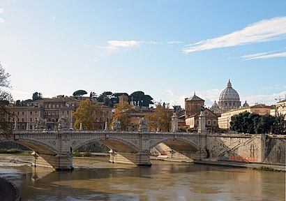
Vittorio Emanuele Bridge station
 Taken by Anonymous
See Vittorio Emanuele Bridge stop, Roma, on the map
Public transit to Vittorio Emanuele Bridge stop (ID: 70054) in Roma
Looking for directions to Vittorio Emanuele Bridge in Roma, Italy?
Download the Moovit App to find the current schedule and step-by-step directions for Bus, Metro or Train routes that pass through Vittorio Emanuele Bridge.
Looking for the nearest stops closest to Vittorio Emanuele Bridge ? Check out this list of closest stops to your destination: Traspontina/Conciliazione; Lungotevere Sassia/Santo Spirito (H); Acciaioli; Ottaviano; Fiorentini Square; Roma San Pietro; Flaminio.
Bus: 190F, 280, 40, 46, 62, 64, 98, N3S, 23, 982, 34, N46, N3D.Train: FL3, FL5, R, R, R, RV.Metro: A.
We make riding on public transit to Vittorio Emanuele Bridge easy, which is why over 1.7 billion users, including users in Roma trust Moovit as the best app for public transit.
Use the app to navigate to popular places including to the airport, hospital, stadium, grocery store, mall, coffee shop, school, college, and university.
Vittorio Emanuele Bridge stop’s code is 70054
The first line to this stop is N904, at 3:14 AM, and the last line is N98 at 2:59 AM.
351 Corso Vittorio Emanuele II, Roma, Italy
This stop serves ATAC and BIS’s lines
Popular routes from Vittorio Emanuele Bridge stop, Roma
- Traspontina/Conciliazione,
- Lungotevere Sassia/Santo Spirito (H),
- Acciaioli,
- Fiorentini Square
Bus stops near Vittorio Emanuele Bridge stop
- Ottaviano
Metro station near Vittorio Emanuele Bridge station
- Roma San Pietro
Train station near Vittorio Emanuele Bridge station
- Flaminio
Light Rail station near Vittorio Emanuele Bridge station
- Casal De' Pazzi/Tiburtina,
- Cola Di Rienzo/Regolo,
- Battistini (Ma),
- Salvini,
- Pigneto,
- Nomentana/XXI April,
- Oslavia/Mazzini,
- Pavese/Atlantic Ocean,
- Herod Atticus/Appia Pignatelli,
- The Swimming Pools,
- Prenestina/Acqua Bullicante,
- Casale S. Basilio/Nomentana,
- Myrtles,
- San Lorenzo Station,
- Heidelberg/Tor Vergata,
- Giolitti,
- Viterbo Porta Romana,
- Olevano Romano,
- Villanova,
- Sanzio Waterfront/Filipperi
Popular public transit stations in Roma
Get around Roma by public transit!
Traveling around Roma has never been so easy. See step by step directions as you travel to any attraction, street or major public transit station. View bus and train schedules, arrival times, service alerts and detailed routes on a map, so you know exactly how to get to anywhere in Roma.
When traveling to any destination around Roma use Moovit's Live Directions with Get Off Notifications to know exactly where and how far to walk, how long to wait for your line, and how many stops are left. Moovit will alert you when it's time to get off — no need to constantly re-check whether yours is the next stop.
Wondering how to use public transit in Roma or how to pay for public transit in Roma? Moovit public transit app can help you navigate your way with public transit easily, and at minimum cost. It includes public transit fees, ticket prices, and costs. Looking for a map of Roma public transit lines? Moovit public transit app shows all public transit maps in Roma with all Bus, Train, Metro, Light Rail, Ferry, Funicular and Gondola routes and stops on an interactive map.
Rome and Lazio has 7 transit type(s), including: Bus, Train, Metro, Light Rail, Ferry, Funicular and Gondola, operated by several transit agencies, including ATAC, Cotral, Trenitalia, Troiani Transportation Services, BIS, ATR Mobility, Tuscia, Shuttle, Seatour, Troiani Bus Lines, CSC Mobility, Terravision, ATRAL, Tambus and Sitbus