Directions to Ponto Frio (Angra Dos Reis) with public transportation
The following transit lines have routes that pass near Ponto Frio
 Bus: 104, 230, T11, T20, T21.
- Ferry: ANGRA DOS REIS - ILHA GRANDE, ANGRA DOS REIS - ILHA GRANDE.
How to get to Ponto Frio by bus?
Click on the bus route to see step by step directions with maps, line arrival times and updated time schedules.
From Bracuí, Cunhambebe
77 minFrom BR Marinas Bracuhy, Cunhambebe
74 minFrom Condominio Praia do Engenho, Cunhambebe
61 minFrom praia da ribeira, Cunhambebe
27 minFrom Praia do Sol- Monsuaba, Jacuecanga
56 minFrom Cicom - Clínica de Imagem Computadorizada, Cunhambebe
24 minFrom Monsuaba, Jacuecanga
48 minFrom Monsuaba, Jacuecanga
56 minFrom Morro Do Moreno, Jacuecanga
37 minFrom Praia da Biscaia, Jacuecanga
63 min
Bus stops near Ponto Frio in Angra Dos Reis
- Ponto De Embarque 04 - Praça Do Porto, 2 min walk,VIEW
- Centro / Praça Do Porto, 2 min walk,VIEW
- Ponto De Embarque 06 - Praça Do Porto, 2 min walk,VIEW
- Ponto De Embarque 07 - Praça Do Porto, 2 min walk,VIEW
- Centro / Largo Da Lapa, 3 min walk,VIEW
- Centro / Santa Luzia, 3 min walk,VIEW
- Ponto 02 - Santa Luzia, 3 min walk,VIEW
- Centro / Largo Da Lapa II, 4 min walk,VIEW
- Ponto De Embarque 10 - Lapa, 4 min walk,VIEW
- Ponto 01 - Santa Luzia, 4 min walk,VIEW
- Rua Coronel Carvalho, 230a, 4 min walk,VIEW
- Ponto De Embarque 11 - Lapa, 4 min walk,VIEW
Ferry station near Ponto Frio in Angra Dos Reis
- Estação Santa Luzia (Angra Dos Reis) ⛴, 27 min walk,VIEW
Bus lines to Ponto Frio in Angra Dos Reis
- C05, Centro (via Morro da Cruz),VIEW
- C05B, Centro (via Balneário),VIEW
- 205, Areal,VIEW
- B203, Serra D'Agua (Túnel),VIEW
- 208, Belém (Circular),VIEW
- A220, Japuíba (Via Gamboa - Circular),VIEW
- B220, Japuíba (Via Balneário / Ribeira - Circular),VIEW
- 207, Centro (Via Morro Da Cruz),VIEW
- B207, Japuíba (via Rio-Santos),VIEW
- 221, Nova Angra,VIEW
- B221, Nova Angra (via Gamboa / Ribeira),VIEW
- 203, Serra D'Água (Via Zungu),VIEW
- 204, Centro,VIEW
- B206, Centro (via Balneário),VIEW
- C206, Centro (Saída Vale da Banqueta),VIEW
- C01, Centro (Circular),VIEW
- C01B, Circular (via Pestalozzi),VIEW
- C03, Marinas,VIEW
- C03B, Marinas (via Balneário),VIEW
- C04, Vila Velha,VIEW
What are the closest stations to Ponto Frio?
The closest stations to Ponto Frio are:
- Ponto De Embarque 04 - Praça Do Porto is 97 meters away, 2 min walk.
- Centro / Praça Do Porto is 109 meters away, 2 min walk.
- Ponto De Embarque 06 - Praça Do Porto is 123 meters away, 2 min walk.
- Ponto De Embarque 07 - Praça Do Porto is 127 meters away, 2 min walk.
- Centro / Largo Da Lapa is 185 meters away, 3 min walk.
- Centro / Santa Luzia is 213 meters away, 3 min walk.
- Centro / Largo Da Lapa II is 222 meters away, 4 min walk.
- Ponto 02 - Santa Luzia is 222 meters away, 3 min walk.
- Ponto De Embarque 10 - Lapa is 230 meters away, 4 min walk.
- Ponto 01 - Santa Luzia is 232 meters away, 4 min walk.
- Rua Coronel Carvalho, 230a is 233 meters away, 4 min walk.
- Ponto De Embarque 11 - Lapa is 242 meters away, 4 min walk.
- Estação Santa Luzia (Angra Dos Reis) ⛴ is 2083 meters away, 27 min walk.
Which bus lines stop near Ponto Frio?
These bus lines stop near Ponto Frio: 104, 230, T11, T20, T21.
What’s the nearest bus station to Ponto Frio in Angra Dos Reis?
The nearest bus stations to Ponto Frio in Angra Dos Reis are Ponto De Embarque 04 - Praça Do Porto, Centro / Praça Do Porto, Ponto De Embarque 06 - Praça Do Porto and Ponto De Embarque 07 - Praça Do Porto. The closest one is a 2 min walk away.
What’s the nearest ferry station to Ponto Frio in Angra Dos Reis?
The nearest ferry station to Ponto Frio in Angra Dos Reis is Estação Santa Luzia (Angra Dos Reis) ⛴. It’s a 27 min walk away.
What time is the first bus to Ponto Frio in Angra Dos Reis?
The T20 is the first bus that goes to Ponto Frio in Angra Dos Reis. It stops nearby at 4:50 AM.
What time is the last bus to Ponto Frio in Angra Dos Reis?
The T11 is the last bus that goes to Ponto Frio in Angra Dos Reis. It stops nearby at 2:01 AM.
What time is the first ferry to Ponto Frio in Angra Dos Reis?
The ANGRA DOS REIS - ILHA GRANDE is the first ferry that goes to Ponto Frio in Angra Dos Reis. It stops nearby at 8:35 AM.
What time is the last ferry to Ponto Frio in Angra Dos Reis?
The ANGRA DOS REIS - ILHA GRANDE is the last ferry that goes to Ponto Frio in Angra Dos Reis. It stops nearby at 6:30 PM.
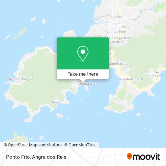
See Ponto Frio, Angra Dos Reis, on the map
Public Transit to Ponto Frio in Angra Dos Reis
Wondering how to get to Ponto Frio in Angra Dos Reis? Moovit helps you find the best way to get to Ponto Frio with step-by-step directions from the nearest public transit station.
Moovit provides free maps and live directions to help you navigate through your city. View schedules, routes, timetables, and find out how long does it take to get to Ponto Frio in real time.
Looking for the nearest stop or station to Ponto Frio? Check out this list of stops closest to your destination: Ponto De Embarque 04 - Praça Do Porto; Centro / Praça Do Porto; Ponto De Embarque 06 - Praça Do Porto; Ponto De Embarque 07 - Praça Do Porto; Centro / Largo Da Lapa; Centro / Santa Luzia; Centro / Largo Da Lapa II; Ponto 02 - Santa Luzia; Ponto De Embarque 10 - Lapa; Ponto 01 - Santa Luzia; Rua Coronel Carvalho; Ponto De Embarque 11 - Lapa; Estação Santa Luzia (Angra Dos Reis) ⛴.
Bus: 104, 230, T11, T20, T21, C05, C05B, 205, B203, 208, A220, B220, 207, B207, 221, B221, 203, 204, B206, C206, C01, C01B, C03, C03B, C04.Ferry: ANGRA DOS REIS - ILHA GRANDE, ANGRA DOS REIS - ILHA GRANDE.
Want to see if there’s another route that gets you there at an earlier time? Moovit helps you find alternative routes or times. Get directions from and directions to Ponto Frio easily from the Moovit App or Website.
We make riding to Ponto Frio easy, which is why over 1.5 million users, including users in Angra Dos Reis, trust Moovit as the best app for public transit. You don’t need to download an individual bus app or train app, Moovit is your all-in-one transit app that helps you find the best bus time or train time available.
For information on prices of bus, costs and ride fares to Ponto Frio, please check the Moovit app.
Use the app to navigate to popular places including to the airport, hospital, stadium, grocery store, mall, coffee shop, school, college, and university.
Ponto Frio Address: Avenida Reis Magos, Centro Angra dos Reis-RJ street in Angra Dos Reis
- As de Souza Calçados,
- Click Angra,
- Condomínio Marina,
- Power Surf Roupas e Acessórios Ltda,
- Julyjak Modas Unissex Ltda,
- Canto das Canoas,
- Vidraçaria Irmãos Tenório,
- Zuleica Florentino dos Santos,
- Capítulo Empreendimentos e Participações,
- Restaurante Recreativo,
- Centro da Cidade,
- Água de Cheiro,
- Restaurante Maria Fumaca,
- Radio Show 92, 1 Fm,
- Sindicato dos Parafusos Ltda,
- Praia Secreta,
- Condomínio Fazenda Garatucaia,
- Frade e Mar,
- Secretaria de Estado de Segurança Pública,
- Digital a
Places Near Ponto Frio (Angra Dos Reis)
- Condominio Laranjeiras, Parati Mirim,
- Mambucaba, Mambucaba,
- Vila Galé Eco Resort De Angra, Angra Dos Reis,
- Centro Histórico de Paraty, Parati,
- BR 101, Km 508 s/n, Cunhambebe,
- Praia de Paraty Mirim, Parati,
- Rodovia BR 101, Km 533 s/n, Mambucaba,
- Alambique Engenho D'Ouro, Parati,
- praia jabaquara - parati, Parati,
- Rua Cônegos Bittencourt, Angra Dos Reis,
- Verolme, Jacuecanga,
- Cachoeira do Tobogã, Parati,
- Praia do Laboratório, Angra Dos Reis,
- Rodovia Procurador Haroldo Fernandes Duarte, Km 513,5 s / n, Cunhambebe,
- Avenida Antônio Bertholdo da Silva Jordão 7346, Jacuecanga,
- Rua Prefeito João Gregório Galindo 2487, Angra Dos Reis,
- Vila Residencial De Mambucaba, Mambucaba,
- Garatucaia, Angra Dos Reis,
- Avenida Almirante Jair Carneiro Toscano de Brito 110, Angra Dos Reis,
- Rua Prefeito João Gregório Galindo, Cunhambebe
How to get to popular places in Angra dos Reis with public transit
Get around Angra Dos Reis by public transit!
Traveling around Angra Dos Reis has never been so easy. See step by step directions as you travel to any attraction, street or major public transit station. View bus and train schedules, arrival times, service alerts and detailed routes on a map, so you know exactly how to get to anywhere in Angra Dos Reis.
When traveling to any destination around Angra Dos Reis use Moovit's Live Directions with Get Off Notifications to know exactly where and how far to walk, how long to wait for your line, and how many stops are left. Moovit will alert you when it's time to get off — no need to constantly re-check whether yours is the next stop.
Wondering how to use public transit in Angra Dos Reis or how to pay for public transit in Angra Dos Reis? Moovit public transit app can help you navigate your way with public transit easily, and at minimum cost. It includes public transit fees, ticket prices, and costs. Looking for a map of Angra Dos Reis public transit lines? Moovit public transit app shows all public transit maps in Angra Dos Reis with all Bus and Ferry routes and stops on an interactive map.
Angra dos Reis has 2 transit type(s), including: Bus and Ferry, operated by several transit agencies, including Viação Senhor do Bonfim, Colitur Transportes Rodoviários, Cooparatyense (Vans), Costa Verde Transportes, Barcas Rio, Objetiva Tour, Vilanova Tour, Rodoviário Oceano, BusUFF and Colitur (Tarifa Zero - Paraty)