How to get to Poolesville Area by bus?
Click on the bus route to see step by step directions with maps, line arrival times and updated time schedules.
From Tenleytown, Washington
47 minFrom Politics and Prose, Washington
83 minFrom 5454 Wisconsin, Montgomery County
55 minFrom Comet Ping Pong, Washington
82 minFrom Rockville, MD, Montgomery County
41 minFrom Millie’S, Washington
49 minFrom British Embassy, Washington
58 minFrom Wheaton Mall, Montgomery County
68 minFrom The Cheesecake Factory, Washington
56 minFrom Glenstone Museum, Montgomery County
85 min
Bus stops near Poolesville Area in Montgomery County
- Montgomery Mall Transit Center & Bay A, 6 min walk,VIEW
- Montgomery Mall Transit Center & Bay E, 6 min walk,VIEW
- Westlake Ter & Auto Park Ave, 6 min walk,VIEW
- Montgomery Mall Transit Center & Bay B, 6 min walk,VIEW
- Montgomery Mall+Bay F, 6 min walk,VIEW
- Montgomery Mall Transit Center, 6 min walk,VIEW
- Rockledge Dr & 6901 Opp Nb, 11 min walk,VIEW
Bus lines to Poolesville Area in Montgomery County
What are the closest stations to Poolesville Area?
The closest stations to Poolesville Area are:
- Montgomery Mall Transit Center & Bay A is 414 yards away, 6 min walk.
- Montgomery Mall Transit Center & Bay E is 420 yards away, 6 min walk.
- Westlake Ter & Auto Park Ave is 424 yards away, 6 min walk.
- Montgomery Mall Transit Center & Bay B is 439 yards away, 6 min walk.
- Montgomery Mall+Bay F is 459 yards away, 6 min walk.
- Montgomery Mall Transit Center is 490 yards away, 6 min walk.
- Rockledge Dr & 6901 Opp Nb is 851 yards away, 11 min walk.
Which bus lines stop near Poolesville Area?
These bus lines stop near Poolesville Area: 26, 47, 798, M70.
What’s the nearest bus station to Poolesville Area in Montgomery County?
The nearest bus stations to Poolesville Area in Montgomery County are Montgomery Mall Transit Center & Bay A, Montgomery Mall Transit Center & Bay E, Westlake Ter & Auto Park Ave, Montgomery Mall Transit Center & Bay B, Montgomery Mall+Bay F and Montgomery Mall Transit Center. The closest one is a 6 min walk away.
What time is the first bus to Poolesville Area in Montgomery County?
The 26 is the first bus that goes to Poolesville Area in Montgomery County. It stops nearby at 4:25 AM.
What time is the last bus to Poolesville Area in Montgomery County?
The M70 is the last bus that goes to Poolesville Area in Montgomery County. It stops nearby at 2:16 AM.
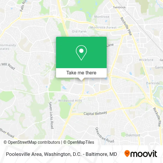
See Poolesville Area, Montgomery County, on the map
Public Transit to Poolesville Area in Montgomery County
Wondering how to get to Poolesville Area in Montgomery County? Moovit helps you find the best way to get to Poolesville Area with step-by-step directions from the nearest public transit station.
Moovit provides free maps and live directions to help you navigate through your city. View schedules, routes, timetables, and find out how long does it take to get to Poolesville Area in real time.
Looking for the nearest stop or station to Poolesville Area? Check out this list of stops closest to your destination: Montgomery Mall Transit Center & Bay A; Montgomery Mall Transit Center & Bay E; Westlake Ter & Auto Park Ave; Montgomery Mall Transit Center & Bay B; Montgomery Mall+Bay F; Montgomery Mall Transit Center; Rockledge Dr & 6901 Opp Nb.
Bus: 26, 47, 798, M70, 6, 96, 42.
Want to see if there’s another route that gets you there at an earlier time? Moovit helps you find alternative routes or times. Get directions from and directions to Poolesville Area easily from the Moovit App or Website.
We make riding to Poolesville Area easy, which is why over 1.5 million users, including users in Montgomery County, trust Moovit as the best app for public transit. You don’t need to download an individual bus app or train app, Moovit is your all-in-one transit app that helps you find the best bus time or train time available.
For information on prices of bus and metro, costs and ride fares to Poolesville Area, please check the Moovit app.
Use the app to navigate to popular places including to the airport, hospital, stadium, grocery store, mall, coffee shop, school, college, and university.
Poolesville Area Address: 10411 Motor City Dr Bethesda, MD 20817 street in Montgomery County
- Washington Nutrition and Counseling Group,
- Benevolent Buddhist Temple,
- General Documents Corporation,
- Nathaniel Jacobson CPA,
- Hass Bashir LLC,
- The Younger Sisters,
- Back To the Paper,
- Talking Type Captions,
- Yvonis,
- LVG Law Firm,
- The Law Offices of Edward A. Friedman,
- Excelsior TV,
- Sweettreatsbyvoni,
- Avrine Law Firm LLC,
- Tony Ward Consulting,
- The Law Offices,
- Bluepoint Financial LLC,
- Home Helpers,
- Foulger Pratt,
- McPherson Financial Partners
Places Near Poolesville Area (Montgomery County)
- Capital One Arena, Washington,
- Pennsylvania Ave NW (3rd st and pennsylvania), Washington,
- Camden Yards, Baltimore,
- National Mall, Washington,
- Museum Of The Bible, Washington,
- Basilica of the National Shrine, Washington,
- Sibley Memorial Hospital, Washington,
- PG Mall, Prince George's County,
- Marriott Marquis Washington, DC, Washington,
- M&T Bank Stadium, Baltimore,
- Rock Creek Tennis Center, Washington,
- The Anthem, Washington,
- Georgetown, Washington,
- Westfield Montgomery Mall, Montgomery County,
- National Zoo, Washington,
- Amazon Hq2, Arlington County,
- Washington DC VA Medical Center, Washington,
- Washington National Cathedral, Washington,
- National Museum of African American History and Culture, Washington,
- Warner Theatre, Washington
How to get to popular places in Washington, D.C. - Baltimore, MD with public transit
Get around Montgomery County by public transit!
Traveling around Montgomery County has never been so easy. See step by step directions as you travel to any attraction, street or major public transit station. View bus and train schedules, arrival times, service alerts and detailed routes on a map, so you know exactly how to get to anywhere in Montgomery County.
When traveling to any destination around Montgomery County use Moovit's Live Directions with Get Off Notifications to know exactly where and how far to walk, how long to wait for your line, and how many stops are left. Moovit will alert you when it's time to get off — no need to constantly re-check whether yours is the next stop.
Wondering how to use public transit in Montgomery County or how to pay for public transit in Montgomery County? Moovit public transit app can help you navigate your way with public transit easily, and at minimum cost. It includes public transit fees, ticket prices, and costs. Looking for a map of Montgomery County public transit lines? Moovit public transit app shows all public transit maps in Montgomery County with all Bus, Train, Metro, Light Rail and Ferry routes and stops on an interactive map.
Washington, D.C. - Baltimore, MD has 5 transit type(s), including: Bus, Train, Metro, Light Rail and Ferry, operated by several transit agencies, including WMATA, Montgomery County Ride On, Fairfax Connector, TheBus, PRTC, DASH - Alexandria, Arlington Transit (ART), RTA of Central Maryland, MDOT MTA, MDOT MTA Light RailLink, MDOT MTA Commuter Bus, MDOT MTA Local Bus, FXBGO!, Virginia Railway Express (VRE) and MARC