How to get to Port Technology Services by bus?
Click on the bus route to see step by step directions with maps, line arrival times and updated time schedules.
Bus stops near Port Technology Services in Norfolk
Light Rail stations near Port Technology Services in Norfolk
- York Street Freemason Station, 5 min walk,VIEW
What are the closest stations to Port Technology Services?
The closest stations to Port Technology Services are:
- 21st & Omohundro is 250 yards away, 4 min walk.
- Colonial & 26th is 313 yards away, 4 min walk.
- York Street Freemason Station is 361 yards away, 5 min walk.
Which bus lines stop near Port Technology Services?
These bus lines stop near Port Technology Services: 023, 961.
Which light rail line stops near Port Technology Services?
800 (Evmc Fort Norfolk Station)
What’s the nearest light rail station to Port Technology Services in Norfolk?
The nearest light rail station to Port Technology Services in Norfolk is York Street Freemason Station. It’s a 5 min walk away.
What’s the nearest bus station to Port Technology Services in Norfolk?
The nearest bus stations to Port Technology Services in Norfolk are 21st & Omohundro and Colonial & 26th. The closest one is a 4 min walk away.
What time is the first light rail to Port Technology Services in Norfolk?
The 800 is the first light rail that goes to Port Technology Services in Norfolk. It stops nearby at 5:27 AM.
What time is the last light rail to Port Technology Services in Norfolk?
The 800 is the last light rail that goes to Port Technology Services in Norfolk. It stops nearby at 11:40 PM.
What time is the first bus to Port Technology Services in Norfolk?
The 011 is the first bus that goes to Port Technology Services in Norfolk. It stops nearby at 6:11 AM.
What time is the last bus to Port Technology Services in Norfolk?
The 004 is the last bus that goes to Port Technology Services in Norfolk. It stops nearby at 10:50 PM.
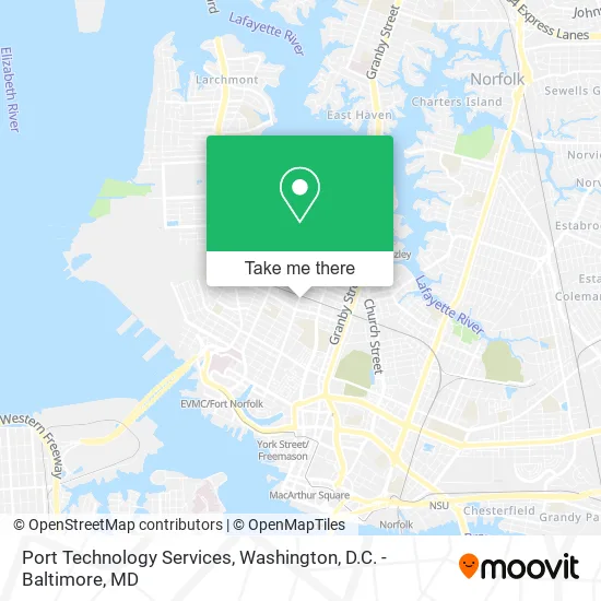
See Port Technology Services, Norfolk, on the map
Public Transit to Port Technology Services in Norfolk
Wondering how to get to Port Technology Services in Norfolk? Moovit helps you find the best way to get to Port Technology Services with step-by-step directions from the nearest public transit station.
Moovit provides free maps and live directions to help you navigate through your city. View schedules, routes, timetables, and find out how long does it take to get to Port Technology Services in real time.
Looking for the nearest stop or station to Port Technology Services? Check out this list of stops closest to your destination: 21st & Omohundro; Colonial & 26th; York Street Freemason Station.
Bus: 023, 961, 004, 011.Light Rail: 800.
Want to see if there’s another route that gets you there at an earlier time? Moovit helps you find alternative routes or times. Get directions from and directions to Port Technology Services easily from the Moovit App or Website.
We make riding to Port Technology Services easy, which is why over 1.5 million users, including users in Norfolk, trust Moovit as the best app for public transit. You don’t need to download an individual bus app or train app, Moovit is your all-in-one transit app that helps you find the best bus time or train time available.
For information on prices of bus, train and light rail, costs and ride fares to Port Technology Services, please check the Moovit app.
Use the app to navigate to popular places including to the airport, hospital, stadium, grocery store, mall, coffee shop, school, college, and university.
Port Technology Services Address: 2200 Colonial Ave Norfolk, VA 23517 street in Norfolk
- The Art Institute of Laser Aesthetics,
- Elite Photography,
- Pink Krystles Pawtique,
- Catnip Cat Cafe,
- Island Toned Luxury Tanning,
- Sea Level Counseling & Wellness,
- 1st American Mortgage,
- Dreamrx Beauty and Body Lounge,
- Kathy Knack Interior Designs,
- East Coast Courier Company,
- Foot Treatment Spa,
- Mi Pollera Spa,
- Createmy,
- Americare Plus,
- The Barter Authority,
- Radin & Radin,
- Re/Max,
- Blushtones,
- Heart Living,
- Muse Writers Center
Places Near Port Technology Services (Norfolk)
- Sibley Memorial Hospital, Washington,
- Camden Yards, Baltimore,
- Rock Creek Tennis Center, Washington,
- Marriott Marquis Washington, DC, Washington,
- The Anthem, Washington,
- Westfield Montgomery Mall, Montgomery County,
- Washington DC VA Medical Center, Washington,
- Amazon Hq2, Arlington County,
- Georgetown, Washington,
- Capital One Arena, Washington,
- M&T Bank Stadium, Baltimore,
- National Mall, Washington,
- National Zoo, Washington,
- Pennsylvania Ave NW (3rd st and pennsylvania), Washington,
- PG Mall, Prince George's County,
- Basilica of the National Shrine, Washington,
- Warner Theatre, Washington,
- National Museum of African American History and Culture, Washington,
- Museum Of The Bible, Washington,
- Washington National Cathedral, Washington
How to get to popular places in Washington, D.C. - Baltimore, MD with public transit
Get around Norfolk by public transit!
Traveling around Norfolk has never been so easy. See step by step directions as you travel to any attraction, street or major public transit station. View bus and train schedules, arrival times, service alerts and detailed routes on a map, so you know exactly how to get to anywhere in Norfolk.
When traveling to any destination around Norfolk use Moovit's Live Directions with Get Off Notifications to know exactly where and how far to walk, how long to wait for your line, and how many stops are left. Moovit will alert you when it's time to get off — no need to constantly re-check whether yours is the next stop.
Wondering how to use public transit in Norfolk or how to pay for public transit in Norfolk? Moovit public transit app can help you navigate your way with public transit easily, and at minimum cost. It includes public transit fees, ticket prices, and costs. Looking for a map of Norfolk public transit lines? Moovit public transit app shows all public transit maps in Norfolk with all Bus, Train, Metro, Light Rail and Ferry routes and stops on an interactive map.
Washington, D.C. - Baltimore, MD has 5 transit type(s), including: Bus, Train, Metro, Light Rail and Ferry, operated by several transit agencies, including WMATA, Montgomery County Ride On, Fairfax Connector, TheBus, PRTC, DASH - Alexandria, Arlington Transit (ART), RTA of Central Maryland, MDOT MTA, MDOT MTA Light RailLink, MDOT MTA Commuter Bus, MDOT MTA Local Bus, FXBGO!, Virginia Railway Express (VRE) and MARC