Porte D'Orléans stop - Tuesday schedule
| Line | Direction | Time |
|---|---|---|
| 3754 | Porte de Saint-Cloud - Murat | 5:26 PM |
| 3754 | Porte de Saint-Cloud - Murat | 6:08 PM |
| 3754 | Porte de Saint-Cloud - Murat | 6:22 PM |
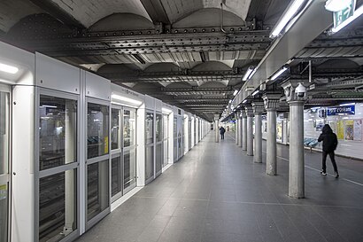
Directions to Porte D'Orléans (Paris) with public transportation
The following transit lines have routes that pass near Porte D'Orléans
 Bus: 126, 187, 38, 68, 92.
- Metro: 4, T3A.
How to get to Porte D'Orléans by bus?
Click on the bus route to see step by step directions with maps, line arrival times and updated time schedules.
How to get to Porte D'Orléans by metro?
Click on the metro route to see step by step directions with maps, line arrival times and updated time schedules.
Bus stops near Porte D'Orléans in Paris
- Porte D'Orléans - Métro, 2 min walk,
- Porte D'Orléans, 2 min walk,
Metro stations near Porte D'Orléans in Paris
- Alésia, 5 min walk,
- Porte D'Orléans, 5 min walk,
Bus lines to Porte D'Orléans in Paris
- N123, Gare D'Arpajon,
- 68, Place De Clichy - Châtillon - Montrouge - Métro,
- N14, La Croix De Berny Rer - Mairie De Saint-Ouen - République,
- N21, Châtelet - Hôpital De Longjumeau,
- N66, Gare Montparnasse - Gare De Chaville Rive Droite,
- N122, Châtelet - Gare De Saint-Rémy-Lès-Chevreuse,
- 194, Sophie Barat,
- 388, Maison Blanche,
- 38, Porte de la Chapelle,
- 92, Porte de Champerret,
- 125, Ecole Vétérinaire de Maisons-Alfort,
- 197, Porte D'Orléans,
- 126, Mairie de Montrouge,
- 128, Robinson RER,
What are the closest stations to Porte D'Orléans?
The closest stations to Porte D'Orléans are:
- Porte D'Orléans - Métro is 72 meters away, 2 min walk.
- Porte D'Orléans is 79 meters away, 2 min walk.
- Alésia is 316 meters away, 5 min walk.
Which bus lines stop near Porte D'Orléans?
These bus lines stop near Porte D'Orléans: 126, 187, 38, 68, 92.
Which metro line stops near Porte D'Orléans?
4 (Porte de Clignancourt)
What’s the nearest metro station to Porte D'Orléans in Paris?
The nearest metro stations to Porte D'Orléans in Paris are Alésia and Porte D'Orléans. The closest one is a 5 min walk away.
What’s the nearest bus station to Porte D'Orléans in Paris?
The nearest bus stations to Porte D'Orléans in Paris are Porte D'Orléans - Métro and Porte D'Orléans. The closest one is a 2 min walk away.
What time is the first light rail to Porte D'Orléans in Paris?
The T3A is the first light rail that goes to Porte D'Orléans in Paris. It stops nearby at 6:20 AM.
What time is the last light rail to Porte D'Orléans in Paris?
The T3A is the last light rail that goes to Porte D'Orléans in Paris. It stops nearby at 1:33 AM.
What time is the first metro to Porte D'Orléans in Paris?
The 4 is the first metro that goes to Porte D'Orléans in Paris. It stops nearby at 5:33 AM.
What time is the last metro to Porte D'Orléans in Paris?
The 4 is the last metro that goes to Porte D'Orléans in Paris. It stops nearby at 1:11 AM.
What time is the first bus to Porte D'Orléans in Paris?
The N14 is the first bus that goes to Porte D'Orléans in Paris. It stops nearby at 3:00 AM.
What time is the last bus to Porte D'Orléans in Paris?
The N123 is the last bus that goes to Porte D'Orléans in Paris. It stops nearby at 3:52 AM.
See Porte D'Orléans, Paris, on the map
Public transit to Porte D'Orléans stop in Paris
Looking for directions to Porte D'Orléans in Paris, France?
Download the Moovit App to find the current schedule and step-by-step directions for Metro, Bus or Train routes that pass through Porte D'Orléans.
Looking for the nearest stops closest to Porte D'Orléans ? Check out this list of closest stops to your destination: Porte D'Orléans - Métro; Porte D'Orléans; Alésia.
Bus: 126, 187, 38, 68, 92, N123, N14, N21, N66, N122, 194, 388.Metro: 4, T3A.
We make riding on public transit to Porte D'Orléans easy, which is why over 1.5 million users, including users in Paris trust Moovit as the best app for public transit.
Use the app to navigate to popular places including to the airport, hospital, stadium, grocery store, mall, coffee shop, school, college, and university.
The first line to this stop is 3754, at 5:26 PM, and the last line is 3754 at 6:22 PM.
201 Boulevard Brune, Paris, France
This stop serves Sénart’s lines
- Porte D'Orléans - Métro,
- Porte D'Orléans
Bus stops near Porte D'Orléans
- Alésia,
- Porte D'Orléans
Metro stations near Porte D'Orléans
- Hameau,
- Pont de Neuilly,
- Lozère,
- Vavin,
- Maupertuis,
- Liège,
- Boussy-Saint-Antoine,
- Facteur Cheval,
- Gare de Chartrettes,
- Foch,
- Marx Dormoy,
- Europe,
- Arpajon,
- République,
- Gare de Pontault (Place Beilstein),
- Gare de Brétigny,
- Malesherbes,
- Maurecourt,
- Palaiseau - Villebon,
- Félix Faure - Rue Des Écoles
Popular public transit stations in Paris
Get around Paris by public transit!
Traveling around Paris has never been so easy. See step by step directions as you travel to any attraction, street or major public transit station. View bus and train schedules, arrival times, service alerts and detailed routes on a map, so you know exactly how to get to anywhere in Paris.
When traveling to any destination around Paris use Moovit's Live Directions with Get Off Notifications to know exactly where and how far to walk, how long to wait for your line, and how many stops are left. Moovit will alert you when it's time to get off — no need to constantly re-check whether yours is the next stop.
Wondering how to use public transit in Paris or how to pay for public transit in Paris? Moovit public transit app can help you navigate your way with public transit easily, and at minimum cost. It includes public transit fees, ticket prices, and costs. Looking for a map of Paris public transit lines? Moovit public transit app shows all public transit maps in Paris with all Bus, Train, Metro, Light Rail, RER, Funicular and Gondola routes and stops on an interactive map.
Paris has 7 transit type(s), including: Bus, Train, Metro, Light Rail, RER, Funicular and Gondola, operated by several transit agencies, including RATP, RER, RER Bus de remplacement, Train, Train Bus de remplacement, Tramway Bus de remplacement, TER, ADP, Magical Shuttle, Argenteuil - Boucles de Seine, Autocars Dominique, Bièvre, Brie et 2 Morin, Le Bus - C.C. du Clermontois and Cœur d’Essonne