How to get to Positive Alternatives & Outcomes by bus?
Click on the bus route to see step by step directions with maps, line arrival times and updated time schedules.
Bus stops near Positive Alternatives & Outcomes in Newport News
Bus lines to Positive Alternatives & Outcomes in Newport News
- 101, KECOUGHTAN,VIEW
- 103, SHELL RD,VIEW
- 104, MARSHALL AVENUE,VIEW
- 105, BRIARFIELD RD,VIEW
- 112, 757X - JEFFERSON AVE,VIEW
- 964, SMITHFIELD,VIEW
- 921, Washington & 34th,VIEW
- 966, Commuter & Independence,VIEW
- 972, Tcc Virginia Beach,VIEW
- 106, WARWICK BOULEVARD,VIEW
- 107, DENBIGH BOULEVARD,VIEW
- 405, W. OAKS/COL.MALL,VIEW
- 414, NEWPORT NEWS TRANSIT CENTER - OAKLAND INDUSTRIAL,VIEW
- 430, DENBIGH FRINGE,VIEW
- 961, 757X - NORFOLK TO NNTC,VIEW
- 967, 757X - NNTC TO INDIAN RIVER PARK & RIDE,VIEW
What are the closest stations to Positive Alternatives & Outcomes?
The closest stations to Positive Alternatives & Outcomes are:
- Washington & 29th is 192 yards away, 3 min walk.
- Washington & 34th is 726 yards away, 9 min walk.
- Newport News Transit Center is 755 yards away, 10 min walk.
Which bus lines stop near Positive Alternatives & Outcomes?
These bus lines stop near Positive Alternatives & Outcomes: 101, 103, 106.
What’s the nearest bus station to Positive Alternatives & Outcomes in Newport News?
The nearest bus station to Positive Alternatives & Outcomes in Newport News is Washington & 29th. It’s a 3 min walk away.
What time is the first bus to Positive Alternatives & Outcomes in Newport News?
The 405 is the first bus that goes to Positive Alternatives & Outcomes in Newport News. It stops nearby at 4:25 AM.
What time is the last bus to Positive Alternatives & Outcomes in Newport News?
The 112 is the last bus that goes to Positive Alternatives & Outcomes in Newport News. It stops nearby at 1:30 AM.
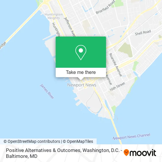
See Positive Alternatives & Outcomes, Newport News, on the map
Public Transit to Positive Alternatives & Outcomes in Newport News
Wondering how to get to Positive Alternatives & Outcomes in Newport News? Moovit helps you find the best way to get to Positive Alternatives & Outcomes with step-by-step directions from the nearest public transit station.
Moovit provides free maps and live directions to help you navigate through your city. View schedules, routes, timetables, and find out how long does it take to get to Positive Alternatives & Outcomes in real time.
Looking for the nearest stop or station to Positive Alternatives & Outcomes? Check out this list of stops closest to your destination: Washington & 29th; Washington & 34th; Newport News Transit Center.
Bus: 101, 103, 106, 104, 105, 112, 921, 966, 972, 107, 405, 414, 430.
Want to see if there’s another route that gets you there at an earlier time? Moovit helps you find alternative routes or times. Get directions from and directions to Positive Alternatives & Outcomes easily from the Moovit App or Website.
We make riding to Positive Alternatives & Outcomes easy, which is why over 1.5 million users, including users in Newport News, trust Moovit as the best app for public transit. You don’t need to download an individual bus app or train app, Moovit is your all-in-one transit app that helps you find the best bus time or train time available.
For information on prices of bus and train, costs and ride fares to Positive Alternatives & Outcomes, please check the Moovit app.
Use the app to navigate to popular places including to the airport, hospital, stadium, grocery store, mall, coffee shop, school, college, and university.
Positive Alternatives & Outcomes Address: 247 28th St Newport News, VA 23607 street in Newport News
- Minority Aids Support Services,
- RFH Healthcare,
- Lash Creator,
- Potter's Hse CH of Practical TCHNG,
- World Class Solutions,
- Secretz,
- Design Engineering Services,
- Quadros & Associates PC,
- Sarfan and Nachman,
- His Passion Ministries,
- Trinity United Methodist Church,
- Saints of Jesus Christ of Latter Day,
- Sunrisetaccoshipyard,
- Newport News Shipbuilding B903,
- NNS,
- Bayport Credit Union ATM,
- Youth Challenge,
- B 903,
- Styles by Beverly,
- ATM
Places Near Positive Alternatives & Outcomes (Newport News)
- Georgetown, Washington,
- National Zoo, Washington,
- Rock Creek Tennis Center, Washington,
- Sibley Memorial Hospital, Washington,
- Marriott Marquis Washington, DC, Washington,
- PG Mall, Prince George's County,
- Washington DC VA Medical Center, Washington,
- Basilica of the National Shrine, Washington,
- Washington National Cathedral, Washington,
- Warner Theatre, Washington,
- Westfield Montgomery Mall, Montgomery County,
- The Anthem, Washington,
- National Theatre, Washington,
- Capital One Arena, Washington,
- Museum Of The Bible, Washington,
- M&T Bank Stadium, Baltimore,
- Amazon Hq2, Arlington County,
- Camden Yards, Baltimore,
- Pennsylvania Ave NW (3rd st and pennsylvania), Washington,
- National Museum of African American History and Culture, Washington
How to get to popular places in Washington, D.C. - Baltimore, MD with public transit
Get around Newport News by public transit!
Traveling around Newport News has never been so easy. See step by step directions as you travel to any attraction, street or major public transit station. View bus and train schedules, arrival times, service alerts and detailed routes on a map, so you know exactly how to get to anywhere in Newport News.
When traveling to any destination around Newport News use Moovit's Live Directions with Get Off Notifications to know exactly where and how far to walk, how long to wait for your line, and how many stops are left. Moovit will alert you when it's time to get off — no need to constantly re-check whether yours is the next stop.
Wondering how to use public transit in Newport News or how to pay for public transit in Newport News? Moovit public transit app can help you navigate your way with public transit easily, and at minimum cost. It includes public transit fees, ticket prices, and costs. Looking for a map of Newport News public transit lines? Moovit public transit app shows all public transit maps in Newport News with all Bus, Train, Metro, Light Rail and Ferry routes and stops on an interactive map.
Washington, D.C. - Baltimore, MD has 5 transit type(s), including: Bus, Train, Metro, Light Rail and Ferry, operated by several transit agencies, including WMATA, Montgomery County Ride On, Fairfax Connector, TheBus, PRTC, DASH - Alexandria, Arlington Transit (ART), RTA of Central Maryland, MDOT MTA, MDOT MTA Light RailLink, MDOT MTA Commuter Bus, MDOT MTA Local Bus, FXBGO!, Virginia Railway Express (VRE) and MARC