How to get to Positive Outcomes by bus?
Click on the bus route to see step by step directions with maps, line arrival times and updated time schedules.
Bus stop near Positive Outcomes in Washington, D.C. - Baltimore, MD
- Main/Clay Nbnd, 5 min walk,VIEW
Bus lines to Positive Outcomes in Washington, D.C. - Baltimore, MD
What are the closest stations to Positive Outcomes?
The closest stations to Positive Outcomes are:
- Main/Clay Nbnd is 354 yards away, 5 min walk.
Which bus lines stop near Positive Outcomes?
These bus lines stop near Positive Outcomes: SMS, SWB.
What’s the nearest bus station to Positive Outcomes in Washington, D.C. - Baltimore, MD?
The nearest bus station to Positive Outcomes in Washington, D.C. - Baltimore, MD is Main/Clay Nbnd. It’s a 5 min walk away.
What time is the first bus to Positive Outcomes in Washington, D.C. - Baltimore, MD?
The SMA is the first bus that goes to Positive Outcomes in Washington, D.C. - Baltimore, MD. It stops nearby at 7:01 AM.
What time is the last bus to Positive Outcomes in Washington, D.C. - Baltimore, MD?
The SMS is the last bus that goes to Positive Outcomes in Washington, D.C. - Baltimore, MD. It stops nearby at 9:52 PM.
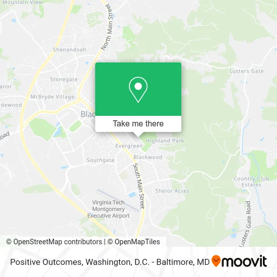
See Positive Outcomes, Washington, D.C. - Baltimore, MD, on the map
Public Transit to Positive Outcomes in Washington, D.C. - Baltimore, MD
Wondering how to get to Positive Outcomes in Washington, D.C. - Baltimore, MD? Moovit helps you find the best way to get to Positive Outcomes with step-by-step directions from the nearest public transit station.
Moovit provides free maps and live directions to help you navigate through your city. View schedules, routes, timetables, and find out how long does it take to get to Positive Outcomes in real time.
Looking for the nearest stop or station to Positive Outcomes? Check out this list of stops closest to your destination: Main/Clay Nbnd.
Bus: SMS, SWB, SMA, SME.
Want to see if there’s another route that gets you there at an earlier time? Moovit helps you find alternative routes or times. Get directions from and directions to Positive Outcomes easily from the Moovit App or Website.
We make riding to Positive Outcomes easy, which is why over 1.5 million users, including users in Washington, D.C. - Baltimore, MD, trust Moovit as the best app for public transit. You don’t need to download an individual bus app or train app, Moovit is your all-in-one transit app that helps you find the best bus time or train time available.
For information on prices of bus and train, costs and ride fares to Positive Outcomes, please check the Moovit app.
Use the app to navigate to popular places including to the airport, hospital, stadium, grocery store, mall, coffee shop, school, college, and university.
Positive Outcomes Address: 1004 Willard Dr Blacksburg, VA 24060 street in Washington, D.C. - Baltimore, MD
- Creation Coach,
- New River Valley Varmints Pet Sitting Agency,
- Barefoot Design Studio, Llc,
- Venture Counsel,
- Blacksburg Municipal Golf Course,
- Ams Consulting,
- Gtp Digital Designs,
- Djuric Sporthorses,
- Slusher Enterprise Rentals,
- Evergreen,
- Huckleberry Ridge, Llc,
- Country Club Park,
- Christian Science Society,
- Tents R US,
- Crestview Tot Lot,
- Graves Park,
- Austin J Cummings,
- Theta XI Fraternity,
- New River Valley Community Services,
- Theta XI
Places Near Positive Outcomes (Washington, D.C. - Baltimore, MD)
- Washington DC VA Medical Center, Washington,
- Rock Creek Tennis Center, Washington,
- Washington National Cathedral, Washington,
- PG Mall, Prince George's County,
- Camden Yards, Baltimore,
- Basilica of the National Shrine, Washington,
- Westfield Montgomery Mall, Montgomery County,
- M&T Bank Stadium, Baltimore,
- The Anthem, Washington,
- National Zoo, Washington,
- Pennsylvania Ave NW (3rd st and pennsylvania), Washington,
- Amazon Hq2, Arlington County,
- National Museum of African American History and Culture, Washington,
- Marriott Marquis Washington, DC, Washington,
- Sibley Memorial Hospital, Washington,
- Capital One Arena, Washington,
- National Theatre, Washington,
- Museum Of The Bible, Washington,
- Georgetown, Washington,
- Warner Theatre, Washington
How to get to popular places in Washington, D.C. - Baltimore, MD with public transit
Get around Washington, D.C. - Baltimore, MD by public transit!
Traveling around Washington, D.C. - Baltimore, MD has never been so easy. See step by step directions as you travel to any attraction, street or major public transit station. View bus and train schedules, arrival times, service alerts and detailed routes on a map, so you know exactly how to get to anywhere in Washington, D.C. - Baltimore, MD.
When traveling to any destination around Washington, D.C. - Baltimore, MD use Moovit's Live Directions with Get Off Notifications to know exactly where and how far to walk, how long to wait for your line, and how many stops are left. Moovit will alert you when it's time to get off — no need to constantly re-check whether yours is the next stop.
Wondering how to use public transit in Washington, D.C. - Baltimore, MD or how to pay for public transit in Washington, D.C. - Baltimore, MD? Moovit public transit app can help you navigate your way with public transit easily, and at minimum cost. It includes public transit fees, ticket prices, and costs. Looking for a map of Washington, D.C. - Baltimore, MD public transit lines? Moovit public transit app shows all public transit maps in Washington, D.C. - Baltimore, MD with all Bus, Train, Metro, Light Rail and Ferry routes and stops on an interactive map.
Washington, D.C. - Baltimore, MD has 5 transit type(s), including: Bus, Train, Metro, Light Rail and Ferry, operated by several transit agencies, including WMATA, Montgomery County Ride On, Fairfax Connector, TheBus, PRTC, DASH - Alexandria, Arlington Transit (ART), RTA of Central Maryland, MDOT MTA, MDOT MTA Light RailLink, MDOT MTA Commuter Bus, MDOT MTA Local Bus, FXBGO!, Virginia Railway Express (VRE) and MARC