How to get to Postfiliale by bus?
Click on the bus route to see step by step directions with maps, line arrival times and updated time schedules.
From Krankenhaus Freudenstadt, Vereinbarte Verwaltungsgemeinschaft Freudenstadt
246 minFrom Mercedes-Benz Werk Rastatt, Vereinbarte Verwaltungsgemeinschaft Rastatt
110 minFrom Parkplatz Bauhaus, Verwaltungsgemeinschaft Offenburg
127 minFrom Hopfenschlingel, Vereinbarte Verwaltungsgemeinschaft Rastatt
80 minFrom Grinde-Hütte, Seebach
119 minFrom Baden-Baden, Karlsruhe/Baden-Baden Airport, Rheinmünster
72 min
How to get to Postfiliale by train?
Click on the train route to see step by step directions with maps, line arrival times and updated time schedules.
From Höhenhotel Pfeifle, Baiersbronn
107 minFrom Krankenhaus Freudenstadt, Vereinbarte Verwaltungsgemeinschaft Freudenstadt
140 minFrom Epplesee, Rheinstetten
62 minFrom Parkplatz Bauhaus, Verwaltungsgemeinschaft Offenburg
82 minFrom Hopfenschlingel, Vereinbarte Verwaltungsgemeinschaft Rastatt
61 minFrom Waldbronn Eistreff, Waldbronn
108 min
Bus stops near Postfiliale in Weitenung
Train stations near Postfiliale in Weitenung
- Baden-Baden Rebland, 41 min walk,VIEW
Bus lines to Postfiliale in Weitenung
- 267, Weitenung Alte Post,VIEW
- 268S, Muckenschopf,VIEW
- 272, Weitenung Wiesenweg,VIEW
- 267, Kappelwindeck Bachschlosssch. - Weitenung Alte Post,VIEW
- 268S, Schwarzach (Bd) Bahnhof - Unzhurst Schule,VIEW
- 272, Bühl (Baden) Bstg 3 - Bühl (Baden) Bstg 1,VIEW
- 272, Weitenung Canadastraße - Bühl (Baden) Bstg 3,VIEW
- 211, Sinzheim Goethestraße,VIEW
- 262, Sinzheim Lvk-Schule,VIEW
- 262, Baden-Baden Bahnhof,VIEW
What are the closest stations to Postfiliale?
The closest stations to Postfiliale are:
- Weitenung Ottenhofen is 248 meters away, 4 min walk.
- Weitenung Tankstelle Huck is 357 meters away, 5 min walk.
- Weitenung Friedhof is 362 meters away, 5 min walk.
- Baden-Baden Rebland is 3220 meters away, 41 min walk.
Which bus lines stop near Postfiliale?
These bus lines stop near Postfiliale: 211, 272, 290, X44.
Which train line stops near Postfiliale?
S7 (Achern)
What’s the nearest bus station to Postfiliale in Weitenung?
The nearest bus station to Postfiliale in Weitenung is Weitenung Ottenhofen. It’s a 4 min walk away.
What time is the first train to Postfiliale in Weitenung?
The S7 is the first train that goes to Postfiliale in Weitenung. It stops nearby at 5:09 AM.
What time is the last train to Postfiliale in Weitenung?
The RB44 is the last train that goes to Postfiliale in Weitenung. It stops nearby at 1:29 AM.
What time is the first bus to Postfiliale in Weitenung?
The 211 is the first bus that goes to Postfiliale in Weitenung. It stops nearby at 5:12 AM.
What time is the last bus to Postfiliale in Weitenung?
The 272 is the last bus that goes to Postfiliale in Weitenung. It stops nearby at 12:30 AM.
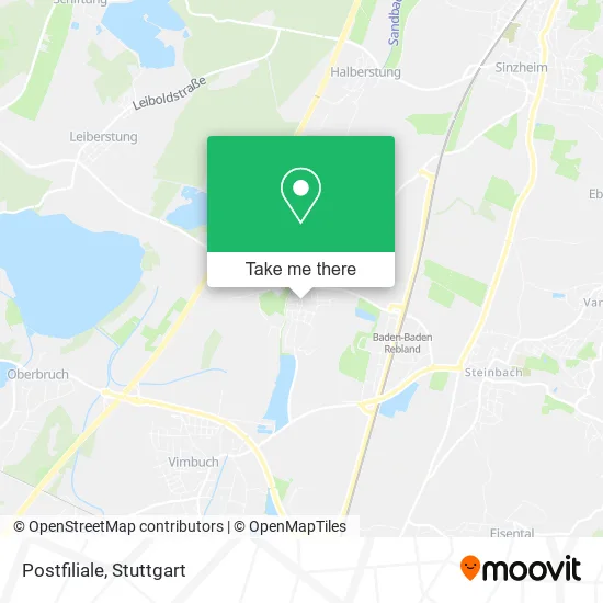
See Postfiliale, Weitenung, on the map
Public Transit to Postfiliale in Weitenung
Wondering how to get to Postfiliale in Weitenung? Moovit helps you find the best way to get to Postfiliale with step-by-step directions from the nearest public transit station.
Moovit provides free maps and live directions to help you navigate through your city. View schedules, routes, timetables, and find out how long does it take to get to Postfiliale in real time.
Looking for the nearest stop or station to Postfiliale? Check out this list of stops closest to your destination: Weitenung Ottenhofen; Weitenung Tankstelle Huck; Weitenung Friedhof; Baden-Baden Rebland.
Bus: 211, 272, 290, X44, 267, 268S, 267, 268S, 262, 262.Train: S7, RB44, S71, S71.
Want to see if there’s another route that gets you there at an earlier time? Moovit helps you find alternative routes or times. Get directions from and directions to Postfiliale easily from the Moovit App or Website.
We make riding to Postfiliale easy, which is why over 1.5 million users, including users in Weitenung, trust Moovit as the best app for public transit. You don’t need to download an individual bus app or train app, Moovit is your all-in-one transit app that helps you find the best bus time or train time available.
For information on prices of bus, train and light rail, costs and ride fares to Postfiliale, please check the Moovit app.
Use the app to navigate to popular places including to the airport, hospital, stadium, grocery store, mall, coffee shop, school, college, and university.
Postfiliale Address: Ottenhofener Straße Ottenhofen, 77815 Bühl street in Weitenung
- Peter's Gute Backstube,
- Nm Steuerberatungs,
- Norbert Metz Unternehmens- und Wirtschaftsberatung,
- Dr. Markus Becker,
- Dr. med. Jana Wiegert,
- Post, Ottenhofener Straße,
- Hartmut Metz Postagentur-Toto,
- Dr. med. Veronika Exner,
- Dr. med. Markus Becker,
- Deutsche Post,
- Yburg Apotheke,
- Al Mulino,
- Pizzeria O Solo Mio,
- Fahrschule Lorenz,
- Alsec,
- Böhmer Alexander,
- Christbaumverband Baden-Württe Mberg,
- Cbbw,
- Rs Grund & Hof,
- Bws
Places Near Postfiliale (Weitenung)
- Gasometer Pforzheim, Pforzheim,
- Waldfriedhof, Degerloch,
- Wilhelma (U-Bahn Wilhelma), Bad Cannstatt,
- Hanns-Martin-Schleyer-Halle (Stuttgart Hans-Martin-Schleyerhalle), Bad Cannstatt,
- Hauptbahnhof Stuttgart, Stuttgart-Mitte,
- Geilhaus Haus 33a, Reutlingen-Betzingen,
- Mettingen Eros-Center Puff Laufhaus, Esslingen Am Neckar,
- Mercedes-Benz Museum, Bad Cannstatt,
- Porsche Museum, Zuffenhausen,
- SI-Centrum, Möhringen,
- FlixBus Haltestelle, Stuttgart,
- Pariser Platz Stuttgart, Stuttgart-Mitte,
- Schleyerhalle, Bad Cannstatt,
- Porsche-Arena, Bad Cannstatt,
- Hanns-Martin-Schleyer-Halle, Bad Cannstatt,
- Im Wizemann (Halle), Bad Cannstatt,
- Marmorsaal Im Weissenburgpark, Stuttgart-Süd,
- Gleis 101/102 (tief), Stuttgart-Mitte,
- Klinikum Stuttgart - Katharinenhospital, Stuttgart-Mitte,
- Mercedes-Benz Museum (Mercedes Museum Stuttgart), Bad Cannstatt
How to get to popular places in Stuttgart with public transit
Get around Weitenung by public transit!
Traveling around Weitenung has never been so easy. See step by step directions as you travel to any attraction, street or major public transit station. View bus and train schedules, arrival times, service alerts and detailed routes on a map, so you know exactly how to get to anywhere in Weitenung.
When traveling to any destination around Weitenung use Moovit's Live Directions with Get Off Notifications to know exactly where and how far to walk, how long to wait for your line, and how many stops are left. Moovit will alert you when it's time to get off — no need to constantly re-check whether yours is the next stop.
Wondering how to use public transit in Weitenung or how to pay for public transit in Weitenung? Moovit public transit app can help you navigate your way with public transit easily, and at minimum cost. It includes public transit fees, ticket prices, and costs. Looking for a map of Weitenung public transit lines? Moovit public transit app shows all public transit maps in Weitenung with all Bus, Train, Subway, Light Rail, Ferry, S-Bahn and Funicular routes and stops on an interactive map.
Stuttgart has 7 transit type(s), including: Bus, Train, Subway, Light Rail, Ferry, S-Bahn and Funicular, operated by several transit agencies, including SSB - Stadtbahn, SSB, SSB - Seilbahn / Zacke, S-Bahn Stuttgart, Rhein-Neckar-Verkehr GmbH (rnv), Karlsruher Verkehrsverbund, DB AG, DB Regiobus BW, Arverio Baden-Württemberg GmbH, DB RegioNetz Verkehrs GmbH Westfrankenbahn, DB Regio AG Baden-Württemberg, Südwestdeutsche Verkehrs-AG, DB Regio AG Mitte Region Hessen, DB and Bodensee-Oberschwaben-Bahn