How to get to Postres by bus?
Click on the bus route to see step by step directions with maps, line arrival times and updated time schedules.
From Centro de Desarrollo Comunitario "HABITAT" San Sebastián De Aparicio, Puebla
62 minFrom Avenida 124 Poniente 26, Puebla
57 minFrom Valle de las Flores, Puebla
66 minFrom Camino a Tlaltepango 11202, Puebla
53 minFrom Lateral de la Recta a Cholula 103, San Gregorio Atzompa
56 minFrom Colegio San Ángel de Puebla, Ocoyucan
46 minFrom El Triangulo, Puebla
59 minFrom San Miguel del Milagro, Puebla
58 minFrom Tepeaca, Puebla
62 minFrom Colonia el Vergel, San Andrés Cholula
29 min
Bus stops near Postres in Puebla
Bus lines to Postres in Puebla
What are the closest stations to Postres?
The closest stations to Postres are:
- Plaza Tercera De La Arboleda, 633 is 69 meters away, 2 min walk.
- Calle De La 38 Sur 615 is 98 meters away, 2 min walk.
Which bus lines stop near Postres?
These bus lines stop near Postres: RUTA 5, RUTA 55.
What’s the nearest bus station to Postres in Puebla?
The nearest bus stations to Postres in Puebla are Plaza Tercera De La Arboleda, 633 and Calle De La 38 Sur 615. The closest one is a 2 min walk away.
What time is the first bus to Postres in Puebla?
The RUTA 55 is the first bus that goes to Postres in Puebla. It stops nearby at 6:01 AM.
What time is the last bus to Postres in Puebla?
The RUTA 55 is the last bus that goes to Postres in Puebla. It stops nearby at 10:37 PM.
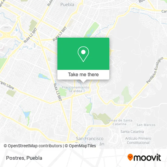
See Postres, Puebla, on the map
Public Transit to Postres in Puebla
Wondering how to get to Postres in Puebla? Moovit helps you find the best way to get to Postres with step-by-step directions from the nearest public transit station.
Moovit provides free maps and live directions to help you navigate through your city. View schedules, routes, timetables, and find out how long does it take to get to Postres in real time.
Looking for the nearest stop or station to Postres? Check out this list of stops closest to your destination: Plaza Tercera De La Arboleda; Calle De La 38 Sur 615.
Bus: RUTA 5, RUTA 55.
Want to see if there’s another route that gets you there at an earlier time? Moovit helps you find alternative routes or times. Get directions from and directions to Postres easily from the Moovit App or Website.
We make riding to Postres easy, which is why over 1.5 million users, including users in Puebla, trust Moovit as the best app for public transit. You don’t need to download an individual bus app or train app, Moovit is your all-in-one transit app that helps you find the best bus time or train time available.
For information on prices of bus, costs and ride fares to Postres, please check the Moovit app.
Use the app to navigate to popular places including to the airport, hospital, stadium, grocery store, mall, coffee shop, school, college, and university.
Postres Address: Postres, Avenida 38 Sur, Unidad Habitacional La Margarita, 72560 Puebla, Puebla street in Puebla
- El Chule,
- Consultorios de Medicina General del Sector Privado,
- Cemitas La Arena,
- Persianas Mercedes Sanchez,
- El Pollo Campero,
- Edificio El Pastel,
- Dulceria Puebla,
- El Semillero,
- La Margarita Puebla,
- Miscelánea Chio,
- Happy Chip's & Corn,
- INFONAVIT la Margarita,
- Panadería 100 Años,
- Papelería Katy,
- Miscelánea Fer,
- Miscelánea Shalom,
- Artículos de Papeleria,
- Carol Kookies,
- Herlinda Sanchez de Velázquez,
- Cremeria
Places Near Postres (Puebla)
- 25 Zona Militar, Puebla,
- Plaza Las Animas, Puebla,
- Centro Comercial Angelópolis, San Andrés Cholula,
- Parque Ecologico, Pue., San Andrés Cholula,
- Plaza Dorada Centro Comercial, Puebla,
- SAT, San Andrés Cholula,
- Centro de Desarrollo Comunitario Tres Cruces, Puebla,
- Tres Cruces, Puebla,
- Parque Puebla, Puebla,
- Ciudad Universitaria, Puebla,
- Zona de los Fuertes, Puebla,
- Secretaria de Finanzas, Puebla,
- Hospital General Regional 36 IMSS San Alejandro, San Andrés Cholula,
- Hospital Imss La Margarita, Puebla,
- Centro Integral de Servicios CIS, San Andrés Cholula,
- Galerías Serdán, San Pedro Cholula,
- Hospital Traumatología y Ortopedia de Puebla, San Pedro Cholula,
- Estadio Cuauhtémoc, Puebla,
- Ciudad Judicial del Estado de Puebla, San Andrés Cholula,
- Complejo Cultural Universitario, Ocoyucan
How to get to popular places in Puebla with public transit
Get around Puebla by public transit!
Traveling around Puebla has never been so easy. See step by step directions as you travel to any attraction, street or major public transit station. View bus and train schedules, arrival times, service alerts and detailed routes on a map, so you know exactly how to get to anywhere in Puebla.
When traveling to any destination around Puebla use Moovit's Live Directions with Get Off Notifications to know exactly where and how far to walk, how long to wait for your line, and how many stops are left. Moovit will alert you when it's time to get off — no need to constantly re-check whether yours is the next stop.
Wondering how to use public transit in Puebla or how to pay for public transit in Puebla? Moovit public transit app can help you navigate your way with public transit easily, and at minimum cost. It includes public transit fees, ticket prices, and costs. Looking for a map of Puebla public transit lines? Moovit public transit app shows all public transit maps in Puebla with all bus routes and stops on an interactive map.
Puebla has 1 transit type(s), including: bus, operated by several transit agencies, including RUTA, RUTA Alimentadoras, Rutas Convencionales and Líneas temporales