Directions to Power Line Rent Equip (Roanoke) with public transportation
The following transit lines have routes that pass near Power Line Rent Equip
 Bus: 21, GREYHOUND US0600, 16, 15, 22.
- Train: NORTHEAST REGIONAL.
How to get to Power Line Rent Equip by bus?
Click on the bus route to see step by step directions with maps, line arrival times and updated time schedules.
How to get to Power Line Rent Equip by train?
Click on the train route to see step by step directions with maps, line arrival times and updated time schedules.
Bus stops near Power Line Rent Equip in Roanoke
Train station near Power Line Rent Equip in Roanoke
- Roanoke, 21 min walk,VIEW
Bus lines to Power Line Rent Equip in Roanoke
What are the closest stations to Power Line Rent Equip?
The closest stations to Power Line Rent Equip are:
- Burrell Sb at Whitten is 386 yards away, 5 min walk.
- Burrell Nb at Whitten is 388 yards away, 5 min walk.
- Williamson Sb at Clover is 440 yards away, 6 min walk.
- Williamson Nb at Clover is 445 yards away, 6 min walk.
- Roanoke is 1780 yards away, 21 min walk.
Which bus lines stop near Power Line Rent Equip?
These bus lines stop near Power Line Rent Equip: 21, GREYHOUND US0600.
Which train line stops near Power Line Rent Equip?
NORTHEAST REGIONAL (Roanoke)
What’s the nearest train station to Power Line Rent Equip in Roanoke?
The nearest train station to Power Line Rent Equip in Roanoke is Roanoke. It’s a 21 min walk away.
What’s the nearest bus station to Power Line Rent Equip in Roanoke?
The nearest bus stations to Power Line Rent Equip in Roanoke are Burrell Sb at Whitten and Burrell Nb at Whitten. The closest one is a 5 min walk away.
What time is the first train to Power Line Rent Equip in Roanoke?
The NORTHEAST REGIONAL is the first train that goes to Power Line Rent Equip in Roanoke. It stops nearby at 9:35 AM.
What time is the last train to Power Line Rent Equip in Roanoke?
The NORTHEAST REGIONAL is the last train that goes to Power Line Rent Equip in Roanoke. It stops nearby at 10:13 PM.
What time is the first bus to Power Line Rent Equip in Roanoke?
The 22 is the first bus that goes to Power Line Rent Equip in Roanoke. It stops nearby at 5:57 AM.
What time is the last bus to Power Line Rent Equip in Roanoke?
The 21 is the last bus that goes to Power Line Rent Equip in Roanoke. It stops nearby at 8:22 PM.
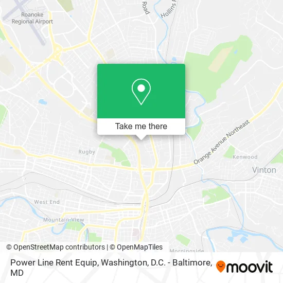
See Power Line Rent Equip, Roanoke, on the map
Public Transit to Power Line Rent Equip in Roanoke
Wondering how to get to Power Line Rent Equip in Roanoke? Moovit helps you find the best way to get to Power Line Rent Equip with step-by-step directions from the nearest public transit station.
Moovit provides free maps and live directions to help you navigate through your city. View schedules, routes, timetables, and find out how long does it take to get to Power Line Rent Equip in real time.
Looking for the nearest stop or station to Power Line Rent Equip? Check out this list of stops closest to your destination: Burrell Sb at Whitten; Burrell Nb at Whitten; Williamson Sb at Clover; Williamson Nb at Clover; Roanoke.
Bus: 21, GREYHOUND US0600, 16, 15, 22.Train: NORTHEAST REGIONAL.
Want to see if there’s another route that gets you there at an earlier time? Moovit helps you find alternative routes or times. Get directions from and directions to Power Line Rent Equip easily from the Moovit App or Website.
We make riding to Power Line Rent Equip easy, which is why over 1.5 million users, including users in Roanoke, trust Moovit as the best app for public transit. You don’t need to download an individual bus app or train app, Moovit is your all-in-one transit app that helps you find the best bus time or train time available.
For information on prices of bus and train, costs and ride fares to Power Line Rent Equip, please check the Moovit app.
Use the app to navigate to popular places including to the airport, hospital, stadium, grocery store, mall, coffee shop, school, college, and university.
Power Line Rent Equip Address: 42 Noble Ave NE Roanoke, VA 24012 street in Roanoke
- Plrei,
- Aerial Bucket Trucks Pressure Diggers Crane Trucks Forestry Tree Trucks Sign Truck Wire and Cable H,
- Roanoke City Firehouse,
- Heiners Bakery,
- Powers Fence Company of Roanoke,
- Guard Rail,
- Sutton Construction of Roanoke,
- Horne's Upholstery,
- Qwik Time Towing,
- Express Towing,
- Roanoke City Garage,
- City of Roanoke Transportation,
- Public Works Service Center,
- Roanoke Solid Waste Management,
- Fire Station Number 2,
- Berglund Truck and Fleet Service,
- Stanford Tee's,
- Drew's Landscapes & Property Management,
- 540 Lawncare,
- Father's and Sons Lawns & More
Places Near Power Line Rent Equip (Roanoke)
- Westfield Montgomery Mall, Montgomery County,
- Amazon Hq2, Arlington County,
- M&T Bank Stadium, Baltimore,
- Museum Of The Bible, Washington,
- Marriott Marquis Washington, DC, Washington,
- Basilica of the National Shrine, Washington,
- Georgetown, Washington,
- Washington National Cathedral, Washington,
- National Theatre, Washington,
- Pennsylvania Ave NW (3rd st and pennsylvania), Washington,
- National Museum of African American History and Culture, Washington,
- Camden Yards, Baltimore,
- PG Mall, Prince George's County,
- Capital One Arena, Washington,
- Rock Creek Tennis Center, Washington,
- The Anthem, Washington,
- National Zoo, Washington,
- Washington DC VA Medical Center, Washington,
- Warner Theatre, Washington,
- Sibley Memorial Hospital, Washington
How to get to popular places in Washington, D.C. - Baltimore, MD with public transit
Get around Roanoke by public transit!
Traveling around Roanoke has never been so easy. See step by step directions as you travel to any attraction, street or major public transit station. View bus and train schedules, arrival times, service alerts and detailed routes on a map, so you know exactly how to get to anywhere in Roanoke.
When traveling to any destination around Roanoke use Moovit's Live Directions with Get Off Notifications to know exactly where and how far to walk, how long to wait for your line, and how many stops are left. Moovit will alert you when it's time to get off — no need to constantly re-check whether yours is the next stop.
Wondering how to use public transit in Roanoke or how to pay for public transit in Roanoke? Moovit public transit app can help you navigate your way with public transit easily, and at minimum cost. It includes public transit fees, ticket prices, and costs. Looking for a map of Roanoke public transit lines? Moovit public transit app shows all public transit maps in Roanoke with all Bus, Train, Metro, Light Rail and Ferry routes and stops on an interactive map.
Washington, D.C. - Baltimore, MD has 5 transit type(s), including: Bus, Train, Metro, Light Rail and Ferry, operated by several transit agencies, including WMATA, Montgomery County Ride On, Fairfax Connector, TheBus, PRTC, DASH - Alexandria, Arlington Transit (ART), RTA of Central Maryland, MDOT MTA, MDOT MTA Light RailLink, MDOT MTA Commuter Bus, MDOT MTA Local Bus, FXBGO!, Virginia Railway Express (VRE) and MARC