Directions to Power Recording Studio (Lynchburg) with public transportation
The following transit lines have routes that pass near Power Recording Studio
 Bus: 11, 12, GREYHOUND US0600, 10, 12X.
- Train: NORTHEAST REGIONAL, CRESCENT.
How to get to Power Recording Studio by bus?
Click on the bus route to see step by step directions with maps, line arrival times and updated time schedules.
How to get to Power Recording Studio by train?
Click on the train route to see step by step directions with maps, line arrival times and updated time schedules.
Bus stops near Power Recording Studio in Lynchburg
Train station near Power Recording Studio in Lynchburg
- Lynchburg Station, 28 min walk,VIEW
Bus lines to Power Recording Studio in Lynchburg
What are the closest stations to Power Recording Studio?
The closest stations to Power Recording Studio are:
- Memorial Ave. & Alleghany Ave. (Outbound) is 258 yards away, 4 min walk.
- Plaza Transfer Center is 496 yards away, 7 min walk.
- Lynchburg Station is 2322 yards away, 28 min walk.
Which bus lines stop near Power Recording Studio?
These bus lines stop near Power Recording Studio: 11, 12, GREYHOUND US0600.
Which train line stops near Power Recording Studio?
NORTHEAST REGIONAL (Roanoke)
What’s the nearest train station to Power Recording Studio in Lynchburg?
The nearest train station to Power Recording Studio in Lynchburg is Lynchburg Station. It’s a 28 min walk away.
What’s the nearest bus station to Power Recording Studio in Lynchburg?
The nearest bus station to Power Recording Studio in Lynchburg is Memorial Ave. & Alleghany Ave. (Outbound). It’s a 4 min walk away.
What time is the first train to Power Recording Studio in Lynchburg?
The CRESCENT is the first train that goes to Power Recording Studio in Lynchburg. It stops nearby at 9:41 AM.
What time is the last train to Power Recording Studio in Lynchburg?
The CRESCENT is the last train that goes to Power Recording Studio in Lynchburg. It stops nearby at 10:16 PM.
What time is the first bus to Power Recording Studio in Lynchburg?
The 1B is the first bus that goes to Power Recording Studio in Lynchburg. It stops nearby at 5:19 AM.
What time is the last bus to Power Recording Studio in Lynchburg?
The 11 is the last bus that goes to Power Recording Studio in Lynchburg. It stops nearby at 10:06 PM.
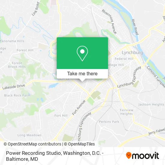
See Power Recording Studio, Lynchburg, on the map
Public Transit to Power Recording Studio in Lynchburg
Wondering how to get to Power Recording Studio in Lynchburg? Moovit helps you find the best way to get to Power Recording Studio with step-by-step directions from the nearest public transit station.
Moovit provides free maps and live directions to help you navigate through your city. View schedules, routes, timetables, and find out how long does it take to get to Power Recording Studio in real time.
Looking for the nearest stop or station to Power Recording Studio? Check out this list of stops closest to your destination: Memorial Ave. & Alleghany Ave. (Outbound); Plaza Transfer Center; Lynchburg Station.
Bus: 11, 12, GREYHOUND US0600, 10, 12X, 1A, 1B.Train: NORTHEAST REGIONAL, CRESCENT.
Want to see if there’s another route that gets you there at an earlier time? Moovit helps you find alternative routes or times. Get directions from and directions to Power Recording Studio easily from the Moovit App or Website.
We make riding to Power Recording Studio easy, which is why over 1.5 million users, including users in Lynchburg, trust Moovit as the best app for public transit. You don’t need to download an individual bus app or train app, Moovit is your all-in-one transit app that helps you find the best bus time or train time available.
For information on prices of bus and train, costs and ride fares to Power Recording Studio, please check the Moovit app.
Use the app to navigate to popular places including to the airport, hospital, stadium, grocery store, mall, coffee shop, school, college, and university.
Power Recording Studio Address: 509 Alleghany Ave Lynchburg, VA 24501 street in Lynchburg
- Unique Styles,
- Yellow Cab of Lynchburg,
- Sonship Hairstylists,
- Libertyx Bitcoin ATM,
- Diamond Cutz,
- Aireco,
- Diamond Cutz Barber,
- Rhema's Gentle Care,
- Alleghany U Store It,
- Rhema Word Ministries,
- Rwm107,
- Rhema Gentle Care Child DVLPT Center,
- Stewart Stainless Supply,
- Holy Trinity Orthodox Church,
- Consumers Dornin-Adams,
- M. and Darby's Cleaning Service,
- Lynchburg Area Center for Independent Living,
- New Convenant Fellowship Church of God,
- Hill City Cuts,
- Seven Hills Electronics
Places Near Power Recording Studio (Lynchburg)
- Rock Creek Tennis Center, Washington,
- Pennsylvania Ave NW (3rd st and pennsylvania), Washington,
- M&T Bank Stadium, Baltimore,
- Washington National Cathedral, Washington,
- National Mall, Washington,
- Museum Of The Bible, Washington,
- National Zoo, Washington,
- PG Mall, Prince George's County,
- The Anthem, Washington,
- Westfield Montgomery Mall, Montgomery County,
- Marriott Marquis Washington, DC, Washington,
- Washington DC VA Medical Center, Washington,
- Sibley Memorial Hospital, Washington,
- Capital One Arena, Washington,
- Basilica of the National Shrine, Washington,
- Warner Theatre, Washington,
- Georgetown, Washington,
- Camden Yards, Baltimore,
- National Museum of African American History and Culture, Washington,
- Amazon Hq2, Arlington County
How to get to popular places in Washington, D.C. - Baltimore, MD with public transit
Get around Lynchburg by public transit!
Traveling around Lynchburg has never been so easy. See step by step directions as you travel to any attraction, street or major public transit station. View bus and train schedules, arrival times, service alerts and detailed routes on a map, so you know exactly how to get to anywhere in Lynchburg.
When traveling to any destination around Lynchburg use Moovit's Live Directions with Get Off Notifications to know exactly where and how far to walk, how long to wait for your line, and how many stops are left. Moovit will alert you when it's time to get off — no need to constantly re-check whether yours is the next stop.
Wondering how to use public transit in Lynchburg or how to pay for public transit in Lynchburg? Moovit public transit app can help you navigate your way with public transit easily, and at minimum cost. It includes public transit fees, ticket prices, and costs. Looking for a map of Lynchburg public transit lines? Moovit public transit app shows all public transit maps in Lynchburg with all Bus, Train, Metro, Light Rail and Ferry routes and stops on an interactive map.
Washington, D.C. - Baltimore, MD has 5 transit type(s), including: Bus, Train, Metro, Light Rail and Ferry, operated by several transit agencies, including WMATA, Montgomery County Ride On, Fairfax Connector, TheBus, PRTC, DASH - Alexandria, Arlington Transit (ART), RTA of Central Maryland, MDOT MTA, MDOT MTA Light RailLink, MDOT MTA Commuter Bus, MDOT MTA Local Bus, FXBGO!, Virginia Railway Express (VRE) and MARC