How to get to Power Woman Fa by bus?
Click on the bus route to see step by step directions with maps, line arrival times and updated time schedules.
From Neufchâtel, Reims
40 minFrom Bistrot de la Gare, Prunay
53 minFrom Champ Paveau, Tinqueux
40 minFrom Girardin, Prunay
52 minFrom Brit Hotel Reims La Neuvillette - Bâtiment B, Reims
54 minFrom Champéa Shopping, Thillois
44 minFrom Funérarium De L'Avenue De Laon, Reims
42 minFrom INTERSPORT, Thillois
44 minFrom Aquamoovprunay, Prunay
56 minFrom Bergelyne, Prunay
49 min
Bus stops near Power Woman Fa in Reims
Light Rail stations near Power Woman Fa in Reims
- Courlancy, 22 min walk,VIEW
Bus lines to Power Woman Fa in Reims
What are the closest stations to Power Woman Fa?
The closest stations to Power Woman Fa are:
- Ponce De Leon is 195 meters away, 3 min walk.
- Luthuli is 378 meters away, 5 min walk.
- Colomb is 406 meters away, 6 min walk.
- Coubertin is 556 meters away, 8 min walk.
- Courlancy is 1717 meters away, 22 min walk.
Which bus lines stop near Power Woman Fa?
These bus lines stop near Power Woman Fa: U2, U4, U9.
What’s the nearest light rail station to Power Woman Fa in Reims?
The nearest light rail station to Power Woman Fa in Reims is Courlancy. It’s a 22 min walk away.
What’s the nearest bus station to Power Woman Fa in Reims?
The nearest bus station to Power Woman Fa in Reims is Ponce De Leon. It’s a 3 min walk away.
What time is the first light rail to Power Woman Fa in Reims?
The TRAM is the first light rail that goes to Power Woman Fa in Reims. It stops nearby at 5:05 AM.
What time is the last light rail to Power Woman Fa in Reims?
The TRAM is the last light rail that goes to Power Woman Fa in Reims. It stops nearby at 1:07 AM.
What time is the first bus to Power Woman Fa in Reims?
The U9 is the first bus that goes to Power Woman Fa in Reims. It stops nearby at 5:31 AM.
What time is the last bus to Power Woman Fa in Reims?
The U9 is the last bus that goes to Power Woman Fa in Reims. It stops nearby at 12:38 AM.
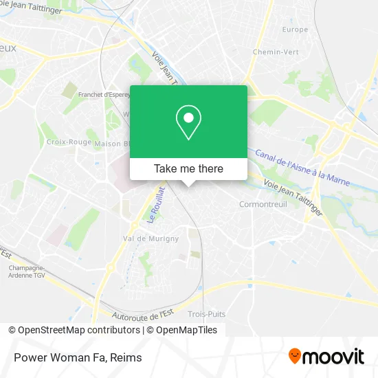
See Power Woman Fa, Reims, on the map
Public Transit to Power Woman Fa in Reims
Wondering how to get to Power Woman Fa in Reims? Moovit helps you find the best way to get to Power Woman Fa with step-by-step directions from the nearest public transit station.
Moovit provides free maps and live directions to help you navigate through your city. View schedules, routes, timetables, and find out how long does it take to get to Power Woman Fa in real time.
Looking for the nearest stop or station to Power Woman Fa? Check out this list of stops closest to your destination: Ponce De Leon; Luthuli; Colomb; Coubertin; Courlancy.
Bus: U2, U4, U9, 21, S2.
Want to see if there’s another route that gets you there at an earlier time? Moovit helps you find alternative routes or times. Get directions from and directions to Power Woman Fa easily from the Moovit App or Website.
We make riding to Power Woman Fa easy, which is why over 1.5 million users, including users in Reims, trust Moovit as the best app for public transit. You don’t need to download an individual bus app or train app, Moovit is your all-in-one transit app that helps you find the best bus time or train time available.
For information on prices of bus, costs and ride fares to Power Woman Fa, please check the Moovit app.
Use the app to navigate to popular places including to the airport, hospital, stadium, grocery store, mall, coffee shop, school, college, and university.
Power Woman Fa Address: 2 Avenue Ponce de Léon 51100 Reims street in Reims
- Adder,
- Ba10,
- Tour Des Argonautes,
- Mokotowitch Laurent,
- Société Remoise de Renovation,
- Diaghonete,
- Bnelec,
- Utile,
- Aefti Marne,
- Optic des Chatillons,
- Commissariat Rue Blaise Pascal,
- Modulo,
- Plurial Novilia,
- Rcs,
- Aroeven Champagne Ardenne,
- 1 Rue Dumont d'Urville,
- Péché,
- Reims - Chatillons,
- Total,
- Borne d'Impression Photo Speedlab
Places Near Power Woman Fa (Reims)
- Bétheny, Bétheny,
- Moulin De La Housse, Reims,
- Tinqueux, Tinqueux,
- Bezannes, Bezannes,
- St Remi, Reims,
- Leclerc, Saint-Brice-Courcelles,
- Hôpital Maison Blanche, Reims,
- Cormontreuil, Reims,
- Polyclinique Reims Bezannes, Bezannes,
- Gare Tgv, Bezannes,
- Hôpital Debré, Reims,
- E. Leclerc Champfleury, Champfleury,
- Parc de Champagne, Reims,
- Parc Des Expositions, Reims,
- CHU, Reims,
- Campus Croix Rouge, Reims,
- La Neuvillette, Reims,
- Carrefour, Tinqueux,
- Ikea, Thillois,
- Croix Blandin, Reims
How to get to popular places in Reims with public transit
Get around Reims by public transit!
Traveling around Reims has never been so easy. See step by step directions as you travel to any attraction, street or major public transit station. View bus and train schedules, arrival times, service alerts and detailed routes on a map, so you know exactly how to get to anywhere in Reims.
When traveling to any destination around Reims use Moovit's Live Directions with Get Off Notifications to know exactly where and how far to walk, how long to wait for your line, and how many stops are left. Moovit will alert you when it's time to get off — no need to constantly re-check whether yours is the next stop.
Wondering how to use public transit in Reims or how to pay for public transit in Reims? Moovit public transit app can help you navigate your way with public transit easily, and at minimum cost. It includes public transit fees, ticket prices, and costs. Looking for a map of Reims public transit lines? Moovit public transit app shows all public transit maps in Reims with all Bus and Light Rail routes and stops on an interactive map.
Reims has 2 transit type(s), including: Bus and Light Rail, operated by several transit agencies, including Transdev Reims