How to get to Powerlink Digital Partners by bus?
Click on the bus route to see step by step directions with maps, line arrival times and updated time schedules.
From Lincoln Hospital, Bronx
90 minFrom Laguardia Airport, Queens
74 minFrom Wagner Park, Manhattan
53 minFrom Mall del Sol Guayaquil,Ecuador, Queens
55 minFrom Bayonne Golf Club Ferry, Manhattan
52 minFrom Middle Village, NY, Queens
48 minFrom Laguardia Airport (LGA) (La Guardia Airport), Queens
74 minFrom 51, Jersey City
52 minFrom NJ 440, Jersey City
75 min
How to get to Powerlink Digital Partners by train?
Click on the train route to see step by step directions with maps, line arrival times and updated time schedules.
How to get to Powerlink Digital Partners by subway?
Click on the subway route to see step by step directions with maps, line arrival times and updated time schedules.
Subway stations near Powerlink Digital Partners in Manhattan
Bus stops near Powerlink Digital Partners in Manhattan
Train station near Powerlink Digital Partners in Manhattan
- 34 St-Penn Station, 5 min walk,VIEW
Bus lines to Powerlink Digital Partners in Manhattan
- M7, 14 St Via Columbus Via 7 Av,VIEW
- M20, Lincoln Center 66 St Via 8 Av,VIEW
- GREYHOUND US0305, New York Port Authority,VIEW
- Q32, Penn Station,VIEW
- QM1, Fresh Meadows - Midtown Express,VIEW
- QM5, Glen Oaks - Midtown Express,VIEW
- QM6, Lake Success - Midtown Express,VIEW
- M5, Limited Washington Heights Gw Bridge,VIEW
- M55, 44 St 6 Av,VIEW
- HAMPTON JITNEY MONTAUK, Amagansett,VIEW
- GREENWICH, Midtown / W 39th Street - Midtown / W 39th Street,VIEW
- 34TH ST, 34th St,VIEW
- M34-SBS, East Side - Javits Center,VIEW
- M34A-SBS, Waterside - Port Authority Terminal,VIEW
- SIM23, Annadale Via Arden Av,VIEW
- SIM24, Midtown Via 34 St Via Madison Av,VIEW
- QM10, Lefrak City - Midtown Express,VIEW
- QM12, Forest Hills - Midtown Express,VIEW
- QM24, Glendale - Midtown Express,VIEW
What are the closest stations to Powerlink Digital Partners?
The closest stations to Powerlink Digital Partners are:
- 42 St-Bryant Pk is 34 yards away, 1 min walk.
- 7 Av/W 37 St is 172 yards away, 3 min walk.
- New York Midtown West is 201 yards away, 3 min walk.
- 7 Av/ W 36 St is 207 yards away, 3 min walk.
- 6 Av/W 37 St is 209 yards away, 3 min walk.
- Times Sq-42 St is 223 yards away, 3 min walk.
- 6 Av/W 38 St is 225 yards away, 3 min walk.
- 37th St & 6th Ave Westsider is 267 yards away, 4 min walk.
- W 34th St & 7th Ave is 296 yards away, 4 min walk.
- W 34 St/7 Av is 300 yards away, 4 min walk.
- 34 St-Penn Station is 334 yards away, 4 min walk.
Which bus lines stop near Powerlink Digital Partners?
These bus lines stop near Powerlink Digital Partners: 119, M20, M55, M7, QM18, QM24.
Which train lines stop near Powerlink Digital Partners?
These train lines stop near Powerlink Digital Partners: 1, RONKONKOMA BRANCH, YEL.
Which subway lines stop near Powerlink Digital Partners?
These subway lines stop near Powerlink Digital Partners: 1, 2, 7X, F, M, Q.
What’s the nearest subway station to Powerlink Digital Partners in Manhattan?
The nearest subway station to Powerlink Digital Partners in Manhattan is 42 St-Bryant Pk. It’s a 1 min walk away.
What’s the nearest train station to Powerlink Digital Partners in Manhattan?
The nearest train station to Powerlink Digital Partners in Manhattan is 34 St-Penn Station. It’s a 5 min walk away.
What’s the nearest bus station to Powerlink Digital Partners in Manhattan?
The nearest bus stations to Powerlink Digital Partners in Manhattan are 7 Av/W 37 St, New York Midtown West, 7 Av/ W 36 St, 6 Av/W 37 St and 6 Av/W 38 St. The closest one is a 3 min walk away.
What time is the first subway to Powerlink Digital Partners in Manhattan?
The N is the first subway that goes to Powerlink Digital Partners in Manhattan. It stops nearby at 3:00 AM.
What time is the last subway to Powerlink Digital Partners in Manhattan?
The N is the last subway that goes to Powerlink Digital Partners in Manhattan. It stops nearby at 4:00 AM.
What time is the first train to Powerlink Digital Partners in Manhattan?
The PORT JEFFERSON BRANCH is the first train that goes to Powerlink Digital Partners in Manhattan. It stops nearby at 3:03 AM.
What time is the last train to Powerlink Digital Partners in Manhattan?
The RONKONKOMA BRANCH is the last train that goes to Powerlink Digital Partners in Manhattan. It stops nearby at 3:15 AM.
What time is the first bus to Powerlink Digital Partners in Manhattan?
The M7 is the first bus that goes to Powerlink Digital Partners in Manhattan. It stops nearby at 3:13 AM.
What time is the last bus to Powerlink Digital Partners in Manhattan?
The M7 is the last bus that goes to Powerlink Digital Partners in Manhattan. It stops nearby at 3:13 AM.
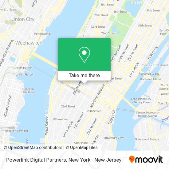
See Powerlink Digital Partners, Manhattan, on the map
Public Transit to Powerlink Digital Partners in Manhattan
Wondering how to get to Powerlink Digital Partners in Manhattan? Moovit helps you find the best way to get to Powerlink Digital Partners with step-by-step directions from the nearest public transit station.
Moovit provides free maps and live directions to help you navigate through your city. View schedules, routes, timetables, and find out how long does it take to get to Powerlink Digital Partners in real time.
Looking for the nearest stop or station to Powerlink Digital Partners? Check out this list of stops closest to your destination: 42 St-Bryant Pk; 7 Av/W 37 St; New York Midtown West; 7 Av/ W 36 St; 6 Av/W 37 St; Times Sq-42 St; 6 Av/W 38 St; 37th St & 6th Ave Westsider; W 34th St & 7th Ave; W 34 St/7 Av; 34 St-Penn Station.
Bus: 119, M20, M55, M7, QM18, QM24, Q32.Train: 1, RONKONKOMA BRANCH, YEL, ACELA, ADIRONDACK, BERKSHIRE FLYER, CARDINAL, CAROLINIAN.Subway: 1, 2, 7X, F, M, Q, B, D, FX, N, R, S, W, A, C, E.
Want to see if there’s another route that gets you there at an earlier time? Moovit helps you find alternative routes or times. Get directions from and directions to Powerlink Digital Partners easily from the Moovit App or Website.
We make riding to Powerlink Digital Partners easy, which is why over 1.7 million users, including users in Manhattan, trust Moovit as the best app for public transit. You don’t need to download an individual bus app or train app, Moovit is your all-in-one transit app that helps you find the best bus time or train time available.
For information on prices of bus, subway and train, costs and ride fares to Powerlink Digital Partners, please check the Moovit app.
Use the app to navigate to popular places including to the airport, hospital, stadium, grocery store, mall, coffee shop, school, college, and university.
Powerlink Digital Partners Address: 500 7th Ave street in Manhattan
- Steptember Us,
- Meridio,
- Aish New York,
- Sijo,
- Jmwilliams Cpa, Llp,
- Hired by Matrix, Inc.,
- Bella Media + Co.,
- Ondo,
- Cerebral Palsy Alliance Research Foundation,
- Webster Bank,
- Aberlite,
- Cvs Pharmacy,
- Distrikt,
- Kubient,
- Hill Run Holdings,
- Visionx Technologies,
- Culinary Agents,
- Usablenet,
- Ondyr Marketing,
- Salesloft
Places Near Powerlink Digital Partners (Manhattan)
- Katz's Deli, Manhattan,
- Rockefeller Center, Manhattan,
- 1 Police Plaza, Manhattan,
- 111 Centre New York City Supreme Court, Manhattan,
- Wall Street, Manhattan,
- 66 John Street, Manhattan,
- SoHo, Manhattan,
- Hudson Yards, Manhattan,
- Queens Center Mall, Queens,
- San Gennaro Feast, Manhattan,
- Bellevue Hospital, Manhattan,
- 911 Memorial, Manhattan,
- 26 Federal Plaza, Manhattan,
- 376 Hudson Street, Manhattan,
- Mountainside Hospital, Glen Ridge,
- Chinatown, Manhattan,
- qqqq, Manhattan,
- Times Square, Manhattan,
- Pier 83, Manhattan,
- 3 Stone St, Manhattan
How to get to popular places in New York - New Jersey with public transit
Get around Manhattan by public transit!
Traveling around Manhattan has never been so easy. See step by step directions as you travel to any attraction, street or major public transit station. View bus and train schedules, arrival times, service alerts and detailed routes on a map, so you know exactly how to get to anywhere in Manhattan.
When traveling to any destination around Manhattan use Moovit's Live Directions with Get Off Notifications to know exactly where and how far to walk, how long to wait for your line, and how many stops are left. Moovit will alert you when it's time to get off — no need to constantly re-check whether yours is the next stop.
Wondering how to use public transit in Manhattan or how to pay for public transit in Manhattan? Moovit public transit app can help you navigate your way with public transit easily, and at minimum cost. It includes public transit fees, ticket prices, and costs. Looking for a map of Manhattan public transit lines? Moovit public transit app shows all public transit maps in Manhattan with all Bus, Train, Subway, Light Rail, Ferry and Cable Car routes and stops on an interactive map.
New York - New Jersey has 6 transit type(s), including: Bus, Train, Subway, Light Rail, Ferry and Cable Car, operated by several transit agencies, including MTA Subway, Metro-North Railroad, LIRR, PATH, MTA New York City Transit - Express routes, MTA Bus, NJ Transit, NYC Ferry, NICE bus, Bee-Line Bus, NJ Transit Rail, Norwalk Transit District, Hartford Line, River Valley Transit and HART