How to get to Powertech by bus?
Click on the bus route to see step by step directions with maps, line arrival times and updated time schedules.
From Totowa, NJ, Totowa
105 minFrom Parsippany, NJ, Parsippany-Troy Hills
81 minFrom Lakeland Bus Stop, Parsippany-Troy Hills
67 minFrom Randolph, NJ, Randolph
55 minFrom West Orange, NJ, West Orange
185 minFrom Community Coach 77 Bus Stop, Livingston
151 minFrom MMNJ, Parsippany-Troy Hills
80 minFrom Saint Barnabas Medical Center, Livingston
169 minFrom Wayne, NJ, Wayne
165 minFrom Mountain Creek Waterpark, West Milford
226 min
Bus stop near Powertech in Rockaway
- W Main St at Nichols Dr, 6 min walk,VIEW
Train station near Powertech in Rockaway
- Dover, 23 min walk,VIEW
Bus lines to Powertech in Rockaway
- 880, Rockaway Mal Via Wharton,VIEW
What are the closest stations to Powertech?
The closest stations to Powertech are:
- W Main St at Nichols Dr is 428 yards away, 6 min walk.
- Dover is 1932 yards away, 23 min walk.
Which bus lines stop near Powertech?
These bus lines stop near Powertech: 875, 880.
What’s the nearest train station to Powertech in Rockaway?
The nearest train station to Powertech in Rockaway is Dover. It’s a 23 min walk away.
What’s the nearest bus station to Powertech in Rockaway?
The nearest bus station to Powertech in Rockaway is W Main St at Nichols Dr. It’s a 6 min walk away.
What time is the first train to Powertech in Rockaway?
The MEL is the first train that goes to Powertech in Rockaway. It stops nearby at 3:02 AM.
What time is the last train to Powertech in Rockaway?
The MEL is the last train that goes to Powertech in Rockaway. It stops nearby at 2:30 AM.
What time is the first bus to Powertech in Rockaway?
The 880 is the first bus that goes to Powertech in Rockaway. It stops nearby at 6:32 AM.
What time is the last bus to Powertech in Rockaway?
The 880 is the last bus that goes to Powertech in Rockaway. It stops nearby at 7:36 PM.
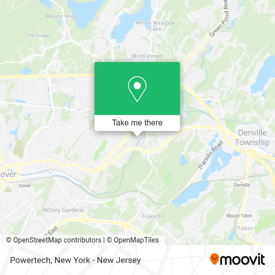
See Powertech, Rockaway, on the map
Public Transit to Powertech in Rockaway
Wondering how to get to Powertech in Rockaway? Moovit helps you find the best way to get to Powertech with step-by-step directions from the nearest public transit station.
Moovit provides free maps and live directions to help you navigate through your city. View schedules, routes, timetables, and find out how long does it take to get to Powertech in real time.
Looking for the nearest stop or station to Powertech? Check out this list of stops closest to your destination: W Main St at Nichols Dr; Dover.
Bus: 875, 880.Train: MEL, ML.
Want to see if there’s another route that gets you there at an earlier time? Moovit helps you find alternative routes or times. Get directions from and directions to Powertech easily from the Moovit App or Website.
We make riding to Powertech easy, which is why over 1.5 million users, including users in Rockaway, trust Moovit as the best app for public transit. You don’t need to download an individual bus app or train app, Moovit is your all-in-one transit app that helps you find the best bus time or train time available.
For information on prices of bus and train, costs and ride fares to Powertech, please check the Moovit app.
Use the app to navigate to popular places including to the airport, hospital, stadium, grocery store, mall, coffee shop, school, college, and university.
Powertech Address: 311 W Main St street in Rockaway
- Rockaway Recycling,
- Rrcats.Com,
- Yovannis Auto Service Llc,
- Tri-County Auto Supply,
- N Tassielli Disposal Inc.,
- Cipshred, Llc,
- Arc Race Engines,
- M20 Motorsports,
- Mfc Offroad,
- M20 Industries,
- Rockaway Borough,
- Affordable Asphalt Paving,
- Classic Tile Inc.,
- Allied Concrete Co.,
- Icmc Weekend Islamic School,
- Cn Tree Service,
- Antiques Plus Inc.,
- P &S Auto Care,
- Stephen Kao,
- Kao Stephen DDS
Places Near Powertech (Rockaway)
- SoHo, Manhattan,
- 111 Centre New York City Supreme Court, Manhattan,
- Bellevue Hospital, Manhattan,
- Times Square, Manhattan,
- San Gennaro Feast, Manhattan,
- 3 Stone St, Manhattan,
- Chinatown, Manhattan,
- qqqq, Manhattan,
- Rockefeller Center, Manhattan,
- Hudson Yards, Manhattan,
- Wall Street, Manhattan,
- Queens Center Mall, Queens,
- Pier 83, Manhattan,
- 1 Police Plaza, Manhattan,
- 66 John Street, Manhattan,
- 26 Federal Plaza, Manhattan,
- 376 Hudson Street, Manhattan,
- 911 Memorial, Manhattan,
- Katz's Deli, Manhattan,
- Mountainside Hospital, Glen Ridge
How to get to popular places in New York - New Jersey with public transit
Get around Rockaway by public transit!
Traveling around Rockaway has never been so easy. See step by step directions as you travel to any attraction, street or major public transit station. View bus and train schedules, arrival times, service alerts and detailed routes on a map, so you know exactly how to get to anywhere in Rockaway.
When traveling to any destination around Rockaway use Moovit's Live Directions with Get Off Notifications to know exactly where and how far to walk, how long to wait for your line, and how many stops are left. Moovit will alert you when it's time to get off — no need to constantly re-check whether yours is the next stop.
Wondering how to use public transit in Rockaway or how to pay for public transit in Rockaway? Moovit public transit app can help you navigate your way with public transit easily, and at minimum cost. It includes public transit fees, ticket prices, and costs. Looking for a map of Rockaway public transit lines? Moovit public transit app shows all public transit maps in Rockaway with all Bus, Train, Subway, Light Rail, Ferry and Cable Car routes and stops on an interactive map.
New York - New Jersey has 6 transit type(s), including: Bus, Train, Subway, Light Rail, Ferry and Cable Car, operated by several transit agencies, including MTA Subway, Metro-North Railroad, LIRR, PATH, MTA New York City Transit - Express routes, MTA Bus, NJ Transit, NYC Ferry, NICE bus, Bee-Line Bus, NJ Transit Rail, Norwalk Transit District, Hartford Line, River Valley Transit and HART