How to get to Ppbl Deposito de Bebidas by bus?
Click on the bus route to see step by step directions with maps, line arrival times and updated time schedules.
From Estrada do Lameirão Pequeno, Campo Grande
47 minFrom Hospital Municipal Pedro II, Santa Cruz
58 minFrom Nova Iguaçu, Nova Iguaçu
79 minFrom Santa Cruz, Santa Cruz
54 minFrom Vargem Grande, Vargem Grande
104 minFrom Km 32, Nova Iguaçu
60 minFrom BRT - Estação Mato Alto, Guaratiba
69 minFrom Hospital da Mulher Mariska Ribeiro, Bangu
59 minFrom Pedra De Guaratiba, Pedra De Guaratiba
80 minFrom Estrada do Mendanha, Campo Grande
50 min
How to get to Ppbl Deposito de Bebidas by train?
Click on the train route to see step by step directions with maps, line arrival times and updated time schedules.
Bus stops near Ppbl Deposito de Bebidas in Inhoaíba
Train station near Ppbl Deposito de Bebidas in Inhoaíba
- Campo Grande, 28 min walk,VIEW
Bus lines to Ppbl Deposito de Bebidas in Inhoaíba
What are the closest stations to Ppbl Deposito de Bebidas?
The closest stations to Ppbl Deposito de Bebidas are:
- Avenida Cesário De Melo | Rua Moranga is 1276 meters away, 17 min walk.
- São Jorge is 1278 meters away, 17 min walk.
- Estrada Do Cantagalo, 881-885 is 2072 meters away, 27 min walk.
- Campo Grande is 2154 meters away, 28 min walk.
Which bus lines stop near Ppbl Deposito de Bebidas?
These bus lines stop near Ppbl Deposito de Bebidas: 17, 2803, 570P.
Which train line stops near Ppbl Deposito de Bebidas?
RAMAL SANTA CRUZ (Central Do Brasil (Expresso))
What’s the nearest train station to Ppbl Deposito de Bebidas in Inhoaíba?
The nearest train station to Ppbl Deposito de Bebidas in Inhoaíba is Campo Grande. It’s a 28 min walk away.
What time is the first train to Ppbl Deposito de Bebidas in Inhoaíba?
The RAMAL SANTA CRUZ is the first train that goes to Ppbl Deposito de Bebidas in Inhoaíba. It stops nearby at 4:04 AM.
What time is the last train to Ppbl Deposito de Bebidas in Inhoaíba?
The RAMAL SANTA CRUZ is the last train that goes to Ppbl Deposito de Bebidas in Inhoaíba. It stops nearby at 11:50 PM.
What time is the first bus to Ppbl Deposito de Bebidas in Inhoaíba?
The 17 is the first bus that goes to Ppbl Deposito de Bebidas in Inhoaíba. It stops nearby at 3:05 AM.
What time is the last bus to Ppbl Deposito de Bebidas in Inhoaíba?
The 17 is the last bus that goes to Ppbl Deposito de Bebidas in Inhoaíba. It stops nearby at 2:44 AM.
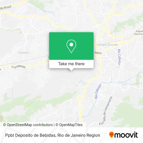
See Ppbl Deposito de Bebidas, Inhoaíba, on the map
Public Transit to Ppbl Deposito de Bebidas in Inhoaíba
Wondering how to get to Ppbl Deposito de Bebidas in Inhoaíba? Moovit helps you find the best way to get to Ppbl Deposito de Bebidas with step-by-step directions from the nearest public transit station.
Moovit provides free maps and live directions to help you navigate through your city. View schedules, routes, timetables, and find out how long does it take to get to Ppbl Deposito de Bebidas in real time.
Looking for the nearest stop or station to Ppbl Deposito de Bebidas? Check out this list of stops closest to your destination: Avenida Cesário De Melo | Rua Moranga; São Jorge; Estrada Do Cantagalo; Campo Grande.
Bus: 17, 2803, 570P, 2307, 845.Train: RAMAL SANTA CRUZ.
Want to see if there’s another route that gets you there at an earlier time? Moovit helps you find alternative routes or times. Get directions from and directions to Ppbl Deposito de Bebidas easily from the Moovit App or Website.
We make riding to Ppbl Deposito de Bebidas easy, which is why over 1.5 million users, including users in Inhoaíba, trust Moovit as the best app for public transit. You don’t need to download an individual bus app or train app, Moovit is your all-in-one transit app that helps you find the best bus time or train time available.
For information on prices of bus and train, costs and ride fares to Ppbl Deposito de Bebidas, please check the Moovit app.
Use the app to navigate to popular places including to the airport, hospital, stadium, grocery store, mall, coffee shop, school, college, and university.
Ppbl Deposito de Bebidas Address: Rua Poeraba, 21 Inhoaíba Rio de Janeiro-RJ 23059-120 street in Inhoaíba
- Rua Poeraba 415,
- Rua Belmonte Moranga,
- Igreja Batista Nova Aurora,
- Rua Hiroshima,
- Rua Péricles Maranhão,
- Rua Carlos Freire, 295,
- Trilha Pedra da Tartaruga,
- Rua Poeraba 14,
- Cantinho do Caldo,
- Américo do Peixe - São Jorge,
- Praça Aldo Botelho,
- Acai de Campo Grande,
- Rua dos Pedreiros, 20,
- Ki-Korpo Moda Praia,
- Praça de Sao jorge,
- Filadelfia Corretores,
- Instituição de Caridade São Cipriano,
- Rua Alfredo de Azevedo,
- Creche Vera Pacheco Jordão,
- Rua Pedro Autran 71
Places Near Ppbl Deposito de Bebidas (Inhoaíba)
- Norte Shopping, Cachambi,
- Shopping Nova América, Del Castilho,
- Shopping Downtown, Barra Da Tijuca,
- Niterói, Niterói,
- Hospital Municipal Ronaldo Gazolla, Acari,
- Shopping RioSul, Botafogo,
- Museu Do Amanhã, Centro,
- Rua Licínio Cardoso, São Francisco Xavier,
- Feira Livre da Gloria, Glória,
- Rua Ulysses Guimarães 16, Cidade Nova,
- Avenida Venezuela 134, Saúde,
- Hospital Federal Cardoso Fontes, Jacarepaguá,
- Praia do Arpoador, Ipanema,
- Rodoviária Novo Rio (Rodoviária do Rio de Janeiro), Santo Cristo,
- Feirão De Malhas, Duque De Caxias,
- Hospital Federal Do Andaraí, Andaraí,
- Hospital Pedro Ernesto, Vila Isabel,
- Shopping Rio Sul, Botafogo,
- Avenida Rio Branco, Centro,
- Rio De Janeiro
How to get to popular places in Rio de Janeiro Region with public transit
Get around Inhoaíba by public transit!
Traveling around Inhoaíba has never been so easy. See step by step directions as you travel to any attraction, street or major public transit station. View bus and train schedules, arrival times, service alerts and detailed routes on a map, so you know exactly how to get to anywhere in Inhoaíba.
When traveling to any destination around Inhoaíba use Moovit's Live Directions with Get Off Notifications to know exactly where and how far to walk, how long to wait for your line, and how many stops are left. Moovit will alert you when it's time to get off — no need to constantly re-check whether yours is the next stop.
Wondering how to use public transit in Inhoaíba or how to pay for public transit in Inhoaíba? Moovit public transit app can help you navigate your way with public transit easily, and at minimum cost. It includes public transit fees, ticket prices, and costs. Looking for a map of Inhoaíba public transit lines? Moovit public transit app shows all public transit maps in Inhoaíba with all Bus, Train, Metro, Light Rail, Ferry, Cable Car, Gondola and Funicular routes and stops on an interactive map.
Rio de Janeiro Region has 8 transit type(s), including: Bus, Train, Metro, Light Rail, Ferry, Cable Car, Gondola and Funicular, operated by several transit agencies, including TrensRJ, Metrô Rio, VLT Carioca, Barcas Rio, BRT MOBI-Rio, Auto Viação Alpha, Auto Viação Tijuca, Gire Transportes, Transurb, Viação Nossa Senhora das Graças, Consórcio INTERSUL, Braso Lisboa (Municipal), Caprichosa Auto Ônibus, Auto Viação Três Amigos and Rodoviária Âncora Matias