How to get to Praça Ministro Romeiro Neto by bus?
Click on the bus route to see step by step directions with maps, line arrival times and updated time schedules.
From Rua Pinto de Azevedo 105, Cidade Nova
37 minFrom Avenida Venceslau Braz 14, Botafogo
32 minFrom Rua Acre, Centro
48 minFrom Rua Sacadura Cabral 120, Saúde
53 minFrom Praça Marechal Âncora, Centro
46 minFrom Hospital dos Servidores do Estado, Gamboa
46 minFrom Av. Das Américas 500, Barra Da Tijuca
34 minFrom Marechal Câmara, Centro
42 minFrom Sesc Tijuca, Andaraí
57 minFrom Rua Afonso Cavalcanti 455, Cidade Nova
38 min
How to get to Praça Ministro Romeiro Neto by metro?
Click on the metro route to see step by step directions with maps, line arrival times and updated time schedules.
From Rua Pinto de Azevedo 105, Cidade Nova
49 minFrom Avenida Venceslau Braz 14, Botafogo
43 minFrom Rua Acre, Centro
44 minFrom Rua Sacadura Cabral 120, Saúde
53 minFrom Praça Marechal Âncora, Centro
49 minFrom Hospital dos Servidores do Estado, Gamboa
54 minFrom Av. Das Américas 500, Barra Da Tijuca
36 minFrom Marechal Câmara, Centro
45 minFrom Sesc Tijuca, Andaraí
62 minFrom Rua Afonso Cavalcanti 455, Cidade Nova
49 min
Bus stops near Praça Ministro Romeiro Neto in Leblon
- Avenida Bartolomeu Mitre, 570 (Linhas Sentido Barra), 4 min walk,VIEW
- Avenida Bartolomeu Mitre, 438 A (Linhas Sentido Gávea), 4 min walk,VIEW
- BRS 2 - Cupertino Durão, 4 min walk,VIEW
- Ponto Final - Leblon, 5 min walk,VIEW
- Ponto Final - Gávea (Linha 565 - Feira Livre), 6 min walk,VIEW
- Ponto Final - Gávea (Linhas 550 E 555), 6 min walk,VIEW
- Praça Antero De Quental, 6 min walk,VIEW
- Ponto Final - Jardim De Alah, 6 min walk,VIEW
Metro station near Praça Ministro Romeiro Neto in Leblon
- Antero De Quental, 5 min walk,VIEW
Funicular station near Praça Ministro Romeiro Neto in Leblon
- Estação 5, 47 min walk,VIEW
Bus lines to Praça Ministro Romeiro Neto in Leblon
- 109, Terminal Gentileza,VIEW
- 111, Central,VIEW
- 160, Leblon (Circular),VIEW
- 475, São Cristóvão ↔ Leblon,VIEW
- 476, Méier ↔ Leblon,VIEW
- 539, São Conrado,VIEW
- 552, Rio Sul (Via Visconde De Pirajá),VIEW
- 553, Recreio,VIEW
- 554, Piabas (Via Barata Ribeiro / Bartolomeu Mitre),VIEW
- 557, Copacabana (via Visconde de Pirajá),VIEW
- 558, Cidade De Deus,VIEW
- 584, Cosme Velho ↔ Leblon (Via Copacabana - Circular),VIEW
- 2334, Campo Grande (Via Barata Ribeiro / Bartolomeu Mitre / Mato Alto),VIEW
- 2335, Santa Cruz (Reversível),VIEW
- 2338, Campo Grande (Reversível),VIEW
- 104, Terminal Gentileza (Feira Livre),VIEW
- 585, Largo do Machado,VIEW
- 157, Santo Cristo,VIEW
- 415, Usina (Via Praia Do Flamengo),VIEW
- SN 415, Usina,VIEW
What are the closest stations to Praça Ministro Romeiro Neto?
The closest stations to Praça Ministro Romeiro Neto are:
- Avenida Bartolomeu Mitre, 570 (Linhas Sentido Barra) is 244 meters away, 4 min walk.
- Avenida Bartolomeu Mitre, 438 A (Linhas Sentido Gávea) is 280 meters away, 4 min walk.
- BRS 2 - Cupertino Durão is 283 meters away, 4 min walk.
- Ponto Final - Leblon is 316 meters away, 5 min walk.
- Antero De Quental is 342 meters away, 5 min walk.
- Ponto Final - Gávea (Linha 565 - Feira Livre) is 393 meters away, 6 min walk.
- Ponto Final - Gávea (Linhas 550 E 555) is 434 meters away, 6 min walk.
- Praça Antero De Quental is 448 meters away, 6 min walk.
- Ponto Final - Jardim De Alah is 454 meters away, 6 min walk.
- Estação 5 is 3671 meters away, 47 min walk.
Which bus lines stop near Praça Ministro Romeiro Neto?
These bus lines stop near Praça Ministro Romeiro Neto: 110, 2335, 2338, 460, 476, 550, 557, 585.
Which metro line stops near Praça Ministro Romeiro Neto?
L1, L4 (Jardim Oceânico)
What’s the nearest metro station to Praça Ministro Romeiro Neto in Leblon?
The nearest metro station to Praça Ministro Romeiro Neto in Leblon is Antero De Quental. It’s a 5 min walk away.
What’s the nearest bus station to Praça Ministro Romeiro Neto in Leblon?
The nearest bus stations to Praça Ministro Romeiro Neto in Leblon are Avenida Bartolomeu Mitre, 570 (Linhas Sentido Barra), Avenida Bartolomeu Mitre, 438 A (Linhas Sentido Gávea) and BRS 2 - Cupertino Durão. The closest one is a 4 min walk away.
What time is the first metro to Praça Ministro Romeiro Neto in Leblon?
The L1, L4 is the first metro that goes to Praça Ministro Romeiro Neto in Leblon. It stops nearby at 5:08 AM.
What time is the last metro to Praça Ministro Romeiro Neto in Leblon?
The L1, L4 is the last metro that goes to Praça Ministro Romeiro Neto in Leblon. It stops nearby at 12:34 AM.
What time is the first bus to Praça Ministro Romeiro Neto in Leblon?
The SN 550 is the first bus that goes to Praça Ministro Romeiro Neto in Leblon. It stops nearby at 3:00 AM.
What time is the last bus to Praça Ministro Romeiro Neto in Leblon?
The SN 550 is the last bus that goes to Praça Ministro Romeiro Neto in Leblon. It stops nearby at 3:20 AM.
What time is the first funicular to Praça Ministro Romeiro Neto in Leblon?
The PAVÃO-PAVÃOZINHO is the first funicular that goes to Praça Ministro Romeiro Neto in Leblon. It stops nearby at 6:00 AM.
What time is the last funicular to Praça Ministro Romeiro Neto in Leblon?
The PAVÃO-PAVÃOZINHO is the last funicular that goes to Praça Ministro Romeiro Neto in Leblon. It stops nearby at 12:00 AM.
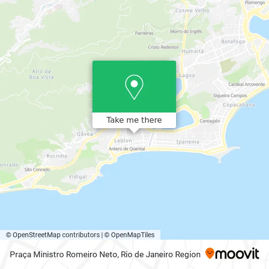
See Praça Ministro Romeiro Neto, Leblon, on the map
Public Transit to Praça Ministro Romeiro Neto in Leblon
Wondering how to get to Praça Ministro Romeiro Neto in Leblon? Moovit helps you find the best way to get to Praça Ministro Romeiro Neto with step-by-step directions from the nearest public transit station.
Moovit provides free maps and live directions to help you navigate through your city. View schedules, routes, timetables, and find out how long does it take to get to Praça Ministro Romeiro Neto in real time.
Looking for the nearest stop or station to Praça Ministro Romeiro Neto? Check out this list of stops closest to your destination: Avenida Bartolomeu Mitre; Avenida Bartolomeu Mitre; BRS 2 - Cupertino Durão; Ponto Final - Leblon; Antero De Quental; Ponto Final - Gávea (Linha 565 - Feira Livre); Ponto Final - Gávea (Linhas 550 E 555); Praça Antero De Quental; Ponto Final - Jardim De Alah; Estação 5.
Bus: 110, 2335, 2338, 460, 476, 550, 557, 585, 109, 111, 160, 475, 104, 157, 415, SN 415, 435, 583, SN 550, 555, 637T.Metro: L1, L4.Funicular: PAVÃO-PAVÃOZINHO.
Want to see if there’s another route that gets you there at an earlier time? Moovit helps you find alternative routes or times. Get directions from and directions to Praça Ministro Romeiro Neto easily from the Moovit App or Website.
We make riding to Praça Ministro Romeiro Neto easy, which is why over 1.5 million users, including users in Leblon, trust Moovit as the best app for public transit. You don’t need to download an individual bus app or train app, Moovit is your all-in-one transit app that helps you find the best bus time or train time available.
For information on prices of bus and metro, costs and ride fares to Praça Ministro Romeiro Neto, please check the Moovit app.
Use the app to navigate to popular places including to the airport, hospital, stadium, grocery store, mall, coffee shop, school, college, and university.
Praça Ministro Romeiro Neto Address: Rua Cupertino Durão street in Leblon
- Rua Cupertino Durão / Rua Humberto de Campos,
- Rua Fadel Fadel 54,
- Cine Leblon,
- Taxi - do Leblon para Ipanema,
- Rua Adalberto Ferreira Próximo ao, S / N,
- Rua Cupertino Durão 219,
- Condomínio do Edifício Saint Etienne,
- Isabel Becker Fotografias,
- Escola Municipal Santos Anjos,
- Leo Pereira Beach Tennis - Leblon,
- Rua Humberto de Campos / Rua Carlos Góis,
- Quadra De Basquete Do Leblon,
- Condominio do Edificio Saint Michel,
- Wwp Consultoria e Assessoria de Engenharia,
- Cachoeira dos Primatas,
- Pro Shop,
- Rua Carlos Gois,
- Avenida Ataulfo de Paiva,
- Banca do Jornal - Fadel,
- Rua José Linhares 245
Places Near Praça Ministro Romeiro Neto (Leblon)
- Shopping Downtown, Barra Da Tijuca,
- Rua Licínio Cardoso, São Francisco Xavier,
- Praia do Arpoador, Ipanema,
- Hospital Municipal Ronaldo Gazolla, Acari,
- Niterói, Niterói,
- Hospital Federal Cardoso Fontes, Jacarepaguá,
- Hospital Pedro Ernesto, Vila Isabel,
- Rua Ulysses Guimarães 16, Cidade Nova,
- Avenida Rio Branco, Centro,
- Feira Livre da Gloria, Glória,
- Norte Shopping, Cachambi,
- Rio De Janeiro,
- Feirão De Malhas, Duque De Caxias,
- Rodoviária Novo Rio (Rodoviária do Rio de Janeiro), Santo Cristo,
- Avenida Venezuela 134, Saúde,
- Hospital Federal Do Andaraí, Andaraí,
- Shopping Rio Sul, Botafogo,
- Shopping Nova América, Del Castilho,
- Shopping RioSul, Botafogo,
- Museu Do Amanhã, Centro
How to get to popular places in Rio de Janeiro Region with public transit
Get around Leblon by public transit!
Traveling around Leblon has never been so easy. See step by step directions as you travel to any attraction, street or major public transit station. View bus and train schedules, arrival times, service alerts and detailed routes on a map, so you know exactly how to get to anywhere in Leblon.
When traveling to any destination around Leblon use Moovit's Live Directions with Get Off Notifications to know exactly where and how far to walk, how long to wait for your line, and how many stops are left. Moovit will alert you when it's time to get off — no need to constantly re-check whether yours is the next stop.
Wondering how to use public transit in Leblon or how to pay for public transit in Leblon? Moovit public transit app can help you navigate your way with public transit easily, and at minimum cost. It includes public transit fees, ticket prices, and costs. Looking for a map of Leblon public transit lines? Moovit public transit app shows all public transit maps in Leblon with all Bus, Train, Metro, Light Rail, Ferry, Cable Car, Gondola and Funicular routes and stops on an interactive map.
Rio de Janeiro Region has 8 transit type(s), including: Bus, Train, Metro, Light Rail, Ferry, Cable Car, Gondola and Funicular, operated by several transit agencies, including TrensRJ, Metrô Rio, VLT Carioca, Barcas Rio, BRT MOBI-Rio, Auto Viação Alpha, Auto Viação Tijuca, Gire Transportes, Transurb, Viação Nossa Senhora das Graças, Consórcio INTERSUL, Braso Lisboa (Municipal), Caprichosa Auto Ônibus, Auto Viação Três Amigos and Rodoviária Âncora Matias
Public transit lines with stations closest to Praça Ministro Romeiro Neto in Leblon
Metro lines with stations closest to Praça Ministro Romeiro Neto in Leblon
Bus lines with stations closest to Praça Ministro Romeiro Neto in Leblon
Avenida Bartolomeu Mitre, 570 (Linhas Sentido Barra)
 109LECD131 - Terminal Gentileza - São Conrado (Via Santa Bárbara / Jardim Botânico)
- 111LECD134 - Central - Leblon (Brs 1 - via Rebouças / Jardim Botânico)
- 160LECD130 - Terminal Gentileza - Leblon (BRS 1 - Expresso - via Túnel Rebouças)
- 475LECD133 - São Cristóvão - Leblon (Expresso - via Praça da Bandeira / Túnel Rebouças)
- 476Méier - Leblon (Brs 2 - Via Túnel Rebouças - Circular)
BRS 2 - Cupertino Durão
- 157Santo Cristo - Gávea-PUC (BRS 1 - via Central / Lgo. Machado / Fonte da Saudade)
- 415Usina - Leblon (Brs 2 - Via Aterro / Lagoa)
- SN 415Usina - Leblon (BRS 2 - via Lapa / Praia do Flamengo)
- 435Grajaú - Gávea (Brs 2 - Via Túnel Santa Bárbara / Túnel Velho)
- 583Cosme Velho - Leblon (Brs 2 - Via Jóquei - Circular)