Praça da Bandeira stop - Monday schedule
| Line | Direction | Time |
|---|---|---|
| 022 INTER 2 (HORÁRIO) | Campina do Siqueira → Cabral | 5:59 AM |
| 022 INTER 2 (HORÁRIO) | Campina do Siqueira → Cabral | 6:07 AM |
| 022 INTER 2 (HORÁRIO) | Campina do Siqueira → Cabral | 6:11 AM |
| 022 INTER 2 (HORÁRIO) | Campina do Siqueira → Cabral | 6:15 AM |
| 022 INTER 2 (HORÁRIO) | Campina do Siqueira → Cabral | 6:19 AM |
| 022 INTER 2 (HORÁRIO) | Campina do Siqueira → Cabral | 6:23 AM |
| 022 INTER 2 (HORÁRIO) | Campina do Siqueira → Cabral | 6:27 AM |
| 022 INTER 2 (HORÁRIO) | Campina do Siqueira → Cabral | 6:30 AM |
| 022 INTER 2 (HORÁRIO) | Campina do Siqueira → Cabral | 6:32 AM |
| 022 INTER 2 (HORÁRIO) | Campina do Siqueira → Cabral | 6:34 AM |
| 022 INTER 2 (HORÁRIO) | Campina do Siqueira → Cabral | 6:37 AM |
| 022 INTER 2 (HORÁRIO) | Campina do Siqueira → Cabral | 6:39 AM |
| 022 INTER 2 (HORÁRIO) | Campina do Siqueira → Cabral | 6:42 AM |
| 022 INTER 2 (HORÁRIO) | Campina do Siqueira → Cabral | 6:45 AM |
| 022 INTER 2 (HORÁRIO) | Campina do Siqueira → Cabral | 6:48 AM |
| 022 INTER 2 (HORÁRIO) | Campina do Siqueira → Cabral | 6:51 AM |
| 022 INTER 2 (HORÁRIO) | Campina do Siqueira → Cabral | 6:54 AM |
| 022 INTER 2 (HORÁRIO) | Campina do Siqueira → Cabral | 6:57 AM |
| 022 INTER 2 (HORÁRIO) | Campina do Siqueira → Cabral | 7:00 AM |
| 022 INTER 2 (HORÁRIO) | Campina do Siqueira → Cabral | 7:03 AM |
| 022 INTER 2 (HORÁRIO) | Campina do Siqueira → Cabral | 7:06 AM |
| 022 INTER 2 (HORÁRIO) | Campina do Siqueira → Cabral | 7:10 AM |
| 022 INTER 2 (HORÁRIO) | Campina do Siqueira → Cabral | 7:14 AM |
| 022 INTER 2 (HORÁRIO) | Campina do Siqueira → Cabral | 7:18 AM |
| 022 INTER 2 (HORÁRIO) | Campina do Siqueira → Cabral | 7:23 AM |
Directions to Praça da Bandeira stop (São Francisco) with public transit
The following transit lines have routes that pass near Praça da Bandeira
 Bus: 010, 022 INTER 2 (HORÁRIO), 023 INTER 2 (ANTI-HORÁRIO), 175 BOM RETIRO / PUC, A77 TANGUÁ / GUADALUPE.
How to get to Praça da Bandeira stop by bus?
Click on the bus route to see step by step directions with maps, line arrival times and updated time schedules.
Bus stops near Praça da Bandeira stop in São Francisco
- Praça da Bandeira (Av. Desembargador Hugo Simas, 259), 1 min walk,
- Praça da Bandeira (R. Doutor Roberto Barroso, 1100), 2 min walk,
- R. Tapajós, 600, 3 min walk,
- Teffé, 4 min walk,
- R. Albino Silva, 145, 4 min walk,
- R. Dom Alberto Gonçalves, 700, 5 min walk,
- R. Solimões, 257, 6 min walk,
Bus lines to Praça da Bandeira stop in São Francisco
- A77 TANGUÁ / GUADALUPE, TANGUÁ / GUADALUPE,
- A80 TANGUÁ (VILA MARTA) / GUADALUPE, TANGUÁ (VILA MARTA) / GUADALUPE,
- 166 VILA NORI, VILA NORI,
- 170 BRACATINGA, BRACATINGA,
- 171 PRIMAVERA, PRIMAVERA,
- 188 MAD. PILARZINHO / UBERABA, MAD. PILARZINHO / UBERABA,
- A78 VILA MARTA / PRAÇA 19, VILA MARTA / PRAÇA 19,
- 164 RAQUEL PRADO / CARLOS GOMES, Marechal Floriano → Raquel Prado,
- 010 INTERBAIRROS I (HORÁRIO), Sentido Horário,
- 023 INTER 2 (ANTI-HORÁRIO), Cabral → Campina do Siqueira,
- 175 BOM RETIRO / PUC, Estação PUC (Linha Verde) ↺ Bom Retiro (Circular),
- 207 CABRAL / OSÓRIO, Praça Osório → Terminal Cabral,
- 011 INTERBAIRROS I (ANTI-HORÁRIO), Sentido Anti-horário,
- 150 CANAL DA MÚSICA / VISTA ALEGRE, Vista Alegre → Teatro Guaíra,
What are the closest stations to Praça da Bandeira?
The closest stations to Praça da Bandeira are:
- Praça da Bandeira (Av. Desembargador Hugo Simas, 259) is 65 meters away, 1 min walk.
- Praça da Bandeira (R. Doutor Roberto Barroso, 1100) is 77 meters away, 2 min walk.
- R. Tapajós, 600 is 192 meters away, 3 min walk.
- Teffé is 289 meters away, 4 min walk.
- R. Albino Silva, 145 is 299 meters away, 4 min walk.
- R. Dom Alberto Gonçalves, 700 is 345 meters away, 5 min walk.
- R. Solimões, 257 is 388 meters away, 6 min walk.
Which bus lines stop near Praça da Bandeira?
These bus lines stop near Praça da Bandeira: 010, 022 INTER 2 (HORÁRIO), 023 INTER 2 (ANTI-HORÁRIO), 175 BOM RETIRO / PUC, A77 TANGUÁ / GUADALUPE.
What’s the nearest bus station to Praça da Bandeira in São Francisco?
The nearest bus station to Praça da Bandeira in São Francisco is Praça da Bandeira (Av. Desembargador Hugo Simas, 259). It’s a 1 min walk away.
What time is the first bus to Praça da Bandeira in São Francisco?
The 188 MAD. PILARZINHO / UBERABA is the first bus that goes to Praça da Bandeira in São Francisco. It stops nearby at 3:03 AM.
What time is the last bus to Praça da Bandeira in São Francisco?
The 188 MAD. PILARZINHO / UBERABA is the last bus that goes to Praça da Bandeira in São Francisco. It stops nearby at 2:47 AM.
Praça da Bandeira station
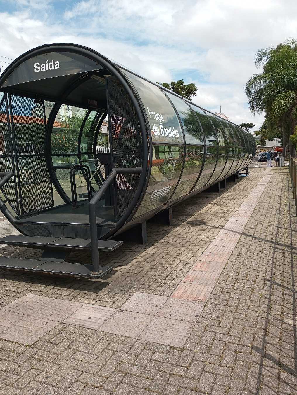 Taken by Anonymous
See Praça da Bandeira stop, São Francisco, on the map
Public transit to Praça da Bandeira stop (ID: 4201287) in São Francisco
Looking for directions to Praça da Bandeira in São Francisco, Brazil?
Download the Moovit App to find the current schedule and step-by-step directions for Bus routes that pass through Praça da Bandeira.
Looking for the nearest stops closest to Praça da Bandeira ? Check out this list of closest stops to your destination: Praça da Bandeira (Av. Desembargador Hugo Simas; Praça da Bandeira (R. Doutor Roberto Barroso; R. Tapajós; Teffé; R. Albino Silva; R. Dom Alberto Gonçalves; R. Solimões.
Bus: 010, 022 INTER 2 (HORÁRIO), 023 INTER 2 (ANTI-HORÁRIO), 175 BOM RETIRO / PUC, A77 TANGUÁ / GUADALUPE, A80 TANGUÁ (VILA MARTA) / GUADALUPE, 166 VILA NORI, 170 BRACATINGA, 171 PRIMAVERA, 164 RAQUEL PRADO / CARLOS GOMES, 010 INTERBAIRROS I (HORÁRIO), 207 CABRAL / OSÓRIO, 011 INTERBAIRROS I (ANTI-HORÁRIO).
We make riding on public transit to Praça da Bandeira easy, which is why over 1.5 million users, including users in São Francisco trust Moovit as the best app for public transit.
Use the app to navigate to popular places including to the airport, hospital, stadium, grocery store, mall, coffee shop, school, college, and university.
Praça da Bandeira stop’s code is 4201287
The first line to this stop is 022 INTER 2 (HORÁRIO), at 5:59 AM, and the last line is 022 INTER 2 (HORÁRIO) at 12:18 AM.
1090 Rua Doutor Roberto Barroso, Curitiba, Brazil
This stop serves Sistema Integrado de Mobilidade (URBS)’s lines
Popular routes from Praça da Bandeira stop, São Francisco
- Praça da Bandeira (Av. Desembargador Hugo Simas, 259),
- Praça da Bandeira (R. Doutor Roberto Barroso, 1100),
- R. Tapajós, 600,
- Teffé,
- R. Albino Silva, 145,
- R. Dom Alberto Gonçalves, 700,
- R. Solimões, 257
Bus stops near Praça da Bandeira stop
- Av. Visconde de Guarapuava, 3900 (Shopping Curitiba),
- R. João Dembinski, 1301,
- Marginal Norte da Rodovia do Xisto (BR 476) - Hiper Condor Araucária,
- Av. Santa Mônica, 667,
- Rodovia Régis Bittencourt (Br 116) - Km 123,
- Av. Jaime Reis, 342,
- R. João Bettega, 4100 - Circuito,
- Rod. BR-277 / R. Domingos Puppi (Viaduto Prefeito Marcelo Puppi),
- R. Benjamim Claudino Barbosa, 2603,
- Rodovia Régis Bittencourt (Br 116) - Passarela,
- Rod. Deputado João Lepoldo Jacomel, 10454,
- R. Padre Germano Mayer, 423,
- R. Rachel Cândido de Siqueira, 356,
- R. Marechal Hermes, 1788,
- R. Marechal Deodoro, 2374,
- Rua Doutor Waldemar De Moura Carvalho, 3183,
- R. José De Mello Braga Júnior, 623,
- Av. Alzira Berton Pauletto, 360,
- Rodovia Br 476 (Do Xisto),
- Rua João Jacob Manfron Neto, S/N
Popular public transit stations in São Francisco
Get around São Francisco by public transit!
Traveling around São Francisco has never been so easy. See step by step directions as you travel to any attraction, street or major public transit station. View bus and train schedules, arrival times, service alerts and detailed routes on a map, so you know exactly how to get to anywhere in São Francisco.
When traveling to any destination around São Francisco use Moovit's Live Directions with Get Off Notifications to know exactly where and how far to walk, how long to wait for your line, and how many stops are left. Moovit will alert you when it's time to get off — no need to constantly re-check whether yours is the next stop.
Wondering how to use public transit in São Francisco or how to pay for public transit in São Francisco? Moovit public transit app can help you navigate your way with public transit easily, and at minimum cost. It includes public transit fees, ticket prices, and costs. Looking for a map of São Francisco public transit lines? Moovit public transit app shows all public transit maps in São Francisco with all Bus and Cable Car routes and stops on an interactive map.
Curitiba Region has 2 transit type(s), including: Bus and Cable Car, operated by several transit agencies, including Sistema Integrado de Mobilidade (URBS), Sistema Integrado de Mobilidade (AMEP), URBS (Cartões bancários e Dinheiro), URBS (Cartões bancários / Cartão URBS), AMEP (Cartões bancários / Cartão MetroCard), AMEP (Cartões bancários / Cartão MetroCard / Dinheiro), Viação Colombo (Dinheiro), TRIAR (Cartão TRIAR / Dinheiro), Empresa Curitiba Cerro Azul (Dinheiro), Expresso Nossa Senhora da Penha (Dinheiro), Empresa Campo Alto Tijucas (Dinheiro), Auto Viação São José (Cartão VEM / Dinheiro), BRT S/A (Cartão VEM / Dinheiro), TransPiedade (Cartão Cidadão / Dinheiro) and Oceânica Sul (Cartão Transporte / Dinheiro)