How to get to Pra Casa by bus?
Click on the bus route to see step by step directions with maps, line arrival times and updated time schedules.
From Roriz, Santo Tirso
116 minFrom Moreirense Futebol Clube, Guimarães
57 minFrom Hospital Narciso Ferreira, Vila Nova De Famalicão
38 minFrom Riba D'Ave, Vila Nova De Famalicão
40 minFrom Quinta Solar da Bordoa, Prazins (Santo Tirso) e Corvite
59 minFrom Joane, Joane
63 minFrom Farturas Félix, Margaride (Santa Eulália), Várzea, Lagares, Varziela e Moure
36 minFrom Escola Superior de Tecnologias de Fafe, Medelo
42 minFrom Moreira de Conegos, Guimarães
57 minFrom X-Aqua, Vila Nova do Campo
74 min
How to get to Pra Casa by train?
Click on the train route to see step by step directions with maps, line arrival times and updated time schedules.
Bus stops near Pra Casa in Oliveira, São Paio e São Sebastião
Train stations near Pra Casa in Oliveira, São Paio e São Sebastião
Bus lines to Pra Casa in Oliveira, São Paio e São Sebastião
- 004, Linha Cidade (via Toural e Escola EB 2/3 João Meira),VIEW
- N11, Circular | Nespereira | Gandarela,VIEW
- 012, Circular | Guimarães (Terminal) (via Carvalhos e Abação),VIEW
- 014, Circular | Guimarães (Terminal) (via Pinheiro e Abação),VIEW
- 031, Circular | São Dâmaso (Sul) (via Margaride e Pedroso),VIEW
- 041, Circular | São Dâmaso (via Silvares e Parque Industrial),VIEW
- N41, Circular | Silvares - Parque Industrial,VIEW
- 042, Circular | São Dâmaso (via Fermentões e Parque Industrial),VIEW
- N42, Circular | Fermentões - Parque Industrial,VIEW
- 062, Circular | São Dâmaso (Sul) (via Aldão e Selho São Lourenço),VIEW
- 071, Circular | Toural (via Covas e Pevidém),VIEW
- N71, Santo Amaro (via Salgueiral),VIEW
- 072, Circular | São Gonçalo (via Santiago de Candoso e Pedral),VIEW
- 073, Circular | Toural (via Mascotelos e Pedral),VIEW
- 082, Circular | São Dâmaso (via Silvares e Selho São Cristóvão),VIEW
- 083, Circular | São Dâmaso (via Candoso São Martinho e Selho São Cristóvão),VIEW
- N83, Circular | S.Martinho Candoso - Gondar,VIEW
- 084, Toural - Gondar (Emboladoura) (via Candoso São Martinho),VIEW
- 3876, Guimarães (Terminal) - Vizela (Ciclo),VIEW
- 9303, Guimarães (Terminal) - Vila das Aves (Igreja),VIEW
What are the closest stations to Pra Casa?
The closest stations to Pra Casa are:
- Paio Galvão is 88 meters away, 2 min walk.
- Plataforma das Artes is 153 meters away, 3 min walk.
- Esc. Sec. Francisco de Holanda is 158 meters away, 3 min walk.
- Sto. António is 301 meters away, 4 min walk.
- Tribunal is 396 meters away, 6 min walk.
- Campo da Feira is 497 meters away, 7 min walk.
- Covas is 2978 meters away, 38 min walk.
- Guimaraes is 3937 meters away, 51 min walk.
Which bus lines stop near Pra Casa?
These bus lines stop near Pra Casa: 011, 071, 101, 121, 3571, 9105, 9306.
Which train line stops near Pra Casa?
LINHA DE GUIMARAES (Guimaraes)
What’s the nearest bus station to Pra Casa in Oliveira, São Paio e São Sebastião?
The nearest bus station to Pra Casa in Oliveira, São Paio e São Sebastião is Paio Galvão. It’s a 2 min walk away.
What time is the first train to Pra Casa in Oliveira, São Paio e São Sebastião?
The LINHA DE GUIMARAES is the first train that goes to Pra Casa in Oliveira, São Paio e São Sebastião. It stops nearby at 6:51 AM.
What time is the last train to Pra Casa in Oliveira, São Paio e São Sebastião?
The LINHA DE GUIMARAES is the last train that goes to Pra Casa in Oliveira, São Paio e São Sebastião. It stops nearby at 12:35 AM.
What time is the first bus to Pra Casa in Oliveira, São Paio e São Sebastião?
The 042 is the first bus that goes to Pra Casa in Oliveira, São Paio e São Sebastião. It stops nearby at 6:30 AM.
What time is the last bus to Pra Casa in Oliveira, São Paio e São Sebastião?
The N41 is the last bus that goes to Pra Casa in Oliveira, São Paio e São Sebastião. It stops nearby at 11:55 PM.
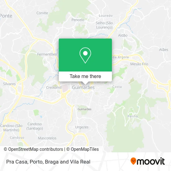
See Pra Casa, Oliveira, São Paio e São Sebastião, on the map
Public Transit to Pra Casa in Oliveira, São Paio e São Sebastião
Wondering how to get to Pra Casa in Oliveira, São Paio e São Sebastião? Moovit helps you find the best way to get to Pra Casa with step-by-step directions from the nearest public transit station.
Moovit provides free maps and live directions to help you navigate through your city. View schedules, routes, timetables, and find out how long does it take to get to Pra Casa in real time.
Looking for the nearest stop or station to Pra Casa? Check out this list of stops closest to your destination: Paio Galvão; Plataforma das Artes; Esc. Sec. Francisco de Holanda; Sto. António; Tribunal; Campo da Feira; Covas; Guimaraes.
Bus: 011, 071, 101, 121, 3571, 9105, 9306, 004, N11, 012, 014, 031, 003, 063, 070, 081, N82, 181, 182, N21, 032, 061.Train: LINHA DE GUIMARAES, IC.
Want to see if there’s another route that gets you there at an earlier time? Moovit helps you find alternative routes or times. Get directions from and directions to Pra Casa easily from the Moovit App or Website.
We make riding to Pra Casa easy, which is why over 1.5 million users, including users in Oliveira, São Paio e São Sebastião, trust Moovit as the best app for public transit. You don’t need to download an individual bus app or train app, Moovit is your all-in-one transit app that helps you find the best bus time or train time available.
For information on prices of bus and train, costs and ride fares to Pra Casa, please check the Moovit app.
Use the app to navigate to popular places including to the airport, hospital, stadium, grocery store, mall, coffee shop, school, college, and university.
Pra Casa Address: Rua de Val de Donas 16 Oliveira do Castelo, 4800-476 Guimarães street in Oliveira, São Paio e São Sebastião
- Castello d'Alba,
- Guimaraes Historical Center Apartments,
- Já Cá Estou, e Tu,
- Sociedade Interbancaria de Serviços S a Sibs,
- Ópticas Vale do Ave,
- Guimarães Centro,
- Casa Carlos,
- Chiffon Guimarães,
- Renascimento,
- Boom Bar,
- Gabinete de Estética Cristina Dias,
- Duquita Lingerie,
- Taverna Bar,
- Instituto Britânico de Guimarães,
- Gpo Coworking - Guimarães,
- A Imobiliária de Vila Meã, S.a.,
- Torino 1897,
- Susana Pimenta Cabeleireiro e Estetica,
- Antigo Nora do Zé da Curva - Restaurante,
- Zolf Guimarães
Places Near Pra Casa (Oliveira, São Paio e São Sebastião)
- Rua Calouste Gulbenkian, Lordelo do Ouro e Massarelos,
- Arrábida Shopping, Santa Marinha e São Pedro da Afurada,
- El Corte Inglés de Gaia, Mafamude e Vilar do Paraíso,
- VILA do CONDE PORTO FASHION OUTLET, Modivas,
- Maia, Maia,
- Hospital da Prelada, Ramalde,
- Parque Aquatico Amarante - Aqua Aventura, Amarante,
- Hospital de Santo António, Cedofeita, Santo Ildefonso, Sé, Miragaia, São Nicolau e Vitória,
- Valongo, Valongo,
- Espinho, Espinho,
- Estádio do Dragão, Campanhã,
- Hospital Santos Silva, Vila Nova De Gaia,
- Palácio de Cristal, Lordelo do Ouro e Massarelos,
- MAR Shopping, Matosinhos e Leça da Palmeira,
- Leça da Palmeira, Matosinhos e Leça da Palmeira,
- Senhor de Matosinhos, Matosinhos e Leça da Palmeira,
- Acesso ao Shopping Parque Nascente, Campanhã,
- Zoo Santo Inácio, Vila Nova De Gaia,
- Canidelo, Vila Nova De Gaia,
- Avintes, Vila Nova De Gaia
How to get to popular places in Porto, Braga and Vila Real with public transit
Get around Oliveira, São Paio e São Sebastião by public transit!
Traveling around Oliveira, São Paio e São Sebastião has never been so easy. See step by step directions as you travel to any attraction, street or major public transit station. View bus and train schedules, arrival times, service alerts and detailed routes on a map, so you know exactly how to get to anywhere in Oliveira, São Paio e São Sebastião.
When traveling to any destination around Oliveira, São Paio e São Sebastião use Moovit's Live Directions with Get Off Notifications to know exactly where and how far to walk, how long to wait for your line, and how many stops are left. Moovit will alert you when it's time to get off — no need to constantly re-check whether yours is the next stop.
Wondering how to use public transit in Oliveira, São Paio e São Sebastião or how to pay for public transit in Oliveira, São Paio e São Sebastião? Moovit public transit app can help you navigate your way with public transit easily, and at minimum cost. It includes public transit fees, ticket prices, and costs. Looking for a map of Oliveira, São Paio e São Sebastião public transit lines? Moovit public transit app shows all public transit maps in Oliveira, São Paio e São Sebastião with all Bus, Train, Metro, Ferry, Funicular and Gondola routes and stops on an interactive map.
Porto, Braga and Vila Real has 6 transit type(s), including: Bus, Train, Metro, Ferry, Funicular and Gondola, operated by several transit agencies, including Metro do Porto, Metro do Porto - Metrobus, CP - Comboios de Portugal, STCP, UNIR Mobilidade da Area Metropolitana do Porto, Getbus - Aerobus, Mobiave, Valpibus, TUB - Transportes Urbanos de Braga, TuViana, Guimabus, Ave Mobilidade, Cávado Mobilidade, Transdev and Câmara Municipal de Santo Tirso