Directions to Praia Coronel s/n (Mangaratiba) with public transportation
The following transit lines have routes that pass near Praia Coronel s/n
How to get to Praia Coronel s/n by bus?
Click on the bus route to see step by step directions with maps, line arrival times and updated time schedules.
From Colegio Estadual Montebello Bondim, Mangaratiba
40 minFrom Itacuruçá, Mangaratiba
56 minFrom Condomínio Porto Real Resort, Mangaratiba
57 minFrom Marina Porto Itacuruça, Mangaratiba
58 minFrom Condomínio Fazenda Muriqui, Mangaratiba
44 minFrom Vila Muriqui, Mangaratiba
44 minFrom Condomínio solar de Itacuruçá, Mangaratiba
53 minFrom Muriqui, Mangaratiba
38 minFrom Club Med Rio das Pedras, Mangaratiba
40 minFrom Condominio Reserva Ecológica do Sahy, Mangaratiba
37 min
Bus stop near Praia Coronel s/n in Mangaratiba
- Entrada Do Parque Bela Vista, 9 min walk,VIEW
Ferry station near Praia Coronel s/n in Mangaratiba
- Mangaratiba ⛴, 21 min walk,VIEW
Bus lines to Praia Coronel s/n in Mangaratiba
- MANGARATIBA - IBICUÍ, Mangaratiba - Ibicuí,VIEW
- MANGARATIBA - ITACURUÇÁ (VIA MURIQUI / AXIXÁ), Mangaratiba - Itacuruçá (Via Muriqui / Axixá),VIEW
- MANGARATIBA - VALE DO SAHY, Mangaratiba - Vale do Sahy,VIEW
- 122T, Itaguaí - Mangaratiba (via Axixá / Itacuruçá / Muriquí),VIEW
- V123, Itaguaí - Mangaratiba (via Sahy / Ibicuí),VIEW
- 457U, Itaguaí - Jacareí (via Mangaratiba/Sahy-Ibicuí),VIEW
What are the closest stations to Praia Coronel s/n?
The closest stations to Praia Coronel s/n are:
- Entrada Do Parque Bela Vista is 522 meters away, 9 min walk.
- Mangaratiba ⛴ is 1502 meters away, 21 min walk.
Which bus lines stop near Praia Coronel s/n?
These bus lines stop near Praia Coronel s/n: 457U, MANGARATIBA - ITACURUÇÁ (VIA MURIQUI / AXIXÁ).
What’s the nearest bus station to Praia Coronel s/n in Mangaratiba?
The nearest bus station to Praia Coronel s/n in Mangaratiba is Entrada Do Parque Bela Vista. It’s a 9 min walk away.
What’s the nearest ferry station to Praia Coronel s/n in Mangaratiba?
The nearest ferry station to Praia Coronel s/n in Mangaratiba is Mangaratiba ⛴. It’s a 21 min walk away.
What time is the first bus to Praia Coronel s/n in Mangaratiba?
The 457U is the first bus that goes to Praia Coronel s/n in Mangaratiba. It stops nearby at 4:34 AM.
What time is the last bus to Praia Coronel s/n in Mangaratiba?
The 457U is the last bus that goes to Praia Coronel s/n in Mangaratiba. It stops nearby at 10:51 PM.
What time is the first ferry to Praia Coronel s/n in Mangaratiba?
The MANGARATIBA - ILHA GRANDE is the first ferry that goes to Praia Coronel s/n in Mangaratiba. It stops nearby at 8:00 AM.
What time is the last ferry to Praia Coronel s/n in Mangaratiba?
The MANGARATIBA - ILHA GRANDE is the last ferry that goes to Praia Coronel s/n in Mangaratiba. It stops nearby at 6:50 PM.
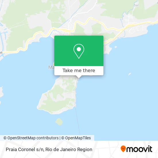
See Praia Coronel s/n, Mangaratiba, on the map
Public Transit to Praia Coronel s/n in Mangaratiba
Wondering how to get to Praia Coronel s/n in Mangaratiba? Moovit helps you find the best way to get to Praia Coronel s/n with step-by-step directions from the nearest public transit station.
Moovit provides free maps and live directions to help you navigate through your city. View schedules, routes, timetables, and find out how long does it take to get to Praia Coronel s/n in real time.
Looking for the nearest stop or station to Praia Coronel s/n? Check out this list of stops closest to your destination: Entrada Do Parque Bela Vista; Mangaratiba ⛴.
Bus: 457U, MANGARATIBA - ITACURUÇÁ (VIA MURIQUI / AXIXÁ), MANGARATIBA - IBICUÍ, MANGARATIBA - VALE DO SAHY, 122T, V123.Ferry: MANGARATIBA - ILHA GRANDE.
Want to see if there’s another route that gets you there at an earlier time? Moovit helps you find alternative routes or times. Get directions from and directions to Praia Coronel s/n easily from the Moovit App or Website.
We make riding to Praia Coronel s/n easy, which is why over 1.5 million users, including users in Mangaratiba, trust Moovit as the best app for public transit. You don’t need to download an individual bus app or train app, Moovit is your all-in-one transit app that helps you find the best bus time or train time available.
For information on prices of bus, costs and ride fares to Praia Coronel s/n, please check the Moovit app.
Use the app to navigate to popular places including to the airport, hospital, stadium, grocery store, mall, coffee shop, school, college, and university.
Praia Coronel s/n Address: Praia Coronel, s/n, Mangaratiba - RJ, 23860-000, Brasil street in Mangaratiba
- Ibicuí Iate Clube,
- Rua Romancista Lúcio Cardoso, 270,
- Parque Municipal da Pedra do Urubu,
- Pousada Alto de Junque,
- Ibicuí,
- Acqio*Quiosque do Mimi,
- Rua Cristóvão V de Vasconcelos,
- Iate Clube de Ibicuí,
- Restaurante e Pizzaria do Magu,
- Mercado Brucalu,
- Alto De Ibicuí,
- Pista de Skate,
- Cleudenia Martins Lour,
- Dpo de Ibicuí,
- Praia de Ibicui,
- Restaurante Cantinho do Sul,
- Rua Rj 14,
- Rua Variante Raul de Gouvea,
- Ibicuí,
- Rua Raul de Gouvêia
Places Near Praia Coronel s/n (Mangaratiba)
- Shopping Downtown, Barra Da Tijuca,
- Avenida Rio Branco, Centro,
- Praia do Arpoador, Ipanema,
- Museu Do Amanhã, Centro,
- Rua Ulysses Guimarães 16, Cidade Nova,
- Shopping Rio Sul, Botafogo,
- Feira Livre da Gloria, Glória,
- Shopping Nova América, Del Castilho,
- Hospital Federal Do Andaraí, Andaraí,
- Shopping RioSul, Botafogo,
- Rua Licínio Cardoso, São Francisco Xavier,
- Norte Shopping, Cachambi,
- Rio De Janeiro,
- Feirão De Malhas, Duque De Caxias,
- Niterói, Niterói,
- Hospital Municipal Ronaldo Gazolla, Acari,
- Rodoviária Novo Rio (Rodoviária do Rio de Janeiro), Santo Cristo,
- Hospital Federal Cardoso Fontes, Jacarepaguá,
- Avenida Venezuela 134, Saúde,
- Hospital Pedro Ernesto, Vila Isabel
How to get to popular places in Rio de Janeiro Region with public transit
Get around Mangaratiba by public transit!
Traveling around Mangaratiba has never been so easy. See step by step directions as you travel to any attraction, street or major public transit station. View bus and train schedules, arrival times, service alerts and detailed routes on a map, so you know exactly how to get to anywhere in Mangaratiba.
When traveling to any destination around Mangaratiba use Moovit's Live Directions with Get Off Notifications to know exactly where and how far to walk, how long to wait for your line, and how many stops are left. Moovit will alert you when it's time to get off — no need to constantly re-check whether yours is the next stop.
Wondering how to use public transit in Mangaratiba or how to pay for public transit in Mangaratiba? Moovit public transit app can help you navigate your way with public transit easily, and at minimum cost. It includes public transit fees, ticket prices, and costs. Looking for a map of Mangaratiba public transit lines? Moovit public transit app shows all public transit maps in Mangaratiba with all Bus, Train, Metro, Light Rail, Ferry, Cable Car, Gondola and Funicular routes and stops on an interactive map.
Rio de Janeiro Region has 8 transit type(s), including: Bus, Train, Metro, Light Rail, Ferry, Cable Car, Gondola and Funicular, operated by several transit agencies, including TrensRJ, Metrô Rio, VLT Carioca, Barcas Rio, BRT MOBI-Rio, Auto Viação Alpha, Auto Viação Tijuca, Gire Transportes, Transurb, Viação Nossa Senhora das Graças, Consórcio INTERSUL, Braso Lisboa (Municipal), Caprichosa Auto Ônibus, Auto Viação Três Amigos and Rodoviária Âncora Matias