How to get to Praia da Itinga by bus?
Click on the bus route to see step by step directions with maps, line arrival times and updated time schedules.
From Inter Seg, Cunhambebe
50 minFrom 2n Transportes Maritimos, Angra Dos Reis
68 minFrom Clínica+Saúde - Parque das Palmeiras Angra, Angra Dos Reis
72 minFrom Defensoria Publica Angra Dos Reis, Angra Dos Reis
75 minFrom Igreja Adventista do Sétimo Dia, Angra Dos Reis
72 minFrom Cicom - Clínica de Imagem Computadorizada, Cunhambebe
46 minFrom Acrópolis Marina Hotel, Angra Dos Reis
68 minFrom C. E. Conde Pereira Carneiro, Angra Dos Reis
75 minFrom Consultorio dr Swami Brilhante, Angra Dos Reis
72 minFrom Igreja Mundial do Poder de Deus, Angra Dos Reis
70 min
Bus stop near Praia da Itinga in Cunhambebe
- Itinga, 1 min walk,VIEW
What are the closest stations to Praia da Itinga?
The closest stations to Praia da Itinga are:
- Itinga is 54 meters away, 1 min walk.
Which bus line stops near Praia da Itinga?
230 (Itinga)
What’s the nearest bus station to Praia da Itinga in Cunhambebe?
The nearest bus station to Praia da Itinga in Cunhambebe is Itinga. It’s a 1 min walk away.
What time is the first bus to Praia da Itinga in Cunhambebe?
The 230 is the first bus that goes to Praia da Itinga in Cunhambebe. It stops nearby at 6:05 AM.
What time is the last bus to Praia da Itinga in Cunhambebe?
The T21C is the last bus that goes to Praia da Itinga in Cunhambebe. It stops nearby at 11:19 PM.
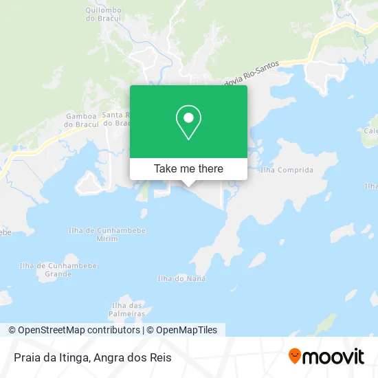
See Praia da Itinga, Cunhambebe, on the map
Public Transit to Praia da Itinga in Cunhambebe
Wondering how to get to Praia da Itinga in Cunhambebe? Moovit helps you find the best way to get to Praia da Itinga with step-by-step directions from the nearest public transit station.
Moovit provides free maps and live directions to help you navigate through your city. View schedules, routes, timetables, and find out how long does it take to get to Praia da Itinga in real time.
Looking for the nearest stop or station to Praia da Itinga? Check out this list of stops closest to your destination: Itinga.
Bus: 230, T21C.
Want to see if there’s another route that gets you there at an earlier time? Moovit helps you find alternative routes or times. Get directions from and directions to Praia da Itinga easily from the Moovit App or Website.
We make riding to Praia da Itinga easy, which is why over 1.5 million users, including users in Cunhambebe, trust Moovit as the best app for public transit. You don’t need to download an individual bus app or train app, Moovit is your all-in-one transit app that helps you find the best bus time or train time available.
For information on prices of bus, costs and ride fares to Praia da Itinga, please check the Moovit app.
Use the app to navigate to popular places including to the airport, hospital, stadium, grocery store, mall, coffee shop, school, college, and university.
Praia da Itinga Address: Bracuí Angra dos Reis-RJ 23943-070 street in Cunhambebe
- Peixaria Albacora,
- Rua Praia da Itinga,
- Praia do Itinga,
- Condomínio Porto Marina Bracuhy,
- Apartament Angra Praia dos Coqueiros,
- Point Pizza,
- Condomínio do Edifico Peninsula do Bracuhy I,
- Angra Apartment,
- BR Marinas Bracuhy,
- Condomínio Porto Real Resort,
- Bracuhy,
- Ruínas do Engenho do Bracuhy,
- Bracuí,
- Camping Cristina,
- Ruínas do Engenho Central do Bracuhy,
- Pizzaria Porto do Brakuhy,
- Condominio Porto Marina Bracuhy,
- Rod. Governador Mário Covas, Km 115 s / n,
- Volt Angra,
- Samba Angra dos Reis
Places Near Praia da Itinga (Cunhambebe)
- Rua Cônegos Bittencourt, Angra Dos Reis,
- Vila Residencial De Mambucaba, Mambucaba,
- Mambucaba, Mambucaba,
- Praia do Laboratório, Angra Dos Reis,
- Garatucaia, Angra Dos Reis,
- Alambique Engenho D'Ouro, Parati,
- Rodovia Procurador Haroldo Fernandes Duarte, Km 513,5 s / n, Cunhambebe,
- Rodovia BR 101, Km 533 s/n, Mambucaba,
- BR 101, Km 508 s/n, Cunhambebe,
- Avenida Antônio Bertholdo da Silva Jordão 7346, Jacuecanga,
- Vila Galé Eco Resort De Angra, Angra Dos Reis,
- Condominio Laranjeiras, Parati Mirim,
- Rua Prefeito João Gregório Galindo 2487, Angra Dos Reis,
- Avenida Almirante Jair Carneiro Toscano de Brito 110, Angra Dos Reis,
- Cachoeira do Tobogã, Parati,
- praia jabaquara - parati, Parati,
- Rua Prefeito João Gregório Galindo, Cunhambebe,
- Praia de Paraty Mirim, Parati,
- Centro Histórico de Paraty, Parati,
- Verolme, Jacuecanga
How to get to popular places in Angra dos Reis with public transit
Get around Cunhambebe by public transit!
Traveling around Cunhambebe has never been so easy. See step by step directions as you travel to any attraction, street or major public transit station. View bus and train schedules, arrival times, service alerts and detailed routes on a map, so you know exactly how to get to anywhere in Cunhambebe.
When traveling to any destination around Cunhambebe use Moovit's Live Directions with Get Off Notifications to know exactly where and how far to walk, how long to wait for your line, and how many stops are left. Moovit will alert you when it's time to get off — no need to constantly re-check whether yours is the next stop.
Wondering how to use public transit in Cunhambebe or how to pay for public transit in Cunhambebe? Moovit public transit app can help you navigate your way with public transit easily, and at minimum cost. It includes public transit fees, ticket prices, and costs. Looking for a map of Cunhambebe public transit lines? Moovit public transit app shows all public transit maps in Cunhambebe with all Bus and Ferry routes and stops on an interactive map.
Angra dos Reis has 2 transit type(s), including: Bus and Ferry, operated by several transit agencies, including Viação Senhor do Bonfim, Colitur Transportes Rodoviários, Cooparatyense (Vans), Costa Verde Transportes, Barcas Rio, Objetiva Tour, Vilanova Tour, Rodoviário Oceano, BusUFF and Colitur (Tarifa Zero - Paraty)