Directions to Praia de Copacabana with public transportation
The following transit lines have routes that pass near Praia de Copacabana
 Bus: 163, 2335, 2338, 2740D (EXECUTIVO), 457.
- Metro: L1, L4.
- Funicular: PAVÃO-PAVÃOZINHO.
How to get to Praia de Copacabana by bus?
Click on the bus route to see step by step directions with maps, line arrival times and updated time schedules.
How to get to Praia de Copacabana by metro?
Click on the metro route to see step by step directions with maps, line arrival times and updated time schedules.
Bus stops near Praia de Copacabana
- BRS 1 / 3 / I - Siqueira Campos, 1 min walk,
- BRS 2 - Hilário De Gouveia, 1 min walk,
- Rua Siqueira Campos | Praça Serzedelo Correia, 2 min walk,
- BRS 1 / 3 / I - Paula Freitas, 3 min walk,
- BRS 2 - Figueiredo Magalhães, 3 min walk,
- Avenida Atlântica | Siqueira Campos, 4 min walk,
- BRS 1 3 - Hilário De Gouveia, 4 min walk,
Metro station near Praia de Copacabana
- Siqueira Campos, 5 min walk,
Funicular station near Praia de Copacabana
- Estação 5, 25 min walk,
Bus lines to Praia de Copacabana
- 104, Terminal Gentileza (Feira Livre),
- SN 104, São Conrado,
- 169, Terminal Gentileza,
- 455, Méier (Via Praia Do Flamengo),
- 456, Norte Shopping,
- 457, Copacabana,
- SN 457, Abolição,
- 483, Penha (Via Central),
- SN 483, Ipanema,
- SV 483, Penha,
- 485, Ipanema,
- 486, Fundão,
- SN 552, Metrô Botafogo,
- 557, Copacabana (Faixa Reversível),
- 558, Cidade De Deus,
- 740D, Charitas,
- 100 - TRO1, General Osório,
- 2740D (EXECUTIVO), Charitas,
- 415, Usina (Via Praia Do Flamengo),
- SN 415, Usina,
What are the closest stations to Praia de Copacabana?
The closest stations to Praia de Copacabana are:
- BRS 1 / 3 / I - Siqueira Campos stop is 54 meters away, 1 min walk.
- BRS 2 - Hilário De Gouveia stop is 66 meters away, 1 min walk.
- Rua Siqueira Campos | Praça Serzedelo Correia stop is 112 meters away, 2 min walk.
- BRS 1 / 3 / I - Paula Freitas stop is 161 meters away, 3 min walk.
- BRS 2 - Figueiredo Magalhães stop is 221 meters away, 3 min walk.
- Avenida Atlântica | Siqueira Campos stop is 239 meters away, 4 min walk.
- BRS 1 3 - Hilário De Gouveia stop is 258 meters away, 4 min walk.
- Siqueira Campos station is 333 meters away, 5 min walk.
- Estação 5 station is 1952 meters away, 25 min walk.
Which bus lines stop near Praia de Copacabana?
These bus lines stop near Praia de Copacabana: 163, 2335, 2338, 2740D (EXECUTIVO), 457, SPA 483.
Which metro line stops near Praia de Copacabana?
L1, L4 (Jardim Oceânico)
What’s the nearest metro station to Praia de Copacabana?
The nearest metro station to Praia de Copacabana is Siqueira Campos. It’s a 5 min walk away.
What’s the nearest bus station to Praia de Copacabana?
The nearest bus stations to Praia de Copacabana are BRS 1 / 3 / I - Siqueira Campos and BRS 2 - Hilário De Gouveia. The closest one is a 1 min walk away.
What’s the nearest funicular station to Praia de Copacabana?
The nearest funicular station to Praia de Copacabana is Estação 5. It’s a 25 min walk away.
What time is the first metro to Praia de Copacabana?
The L1, L4 is the first metro that goes to Praia de Copacabana. It stops nearby at 5:17 AM.
What time is the last metro to Praia de Copacabana?
The L1, L4 is the last metro that goes to Praia de Copacabana. It stops nearby at 12:25 AM.
What time is the first bus to Praia de Copacabana?
The 740D is the first bus that goes to Praia de Copacabana. It stops nearby at 3:04 AM.
What time is the last bus to Praia de Copacabana?
The SN 554 is the last bus that goes to Praia de Copacabana. It stops nearby at 3:47 AM.
What time is the first funicular to Praia de Copacabana?
The PAVÃO-PAVÃOZINHO is the first funicular that goes to Praia de Copacabana. It stops nearby at 6:00 AM.
What time is the last funicular to Praia de Copacabana?
The PAVÃO-PAVÃOZINHO is the last funicular that goes to Praia de Copacabana. It stops nearby at 12:00 AM.
See Praia de Copacabana on the map
Public Transportation to Praia de Copacabana
Wondering how to get to Praia de Copacabana? Moovit helps you find the best way to get to Praia de Copacabana with step-by-step directions from the nearest public transit station.
Moovit provides free maps and live directions to help you navigate through your city. View schedules, routes, timetables, and find out how long does it take to get to Praia de Copacabana in real time.
Looking for the nearest stop or station to Praia de Copacabana? Check out this list of stops closest to your destination: BRS 1 / 3 / I - Siqueira Campos; BRS 2 - Hilário De Gouveia; Rua Siqueira Campos | Praça Serzedelo Correia; BRS 1 / 3 / I - Paula Freitas; BRS 2 - Figueiredo Magalhães; Avenida Atlântica | Siqueira Campos; BRS 1 3 - Hilário De Gouveia; Siqueira Campos; Estação 5.
Bus: 163, 2335, 2338, 2740D (EXECUTIVO), 457, SPA 483, 415, SN 415, 426, 433, 473, 104, SN 104, 169, 455, 456, LECD153, 435, 164.Metro: L1, L4.Funicular: PAVÃO-PAVÃOZINHO.
Want to see if there’s another route that gets you there at an earlier time? Moovit helps you find alternative routes or times. Get directions from and directions to Praia de Copacabana easily from the Moovit App or Website.
We make riding to Praia de Copacabana easy, which is why over 1.7 billion users, including users in Copacabana, trust Moovit as the best app for public transit. You don’t need to download an individual bus app or train app, Moovit is your all-in-one transit app that helps you find the best bus time or train time available.
For information on prices of bus and metro, costs and ride fares to Praia de Copacabana, please check the Moovit app.
Use the app to navigate to popular places including to the airport, hospital, stadium, grocery store, mall, coffee shop, school, college, and university.
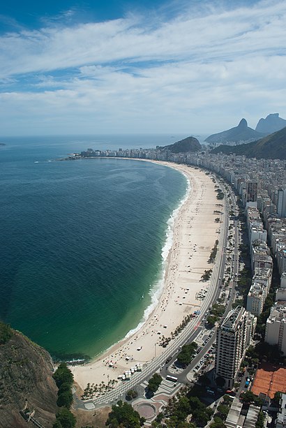
Praia de Copacabana Address: Av. Atlântica street in Copacabana
- Rio Line Turismo,
- Igreja Batista Filadelfia,
- Windsor Palace Hotel,
- Lapa - Rio Scenarium,
- Rua Domingos Ferreira 10,
- Rondinella Bar, Restaurante e Pizza,
- Carretão Copacabana,
- Windsor Palace Hotel - Copacabana,
- Rua Siqueira Campos, 5,
- Carretão (Churrascaria Carretao Siqueira Campos),
- Studio Blink,
- Ganache Tortas,
- Deck Beer Bar e Restaurante (DECK Copacabana),
- Rua Siqueira Campos / Rua Domingos Ferreira,
- Faenza Pizza & Grill,
- Itti - International Tefl Training Institute,
- 18 Do Forte,
- Quiosque Buenos Aires Restô,
- Faenza Pizza & Grill (Faenza Copacabana),
- Rua Domingos Ferreira Próximo ao 46-50
Places Near Praia de Copacabana
- Hospital Pedro Ernesto, Vila Isabel,
- Feirão De Malhas, Duque De Caxias,
- Rua Licínio Cardoso, São Francisco Xavier,
- Hospital Federal Cardoso Fontes, Jacarepaguá,
- Avenida Venezuela 134, Saúde,
- Rodoviária Novo Rio (Rodoviária do Rio de Janeiro), Santo Cristo,
- West Shopping, Campo Grande,
- Shopping RioSul, Botafogo,
- Hospital Municipal Ronaldo Gazolla, Acari,
- Shopping Rio Sul, Botafogo,
- Norte Shopping, Cachambi,
- Hospital Federal Do Andaraí, Andaraí,
- Niterói, Niterói,
- Shopping Nova América, Del Castilho,
- Avenida Rio Branco, Centro,
- Rio De Janeiro,
- Museu Do Amanhã, Centro,
- Feira Livre da Gloria, Glória,
- Praia do Arpoador, Ipanema,
- Shopping Downtown, Barra Da Tijuca
How to get to popular places in Rio de Janeiro Region with public transit
Get around Copacabana by public transit!
Traveling around Copacabana has never been so easy. See step by step directions as you travel to any attraction, street or major public transit station. View bus and train schedules, arrival times, service alerts and detailed routes on a map, so you know exactly how to get to anywhere in Copacabana.
When traveling to any destination around Copacabana use Moovit's Live Directions with Get Off Notifications to know exactly where and how far to walk, how long to wait for your line, and how many stops are left. Moovit will alert you when it's time to get off — no need to constantly re-check whether yours is the next stop.
Wondering how to use public transit in Copacabana or how to pay for public transit in Copacabana? Moovit public transit app can help you navigate your way with public transit easily, and at minimum cost. It includes public transit fees, ticket prices, and costs. Looking for a map of Copacabana public transit lines? Moovit public transit app shows all public transit maps in Copacabana with all Bus, Train, Metro, Light Rail, Ferry, Cable Car, Gondola and Funicular routes and stops on an interactive map.
Rio de Janeiro Region has 8 transit type(s), including: Bus, Train, Metro, Light Rail, Ferry, Cable Car, Gondola and Funicular, operated by several transit agencies, including TrensRJ, Metrô Rio, VLT Carioca, Barcas Rio, BRT MOBI-Rio, Auto Viação Alpha, Auto Viação Tijuca, Gire Transportes, Transurb, Viação Nossa Senhora das Graças, Consórcio INTERSUL, Braso Lisboa, Caprichosa Auto Ônibus, Auto Viação Três Amigos and Rodoviária Âncora Matias