How to get to Precision by bus?
Click on the bus route to see step by step directions with maps, line arrival times and updated time schedules.
From South Plantation High School, Plantation
58 minFrom Amazon Fulfillment Center-DMF3, Pompano Beach
77 minFrom Port Everglades, Fort Lauderdale
57 minFrom Walmart (Walmart Supercenter Ft Lauderdale - W Broward Blvd), Fort Lauderdale
49 minFrom Florida Turnpike Sunrise Blvd. Toll Plaza, Plantation
80 minFrom Broward County, Fort Lauderdale
25 minFrom Sawgrass Recreation Park / Airboat Rides, Plantation
81 minFrom Oakland Park Boulevard & University Drive, Plantation
59 minFrom Chase, Fort Lauderdale
47 minFrom Margate, FL, Coral Springs-Margate
80 min
How to get to Precision by train?
Click on the train route to see step by step directions with maps, line arrival times and updated time schedules.
Bus stops near Precision in Fort Lauderdale
Train station near Precision in Fort Lauderdale
- Cypress Creek Station, 8 min walk,VIEW
Bus lines to Precision in Fort Lauderdale
What are the closest stations to Precision?
The closest stations to Precision are:
- Andrews Avenue/Northwest 35th Street is 247 yards away, 4 min walk.
- Cypress Creek Station is 666 yards away, 8 min walk.
- Oakland Park Boulevard & Andrews Avenue is 693 yards away, 9 min walk.
Which bus lines stop near Precision?
These bus lines stop near Precision: 14, 60, 72.
Which train line stops near Precision?
TRIRAIL (Northbound To Mangonia Park)
What’s the nearest train station to Precision in Fort Lauderdale?
The nearest train station to Precision in Fort Lauderdale is Cypress Creek Station. It’s a 8 min walk away.
What’s the nearest bus station to Precision in Fort Lauderdale?
The nearest bus station to Precision in Fort Lauderdale is Andrews Avenue/Northwest 35th Street. It’s a 4 min walk away.
What time is the first train to Precision in Fort Lauderdale?
The TRIRAIL is the first train that goes to Precision in Fort Lauderdale. It stops nearby at 4:38 AM.
What time is the last train to Precision in Fort Lauderdale?
The TRIRAIL is the last train that goes to Precision in Fort Lauderdale. It stops nearby at 10:43 PM.
What time is the first bus to Precision in Fort Lauderdale?
The 72 is the first bus that goes to Precision in Fort Lauderdale. It stops nearby at 5:14 AM.
What time is the last bus to Precision in Fort Lauderdale?
The 72 is the last bus that goes to Precision in Fort Lauderdale. It stops nearby at 1:20 AM.
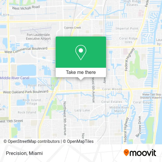
See Precision, Fort Lauderdale, on the map
Public Transit to Precision in Fort Lauderdale
Wondering how to get to Precision in Fort Lauderdale? Moovit helps you find the best way to get to Precision with step-by-step directions from the nearest public transit station.
Moovit provides free maps and live directions to help you navigate through your city. View schedules, routes, timetables, and find out how long does it take to get to Precision in real time.
Looking for the nearest stop or station to Precision? Check out this list of stops closest to your destination: Andrews Avenue/Northwest 35th Street; Cypress Creek Station; Oakland Park Boulevard & Andrews Avenue.
Bus: 14, 60, 72.Train: TRIRAIL.
Want to see if there’s another route that gets you there at an earlier time? Moovit helps you find alternative routes or times. Get directions from and directions to Precision easily from the Moovit App or Website.
We make riding to Precision easy, which is why over 1.5 million users, including users in Fort Lauderdale, trust Moovit as the best app for public transit. You don’t need to download an individual bus app or train app, Moovit is your all-in-one transit app that helps you find the best bus time or train time available.
For information on prices of bus and train, costs and ride fares to Precision, please check the Moovit app.
Use the app to navigate to popular places including to the airport, hospital, stadium, grocery store, mall, coffee shop, school, college, and university.
Precision Address: 3520 N Andrews Ave Fort Lauderdale, FL 33309 street in Fort Lauderdale
- Tio Sam Food,
- Soccer Beer Bar,
- Bravo Supermarkets,
- Eco Cleaners,
- Transportes Zuleta Express Inc,
- Dog Beautician Com,
- Jyg Mendez,
- Florida Training Center,
- FTC Training Center,
- Save-A-Lot,
- Thunder Painting,
- Mario Barber Shop,
- Lafamilia Auto Lfaa,
- County Clare Enterprises,
- Cellularplus,
- Rebel,
- Reef Photo & Video,
- Freedom Christian Tabernacle,
- Dicars Autosales,
- Broward County
Places Near Precision (Fort Lauderdale)
- Port of Miami Cruise Terminal, Miami,
- Miami Freedom Park, Miami,
- Sawgrass Mall, Miami,
- Aventura Mall, Miami,
- Miami VA Hospital, Miami,
- Miami Design District, Miami,
- Zoo Miami, Miami,
- Keiser University Flagship Campus, West Palm Beach,
- Marlins Park, Miami,
- Bayside Marketplace, Miami,
- Wynwood, Miami,
- Richard E. Gerstein Justice Building, Miami,
- Dolphin Mall, Miami,
- Miami-Dade County Courthouse, Miami,
- Sawgrass mall ( FL ), Miami Beach,
- Hard Rock Stadium, Miami Gardens,
- Dolphin Mall Bus, Miami,
- Aventura Mall, Miami Beach,
- Brickell City Centre, Miami,
- Little Havana, Miami
How to get to popular places in Miami with public transit
Get around Fort Lauderdale by public transit!
Traveling around Fort Lauderdale has never been so easy. See step by step directions as you travel to any attraction, street or major public transit station. View bus and train schedules, arrival times, service alerts and detailed routes on a map, so you know exactly how to get to anywhere in Fort Lauderdale.
When traveling to any destination around Fort Lauderdale use Moovit's Live Directions with Get Off Notifications to know exactly where and how far to walk, how long to wait for your line, and how many stops are left. Moovit will alert you when it's time to get off — no need to constantly re-check whether yours is the next stop.
Wondering how to use public transit in Fort Lauderdale or how to pay for public transit in Fort Lauderdale? Moovit public transit app can help you navigate your way with public transit easily, and at minimum cost. It includes public transit fees, ticket prices, and costs. Looking for a map of Fort Lauderdale public transit lines? Moovit public transit app shows all public transit maps in Fort Lauderdale with all Bus, Train, Light Rail and Ferry routes and stops on an interactive map.
Miami has 4 transit type(s), including: Bus, Train, Light Rail and Ferry, operated by several transit agencies, including Broward County Transit, Miami-Dade Transit, Metrorail, Palm Tran, Tri-Rail, Brightline, MARTY, City of Homestead Trolley, Key West Transit, Treasure Coast Connector, GoLine IRT, Amtrak, Greyhound-us, FlixBus-us and Aventura Express Shuttle Bus