How to get to Precision Design Group by bus?
Click on the bus route to see step by step directions with maps, line arrival times and updated time schedules.
From Mountain Vista @ Russell (N), Paradise
78 minFrom Galleria at Sunset, Henderson
61 minFrom S Decatur Blvd / W Silverado Ranch Blvd, Enterprise
35 minFrom 5103 Etm D2gate, Paradise
71 minFrom Town Square Las Vegas, Enterprise
68 minFrom Ccsd Bus Yard, Henderson
62 minFrom McCarran International Airport (LAS) Terminal 3, Paradise
71 minFrom Tahiti Village Resort - 2507A, Enterprise
67 minFrom Sunset Park, Paradise
44 minFrom Absolute Dental - Sunset, Paradise
40 min
Bus stops near Precision Design Group in Henderson
Bus lines to Precision Design Group in Henderson
What are the closest stations to Precision Design Group?
The closest stations to Precision Design Group are:
- Nb Eastern After Coronado Center is 319 yards away, 5 min walk.
- Eb Horizon Ridge After Eastern is 797 yards away, 10 min walk.
Which bus lines stop near Precision Design Group?
These bus lines stop near Precision Design Group: 110, 221.
What’s the nearest bus station to Precision Design Group in Henderson?
The nearest bus station to Precision Design Group in Henderson is Nb Eastern After Coronado Center. It’s a 5 min walk away.
What time is the first bus to Precision Design Group in Henderson?
The 110 is the first bus that goes to Precision Design Group in Henderson. It stops nearby at 3:22 AM.
What time is the last bus to Precision Design Group in Henderson?
The 110 is the last bus that goes to Precision Design Group in Henderson. It stops nearby at 3:26 AM.
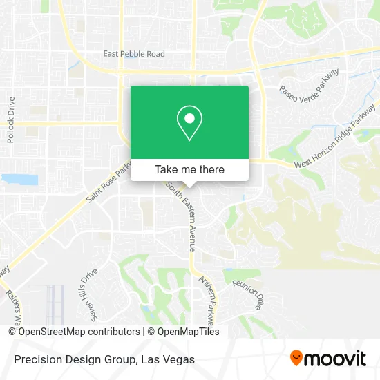
See Precision Design Group, Henderson, on the map
Public Transit to Precision Design Group in Henderson
Wondering how to get to Precision Design Group in Henderson? Moovit helps you find the best way to get to Precision Design Group with step-by-step directions from the nearest public transit station.
Moovit provides free maps and live directions to help you navigate through your city. View schedules, routes, timetables, and find out how long does it take to get to Precision Design Group in real time.
Looking for the nearest stop or station to Precision Design Group? Check out this list of stops closest to your destination: Nb Eastern After Coronado Center; Eb Horizon Ridge After Eastern.
Bus: 110, 221.
Want to see if there’s another route that gets you there at an earlier time? Moovit helps you find alternative routes or times. Get directions from and directions to Precision Design Group easily from the Moovit App or Website.
We make riding to Precision Design Group easy, which is why over 1.7 million users, including users in Henderson, trust Moovit as the best app for public transit. You don’t need to download an individual bus app or train app, Moovit is your all-in-one transit app that helps you find the best bus time or train time available.
For information on prices of bus, costs and ride fares to Precision Design Group, please check the Moovit app.
Use the app to navigate to popular places including to the airport, hospital, stadium, grocery store, mall, coffee shop, school, college, and university.
Precision Design Group Address: 2637 W Horizon Ridge Pkwy Ste 120 street in Henderson
- W Horizon Ridge Pkwy / S Eastern Ave,
- Eastern And Horizon Ridge,
- Social Security Resource Center,
- Henderson, Nevada,
- Sunridge Heights And Eastern,
- Cacti Landscapes Las Vegas,
- Cacti Landscapes,
- Black Mountain Home Loans David Chamblee Mortgage Lender NMLS,
- Quest Diagnostics Siena Heights Draw Station,
- Coronado High School,
- Little Tokyo Massage Club,
- St Rose Siena Hospital,
- 3001 St Rose Pkwy,
- St Rose Siena Cafeteria Vending Machines,
- Saint Rose Parkway & Eastern Avenue,
- Horizon Ridge @ Jeffreys (W),
- Henderson NV,
- Horizon Ridge, Green Valley Pkwy Intersection,
- Encompass Health Rehabilitation Hospital of Henderson,
- Seven Hills Behavioral Health Hospital
Places Near Precision Design Group (Henderson)
- Lee Canyon, Las Vegas,
- The Neon Museum, Las Vegas,
- Welcome To Fabulous Las Vegas Sign, Paradise,
- Meow Wolf - Las Vegas (Meow Wolf's Omega Mart), Las Vegas,
- The Palms Casino Resort, Paradise,
- Las Vegas North Premium Outlets, Las Vegas,
- The Deuce Bus Stop at Fremont St, Las Vegas,
- Las Vegas Premium Outlets-North, Enterprise,
- Zak Bagans Haunted Museum, Las Vegas,
- Gold & Silver Pawn Shop, Las Vegas,
- Las Vegas South Premium Outlets, Enterprise,
- Walmart Supercenter, Las Vegas,
- Trump International Hotel Las Vegas, Paradise,
- Arte Museum Las Vegas, Paradise,
- Area15, Las Vegas,
- Koolsville Tattoos, Las Vegas,
- Omega Mart, Las Vegas,
- Allegiant Stadium, Paradise,
- Walmart, Las Vegas,
- Town Square, Enterprise
How to get to popular places in Las Vegas with public transit
Get around Henderson by public transit!
Traveling around Henderson has never been so easy. See step by step directions as you travel to any attraction, street or major public transit station. View bus and train schedules, arrival times, service alerts and detailed routes on a map, so you know exactly how to get to anywhere in Henderson.
When traveling to any destination around Henderson use Moovit's Live Directions with Get Off Notifications to know exactly where and how far to walk, how long to wait for your line, and how many stops are left. Moovit will alert you when it's time to get off — no need to constantly re-check whether yours is the next stop.
Wondering how to use public transit in Henderson or how to pay for public transit in Henderson? Moovit public transit app can help you navigate your way with public transit easily, and at minimum cost. It includes public transit fees, ticket prices, and costs. Looking for a map of Henderson public transit lines? Moovit public transit app shows all public transit maps in Henderson with all Bus and Monorail routes and stops on an interactive map.
Las Vegas has 2 transit type(s), including: Bus and Monorail, operated by several transit agencies, including RTCSNV, City of Las Vegas, Alvand Transportation, Vegas Airporter, Las Vegas Monorail, FlixBus-us and Greyhound-us