Directions to Precision Tile (Lynchburg) with public transportation
The following transit lines have routes that pass near Precision Tile
 Bus: 11, 12, GREYHOUND US0600, 12X, 1B.
- Train: NORTHEAST REGIONAL, CRESCENT.
How to get to Precision Tile by bus?
Click on the bus route to see step by step directions with maps, line arrival times and updated time schedules.
How to get to Precision Tile by train?
Click on the train route to see step by step directions with maps, line arrival times and updated time schedules.
Bus stops near Precision Tile in Lynchburg
Train station near Precision Tile in Lynchburg
- Lynchburg Station, 32 min walk,VIEW
Bus lines to Precision Tile in Lynchburg
What are the closest stations to Precision Tile?
The closest stations to Precision Tile are:
- Oakley Ave & Macon St. (Outbound) is 25 yards away, 1 min walk.
- Lower Plaza (Lynchburg Health Department) is 871 yards away, 11 min walk.
- Langhorne Ln. & Wingfield Ave. (Outbound) is 1078 yards away, 13 min walk.
- Atherholt Rd./ Forest Health And Rehab is 2320 yards away, 28 min walk.
- Lynchburg Station is 2687 yards away, 32 min walk.
Which bus lines stop near Precision Tile?
These bus lines stop near Precision Tile: 11, 12, GREYHOUND US0600.
Which train line stops near Precision Tile?
NORTHEAST REGIONAL (Roanoke)
What’s the nearest bus station to Precision Tile in Lynchburg?
The nearest bus station to Precision Tile in Lynchburg is Oakley Ave & Macon St. (Outbound). It’s a 1 min walk away.
What time is the first train to Precision Tile in Lynchburg?
The CRESCENT is the first train that goes to Precision Tile in Lynchburg. It stops nearby at 9:41 AM.
What time is the last train to Precision Tile in Lynchburg?
The CRESCENT is the last train that goes to Precision Tile in Lynchburg. It stops nearby at 10:16 PM.
What time is the first bus to Precision Tile in Lynchburg?
The 1B is the first bus that goes to Precision Tile in Lynchburg. It stops nearby at 5:25 AM.
What time is the last bus to Precision Tile in Lynchburg?
The 1A is the last bus that goes to Precision Tile in Lynchburg. It stops nearby at 10:00 PM.
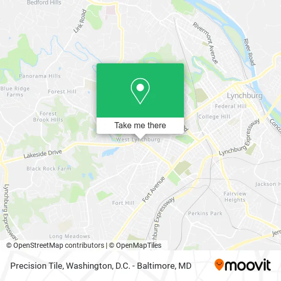
See Precision Tile, Lynchburg, on the map
Public Transit to Precision Tile in Lynchburg
Wondering how to get to Precision Tile in Lynchburg? Moovit helps you find the best way to get to Precision Tile with step-by-step directions from the nearest public transit station.
Moovit provides free maps and live directions to help you navigate through your city. View schedules, routes, timetables, and find out how long does it take to get to Precision Tile in real time.
Looking for the nearest stop or station to Precision Tile? Check out this list of stops closest to your destination: Oakley Ave & Macon St. (Outbound); Lower Plaza (Lynchburg Health Department); Langhorne Ln. & Wingfield Ave. (Outbound); Atherholt Rd./ Forest Health And Rehab; Lynchburg Station.
Bus: 11, 12, GREYHOUND US0600, 12X, 1B, 10, 1A.Train: NORTHEAST REGIONAL, CRESCENT.
Want to see if there’s another route that gets you there at an earlier time? Moovit helps you find alternative routes or times. Get directions from and directions to Precision Tile easily from the Moovit App or Website.
We make riding to Precision Tile easy, which is why over 1.5 million users, including users in Lynchburg, trust Moovit as the best app for public transit. You don’t need to download an individual bus app or train app, Moovit is your all-in-one transit app that helps you find the best bus time or train time available.
For information on prices of bus and train, costs and ride fares to Precision Tile, please check the Moovit app.
Use the app to navigate to popular places including to the airport, hospital, stadium, grocery store, mall, coffee shop, school, college, and university.
Precision Tile Address: 105 Oakley Ave Lynchburg, VA 24501 street in Lynchburg
- Caskie Graphics,
- Asc Coin Laundry,
- Lynchburg Oakley Ave Coin Laundry,
- The UPS Store,
- Lynchburg Fence,
- Gary Systems Inc-Gsi,
- Corporate Consulting,
- Safelite AutoGlass,
- Caribbean Import/Export,
- Lynchburg Fence & Railing Co., Llc,
- Northstar Business Suites,
- Lynchburg Supervised Apts,
- Rockbridge Apartments,
- Conner Produce Co.,
- Changing Faces Beauty Salon,
- Conner Produce,
- Lakeside Plaza Apartments,
- Roofers for Hire,
- ATM,
- Madvapes Express Lynchburg
Places Near Precision Tile (Lynchburg)
- Rock Creek Tennis Center, Washington,
- M&T Bank Stadium, Baltimore,
- Westfield Montgomery Mall, Montgomery County,
- Capital One Arena, Washington,
- The Anthem, Washington,
- Pennsylvania Ave NW (3rd st and pennsylvania), Washington,
- PG Mall, Prince George's County,
- Camden Yards, Baltimore,
- Sibley Memorial Hospital, Washington,
- National Museum of African American History and Culture, Washington,
- Georgetown, Washington,
- Washington DC VA Medical Center, Washington,
- National Zoo, Washington,
- Museum Of The Bible, Washington,
- Marriott Marquis Washington, DC, Washington,
- Basilica of the National Shrine, Washington,
- Washington National Cathedral, Washington,
- National Mall, Washington,
- Warner Theatre, Washington,
- Amazon Hq2, Arlington County
How to get to popular places in Washington, D.C. - Baltimore, MD with public transit
Get around Lynchburg by public transit!
Traveling around Lynchburg has never been so easy. See step by step directions as you travel to any attraction, street or major public transit station. View bus and train schedules, arrival times, service alerts and detailed routes on a map, so you know exactly how to get to anywhere in Lynchburg.
When traveling to any destination around Lynchburg use Moovit's Live Directions with Get Off Notifications to know exactly where and how far to walk, how long to wait for your line, and how many stops are left. Moovit will alert you when it's time to get off — no need to constantly re-check whether yours is the next stop.
Wondering how to use public transit in Lynchburg or how to pay for public transit in Lynchburg? Moovit public transit app can help you navigate your way with public transit easily, and at minimum cost. It includes public transit fees, ticket prices, and costs. Looking for a map of Lynchburg public transit lines? Moovit public transit app shows all public transit maps in Lynchburg with all Bus, Train, Metro, Light Rail and Ferry routes and stops on an interactive map.
Washington, D.C. - Baltimore, MD has 5 transit type(s), including: Bus, Train, Metro, Light Rail and Ferry, operated by several transit agencies, including WMATA, Montgomery County Ride On, Fairfax Connector, TheBus, PRTC, DASH - Alexandria, Arlington Transit (ART), RTA of Central Maryland, MDOT MTA, MDOT MTA Light RailLink, MDOT MTA Commuter Bus, MDOT MTA Local Bus, FXBGO!, Virginia Railway Express (VRE) and MARC