How to get to Predes by bus?
Click on the bus route to see step by step directions with maps, line arrival times and updated time schedules.
From Jardim Paraíso, Nova Iguaçu
135 minFrom Seropédica, Seropédica
63 minFrom Presídio Milton Dias - Japeri, Japeri
108 minFrom São João de Meriti, Nova Iguaçu
107 minFrom Jardim Laranjeiras, Nova Iguaçu
134 minFrom Km 32, Nova Iguaçu
118 minFrom Cabuçu, Nova Iguaçu
124 minFrom Nova Iguaçu, Nova Iguaçu
123 minFrom Miguel Pereira, Miguel Pereira
93 min
How to get to Predes by train?
Click on the train route to see step by step directions with maps, line arrival times and updated time schedules.
Bus stops near Predes in Paracambi
Train station near Predes in Paracambi
- Paracambi, 10 min walk,VIEW
Bus lines to Predes in Paracambi
What are the closest stations to Predes?
The closest stations to Predes are:
- Rua Prefeito Bento Barbosa, 311 is 171 meters away, 3 min walk.
- Rua Do Acre, 280 is 176 meters away, 3 min walk.
- Praça Da Chácara is 178 meters away, 3 min walk.
- Paracambi is 725 meters away, 10 min walk.
Which bus lines stop near Predes?
These bus lines stop near Predes: 01, 02, 106P, 112, 437P.
Which train line stops near Predes?
EXTENSÃO PARACAMBI (Paracambi)
What’s the nearest train station to Predes in Paracambi?
The nearest train station to Predes in Paracambi is Paracambi. It’s a 10 min walk away.
What’s the nearest bus station to Predes in Paracambi?
The nearest bus stations to Predes in Paracambi are Rua Prefeito Bento Barbosa, 311, Rua Do Acre, 280 and Praça Da Chácara. The closest one is a 3 min walk away.
What time is the first train to Predes in Paracambi?
The EXTENSÃO PARACAMBI is the first train that goes to Predes in Paracambi. It stops nearby at 3:27 AM.
What time is the last train to Predes in Paracambi?
The EXTENSÃO PARACAMBI is the last train that goes to Predes in Paracambi. It stops nearby at 12:58 AM.
What time is the first bus to Predes in Paracambi?
The 01 is the first bus that goes to Predes in Paracambi. It stops nearby at 5:25 AM.
What time is the last bus to Predes in Paracambi?
The 01 is the last bus that goes to Predes in Paracambi. It stops nearby at 10:46 PM.
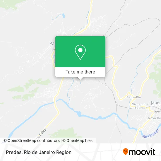
See Predes, Paracambi, on the map
Public Transit to Predes in Paracambi
Wondering how to get to Predes in Paracambi? Moovit helps you find the best way to get to Predes with step-by-step directions from the nearest public transit station.
Moovit provides free maps and live directions to help you navigate through your city. View schedules, routes, timetables, and find out how long does it take to get to Predes in real time.
Looking for the nearest stop or station to Predes? Check out this list of stops closest to your destination: Rua Prefeito Bento Barbosa; Rua Do Acre; Praça Da Chácara; Paracambi.
Bus: 01, 02, 106P, 112, 437P, 03.Train: EXTENSÃO PARACAMBI.
Want to see if there’s another route that gets you there at an earlier time? Moovit helps you find alternative routes or times. Get directions from and directions to Predes easily from the Moovit App or Website.
We make riding to Predes easy, which is why over 1.5 million users, including users in Paracambi, trust Moovit as the best app for public transit. You don’t need to download an individual bus app or train app, Moovit is your all-in-one transit app that helps you find the best bus time or train time available.
For information on prices of bus and train, costs and ride fares to Predes, please check the Moovit app.
Use the app to navigate to popular places including to the airport, hospital, stadium, grocery store, mall, coffee shop, school, college, and university.
Predes Address: Avenida Jonas Leal, 787 Paracambi Paracambi-RJ 26600-000 street in Paracambi
- Lucia Melo dos Santos,
- Dayannadefreita,
- Mercardo Guimarães,
- Bradesco,
- Bazar das Amigas,
- Paracambi Top Hotel,
- Rua do Acre, 120,
- Rua Amazonas, 97,
- Rua Prefeito Bento Barbosa 264,
- Casa de Rute Instituicao Para Idosas,
- Supermercado Chacara,
- Rua Paula Leite,
- Padaria Dona Felicidade,
- Shopping Estação Paracambi,
- Make Milady's,
- Espaco do Caldo,
- Bfs Medical Serviços Medicos,
- L D Meireles Bar E Mercearia,
- Duda Lanches,
- Elaine Cabeleireira
Places Near Predes (Paracambi)
- Feirão De Malhas, Duque De Caxias,
- Rua Ulysses Guimarães 16, Cidade Nova,
- Hospital Municipal Ronaldo Gazolla, Acari,
- Feira Livre da Gloria, Glória,
- Praia do Arpoador, Ipanema,
- Shopping Downtown, Barra Da Tijuca,
- Avenida Venezuela 134, Saúde,
- Museu Do Amanhã, Centro,
- Shopping Nova América, Del Castilho,
- Niterói, Niterói,
- Norte Shopping, Cachambi,
- Hospital Federal Cardoso Fontes, Jacarepaguá,
- Rua Licínio Cardoso, São Francisco Xavier,
- Avenida Rio Branco, Centro,
- Rodoviária Novo Rio (Rodoviária do Rio de Janeiro), Santo Cristo,
- Shopping RioSul, Botafogo,
- Shopping Rio Sul, Botafogo,
- Hospital Pedro Ernesto, Vila Isabel,
- Rio De Janeiro,
- Hospital Federal Do Andaraí, Andaraí
How to get to popular places in Rio de Janeiro Region with public transit
Get around Paracambi by public transit!
Traveling around Paracambi has never been so easy. See step by step directions as you travel to any attraction, street or major public transit station. View bus and train schedules, arrival times, service alerts and detailed routes on a map, so you know exactly how to get to anywhere in Paracambi.
When traveling to any destination around Paracambi use Moovit's Live Directions with Get Off Notifications to know exactly where and how far to walk, how long to wait for your line, and how many stops are left. Moovit will alert you when it's time to get off — no need to constantly re-check whether yours is the next stop.
Wondering how to use public transit in Paracambi or how to pay for public transit in Paracambi? Moovit public transit app can help you navigate your way with public transit easily, and at minimum cost. It includes public transit fees, ticket prices, and costs. Looking for a map of Paracambi public transit lines? Moovit public transit app shows all public transit maps in Paracambi with all Bus, Train, Metro, Light Rail, Ferry, Cable Car, Gondola and Funicular routes and stops on an interactive map.
Rio de Janeiro Region has 8 transit type(s), including: Bus, Train, Metro, Light Rail, Ferry, Cable Car, Gondola and Funicular, operated by several transit agencies, including TrensRJ, Metrô Rio, VLT Carioca, Barcas Rio, BRT MOBI-Rio, Auto Viação Alpha, Auto Viação Tijuca, Gire Transportes, Transurb, Viação Nossa Senhora das Graças, Consórcio INTERSUL, Braso Lisboa (Municipal), Caprichosa Auto Ônibus, Auto Viação Três Amigos and Rodoviária Âncora Matias