How to get to Premium Churreria by bus?
Click on the bus route to see step by step directions with maps, line arrival times and updated time schedules.
From Hospital Universitario de Getafe, Getafe
95 minFrom Mercadillo de Plaza de Castilla, Madrid
65 minFrom Avenida Complutense S/N, Madrid
74 minFrom Juan Bravo 39 y 49, Madrid
49 minFrom IKEA Ensanche de Vallecas, Madrid
53 minFrom La Cubierta de Leganés, Leganés
96 minFrom Via Lusitana 21, Madrid
68 minFrom Calle de Villaamil, Madrid
106 minFrom Hotel Exe Plaza, Madrid
61 minFrom Calle de Victor de la Serna, Madrid
61 min
How to get to Premium Churreria by train?
Click on the train route to see step by step directions with maps, line arrival times and updated time schedules.
How to get to Premium Churreria by metro?
Click on the metro route to see step by step directions with maps, line arrival times and updated time schedules.
From Hospital Universitario de Getafe, Getafe
105 minFrom Mercadillo de Plaza de Castilla, Madrid
59 minFrom Avenida Complutense S/N, Madrid
55 minFrom Juan Bravo 39 y 49, Madrid
50 minFrom IKEA Ensanche de Vallecas, Madrid
53 minFrom La Cubierta de Leganés, Leganés
81 minFrom Via Lusitana 21, Madrid
59 minFrom Calle de Villaamil, Madrid
66 minFrom Hotel Exe Plaza, Madrid
56 minFrom Calle de Victor de la Serna, Madrid
74 min
Bus stops near Premium Churreria in Madrid
Train station near Premium Churreria in Madrid
- El Pozo, 13 min walk,VIEW
Metro station near Premium Churreria in Madrid
- Portazgo, 31 min walk,VIEW
Bus lines to Premium Churreria in Madrid
What are the closest stations to Premium Churreria?
The closest stations to Premium Churreria are:
- Palomeras Bajas - Romeo Y Julieta is 171 meters away, 3 min walk.
- Puerto Balbarán - Felipe De Diego is 324 meters away, 5 min walk.
- Avenida De Entrevías - Vedra is 383 meters away, 6 min walk.
- Avenida De Entrevías - Villacarrillo is 400 meters away, 6 min walk.
- El Pozo is 941 meters away, 13 min walk.
- Portazgo is 2359 meters away, 31 min walk.
Which bus lines stop near Premium Churreria?
These bus lines stop near Premium Churreria: 144, 57.
Which train lines stop near Premium Churreria?
These train lines stop near Premium Churreria: C2, C7.
Which metro line stops near Premium Churreria?
M-1 (Valdecarros)
What’s the nearest train station to Premium Churreria in Madrid?
The nearest train station to Premium Churreria in Madrid is El Pozo. It’s a 13 min walk away.
What’s the nearest bus station to Premium Churreria in Madrid?
The nearest bus station to Premium Churreria in Madrid is Palomeras Bajas - Romeo Y Julieta. It’s a 3 min walk away.
What time is the first metro to Premium Churreria in Madrid?
The M-1 is the first metro that goes to Premium Churreria in Madrid. It stops nearby at 6:05 AM.
What time is the last metro to Premium Churreria in Madrid?
The M-1 is the last metro that goes to Premium Churreria in Madrid. It stops nearby at 2:09 AM.
What time is the first train to Premium Churreria in Madrid?
The C2 is the first train that goes to Premium Churreria in Madrid. It stops nearby at 5:46 AM.
What time is the last train to Premium Churreria in Madrid?
The C2 is the last train that goes to Premium Churreria in Madrid. It stops nearby at 11:57 PM.
What time is the first bus to Premium Churreria in Madrid?
The N11 is the first bus that goes to Premium Churreria in Madrid. It stops nearby at 3:04 AM.
What time is the last bus to Premium Churreria in Madrid?
The N11 is the last bus that goes to Premium Churreria in Madrid. It stops nearby at 3:44 AM.
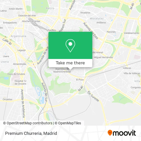
See Premium Churreria, Madrid, on the map
Public Transit to Premium Churreria in Madrid
Wondering how to get to Premium Churreria in Madrid? Moovit helps you find the best way to get to Premium Churreria with step-by-step directions from the nearest public transit station.
Moovit provides free maps and live directions to help you navigate through your city. View schedules, routes, timetables, and find out how long does it take to get to Premium Churreria in real time.
Looking for the nearest stop or station to Premium Churreria? Check out this list of stops closest to your destination: Palomeras Bajas - Romeo Y Julieta; Puerto Balbarán - Felipe De Diego; Avenida De Entrevías - Vedra; Avenida De Entrevías - Villacarrillo; El Pozo; Portazgo.
Bus: 144, 57, 136, 24, 102, 103, N11.Train: C2, C7.Metro: M-1.
Want to see if there’s another route that gets you there at an earlier time? Moovit helps you find alternative routes or times. Get directions from and directions to Premium Churreria easily from the Moovit App or Website.
We make riding to Premium Churreria easy, which is why over 1.5 million users, including users in Madrid, trust Moovit as the best app for public transit. You don’t need to download an individual bus app or train app, Moovit is your all-in-one transit app that helps you find the best bus time or train time available.
For information on prices of bus, metro and train, costs and ride fares to Premium Churreria, please check the Moovit app.
Use the app to navigate to popular places including to the airport, hospital, stadium, grocery store, mall, coffee shop, school, college, and university.
Premium Churreria Address: Calle de Felipe de Diego, 28018 Palomeras Bajas Madrid street in Madrid
- Calle Romeo y Julieta 12,
- Calle del Puerto de Balbarán,
- Colegio Público Palomeras Bajas,
- Avenida del Parque de Palomeras Bajas 14,
- Calle Felipe de Diego 13,
- Calle Felipe de Diego 2,
- Calle Puerto de Balbaran 113,
- Colegio Gredos San Diego,
- Fisioterapia Jessica m,
- Calle La Reina De Africa,
- Cerveceria Cruz Blanca,
- Dreamfit Vallecas,
- Calle de Vedra / Avenida Entrevías,
- Instalaciones Calorificas A.F,
- Carpinteria Perez Martin,
- Farmacia - Avenida Entrevías 100,
- Instalación Deportiva Municipal Básica José Durán,
- Bar Cafeteria Gonzalez,
- Carrefour,
- Centro Comercial Madrid Sur (Farmacia)
Places Near Premium Churreria (Madrid)
- Mendez Alvaro, Madrid,
- Plenilunio, Área Metropolitana De Madrid Y Corredor Del Henares,
- Rastro De Madrid, Área Metropolitana De Madrid Y Corredor Del Henares,
- Hospital Universitario La Paz, Madrid,
- Mercadillo de Majadahonda, Majadahonda,
- Estadio Wanda Metropolitano, Área Metropolitana De Madrid Y Corredor Del Henares,
- Centro Comercial La Vaguada, Área Metropolitana De Madrid Y Corredor Del Henares,
- Hospital Clínico Universitario San Carlos, Madrid,
- Calle de López de Hoyos 169, Madrid,
- Nassica, Área Metropolitana De Madrid Y Corredor Del Henares,
- Sala La Riviera, Madrid,
- Centro Comercial La Gavia, Área Metropolitana De Madrid Y Corredor Del Henares,
- Palacio De Vistalegre, Área Metropolitana De Madrid Y Corredor Del Henares,
- Centro Comercial Oasiz Madrid, Área Metropolitana De Madrid Y Corredor Del Henares,
- Wizink Center, Madrid,
- Centro Comercial Islazul, Área Metropolitana De Madrid Y Corredor Del Henares,
- Estacion de Chamartin, Madrid,
- Tres Aguas, Alcorcón,
- Plaza Mayor, Madrid,
- Hospital Universitario Ramón y Cajal, Madrid
How to get to popular places in Madrid with public transit
Get around Madrid by public transit!
Traveling around Madrid has never been so easy. See step by step directions as you travel to any attraction, street or major public transit station. View bus and train schedules, arrival times, service alerts and detailed routes on a map, so you know exactly how to get to anywhere in Madrid.
When traveling to any destination around Madrid use Moovit's Live Directions with Get Off Notifications to know exactly where and how far to walk, how long to wait for your line, and how many stops are left. Moovit will alert you when it's time to get off — no need to constantly re-check whether yours is the next stop.
Wondering how to use public transit in Madrid or how to pay for public transit in Madrid? Moovit public transit app can help you navigate your way with public transit easily, and at minimum cost. It includes public transit fees, ticket prices, and costs. Looking for a map of Madrid public transit lines? Moovit public transit app shows all public transit maps in Madrid with all Bus, Train, Metro and Light Rail routes and stops on an interactive map.
Madrid has 4 transit type(s), including: Bus, Train, Metro and Light Rail, operated by several transit agencies, including Metro de Madrid, Metro Ligero, Tranvía de Parla, Renfe Cercanías - Servicios de Autobús especiales, Renfe Cercanias, Renfe Cercanías, EMT, Interurbanos, Urbanos de Alcalá de Henares, Urbanos de Alcobendas, Urbanos de Alcorcón, Urbanos de Algete, Urbanos de Aranjuez, Urbanos de Arganda del Rey and Urbanos de Arroyomolinos