How to get to Preschool @ The David Posnack JCC by bus?
Click on the bus route to see step by step directions with maps, line arrival times and updated time schedules.
From Dania Pointe, Hollywood
43 minFrom Antique Trade Center, Hollywood
71 minFrom N University Dr, Plantation
40 minFrom Joe Robbie Stadium, Miami Gardens
75 minFrom South Plantation High School, Plantation
76 minFrom Calder Race Course (Calder Casino), Miami Gardens
53 minFrom Miami International Autodrome F1 Track, Miami Gardens
69 minFrom FIU at I-75, Miramar-Pembroke Pines
104 minFrom Hard Rock Stadium, Miami Gardens
65 minFrom Memorial West Hospital, Miramar-Pembroke Pines
26 min
Bus stops near Preschool @ The David Posnack JCC in Davie
Bus lines to Preschool @ The David Posnack JCC in Davie
What are the closest stations to Preschool @ The David Posnack JCC?
The closest stations to Preschool @ The David Posnack JCC are:
- Stirling Road/Pine Island Road is 260 yards away, 4 min walk.
- University Drive & Stirling Road is 1071 yards away, 13 min walk.
Which bus lines stop near Preschool @ The David Posnack JCC?
These bus lines stop near Preschool @ The David Posnack JCC: 02, 16.
What’s the nearest bus station to Preschool @ The David Posnack JCC in Davie?
The nearest bus station to Preschool @ The David Posnack JCC in Davie is Stirling Road/Pine Island Road. It’s a 4 min walk away.
What time is the first bus to Preschool @ The David Posnack JCC in Davie?
The 02 is the first bus that goes to Preschool @ The David Posnack JCC in Davie. It stops nearby at 5:26 AM.
What time is the last bus to Preschool @ The David Posnack JCC in Davie?
The 02 is the last bus that goes to Preschool @ The David Posnack JCC in Davie. It stops nearby at 11:55 PM.
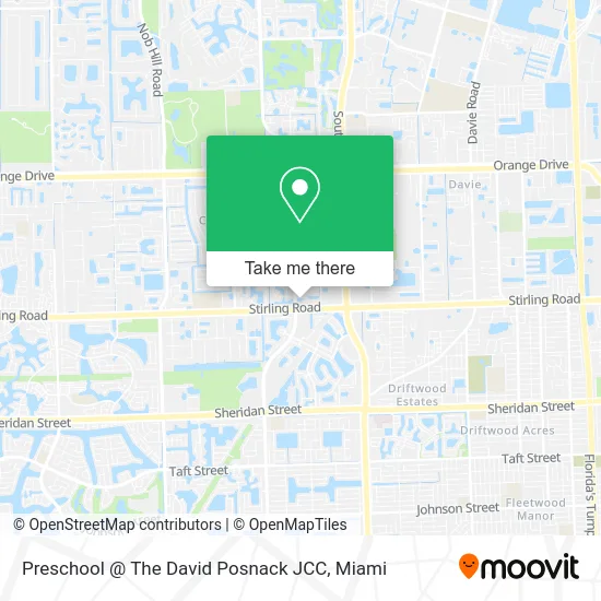
See Preschool @ The David Posnack JCC, Davie, on the map
Public Transit to Preschool @ The David Posnack JCC in Davie
Wondering how to get to Preschool @ The David Posnack JCC in Davie? Moovit helps you find the best way to get to Preschool @ The David Posnack JCC with step-by-step directions from the nearest public transit station.
Moovit provides free maps and live directions to help you navigate through your city. View schedules, routes, timetables, and find out how long does it take to get to Preschool @ The David Posnack JCC in real time.
Looking for the nearest stop or station to Preschool @ The David Posnack JCC? Check out this list of stops closest to your destination: Stirling Road/Pine Island Road; University Drive & Stirling Road.
Bus: 02, 16.
Want to see if there’s another route that gets you there at an earlier time? Moovit helps you find alternative routes or times. Get directions from and directions to Preschool @ The David Posnack JCC easily from the Moovit App or Website.
We make riding to Preschool @ The David Posnack JCC easy, which is why over 1.5 million users, including users in Davie, trust Moovit as the best app for public transit. You don’t need to download an individual bus app or train app, Moovit is your all-in-one transit app that helps you find the best bus time or train time available.
For information on prices of bus, costs and ride fares to Preschool @ The David Posnack JCC, please check the Moovit app.
Use the app to navigate to popular places including to the airport, hospital, stadium, grocery store, mall, coffee shop, school, college, and university.
Preschool @ The David Posnack JCC Address: 5850 S Pine Island Rd street in Davie
- Yoga,
- Behavioral Health Associates of Broward,
- Goodman JFS of Broward County,
- David Posnack Jewish Community Center,
- Diamond Mediations,
- Lorena CORA Pet PH,
- Blakeins Group,
- Fullhouse Construction,
- Shred Nations,
- Yeawefixthat,
- Royal MG of Davie,
- Bagel Boss of Hollywoo,
- A Place in Time Christian Ministries,
- Calvary Kids,
- Wilrose Realty,
- Bristol West Insurance Group,
- David Posnack,
- Fort Lauderdale Speedy Trane Hvac Systems,
- Aesthetic Clinique,
- KeyMe
Places Near Preschool @ The David Posnack JCC (Davie)
- Miami Design District, Miami,
- Hard Rock Stadium, Miami Gardens,
- Miami VA Hospital, Miami,
- Brickell City Centre, Miami,
- Sawgrass mall ( FL ), Miami Beach,
- Keiser University Flagship Campus, West Palm Beach,
- Marlins Park, Miami,
- Miami Freedom Park, Miami,
- Little Havana, Miami,
- Port of Miami Cruise Terminal, Miami,
- Dolphin Mall Bus, Miami,
- Aventura Mall, Miami,
- Miami-Dade County Courthouse, Miami,
- Richard E. Gerstein Justice Building, Miami,
- Sawgrass Mall, Miami,
- Bayside Marketplace, Miami,
- Wynwood, Miami,
- Dolphin Mall, Miami,
- Aventura Mall, Miami Beach,
- Zoo Miami, Miami
How to get to popular places in Miami with public transit
Get around Davie by public transit!
Traveling around Davie has never been so easy. See step by step directions as you travel to any attraction, street or major public transit station. View bus and train schedules, arrival times, service alerts and detailed routes on a map, so you know exactly how to get to anywhere in Davie.
When traveling to any destination around Davie use Moovit's Live Directions with Get Off Notifications to know exactly where and how far to walk, how long to wait for your line, and how many stops are left. Moovit will alert you when it's time to get off — no need to constantly re-check whether yours is the next stop.
Wondering how to use public transit in Davie or how to pay for public transit in Davie? Moovit public transit app can help you navigate your way with public transit easily, and at minimum cost. It includes public transit fees, ticket prices, and costs. Looking for a map of Davie public transit lines? Moovit public transit app shows all public transit maps in Davie with all Bus, Train, Light Rail and Ferry routes and stops on an interactive map.
Miami has 4 transit type(s), including: Bus, Train, Light Rail and Ferry, operated by several transit agencies, including Broward County Transit, Miami-Dade Transit, Metrorail, Palm Tran, Tri-Rail, Brightline, MARTY, City of Homestead Trolley, Key West Transit, Treasure Coast Connector, GoLine IRT, Amtrak, Greyhound-us, FlixBus-us and Aventura Express Shuttle Bus