How to get to Pressing by bus?
Click on the bus route to see step by step directions with maps, line arrival times and updated time schedules.
From Rosny-Sous-Bois, Rosny-Sous-Bois
93 minFrom E.Leclerc, Vitry-Sur-Seine
84 minFrom Parc zoologique de Paris, Paris
74 minFrom Créteil, Creteil
53 minFrom Hôpital National de Saint-Maurice, Saint-Maurice
54 minFrom Université Paris-Est Créteil (UPEC), Creteil
63 minFrom Villeneuve-Saint-Georges, Villeneuve-Saint-Georges
80 minFrom Route de la Pyramide, Paris
66 minFrom Alfortville, Alfortville
80 minFrom Créteil Soleil, Creteil
64 min
Bus stops near Pressing in Chennevieres-Sur-Marne
Bus lines to Pressing in Chennevieres-Sur-Marne
What are the closest stations to Pressing?
The closest stations to Pressing are:
- Centre Commercial de Pincevent is 90 meters away, 3 min walk.
- Lycée Champlain is 363 meters away, 7 min walk.
- Centre Commercial is 629 meters away, 9 min walk.
- Centre Commercial Pince Vent is 641 meters away, 10 min walk.
- Champlain - Pagnol is 692 meters away, 11 min walk.
Which bus lines stop near Pressing?
These bus lines stop near Pressing: 308, 437.
What’s the nearest bus station to Pressing in Chennevieres-Sur-Marne?
The nearest bus station to Pressing in Chennevieres-Sur-Marne is Centre Commercial de Pincevent. It’s a 3 min walk away.
What time is the first bus to Pressing in Chennevieres-Sur-Marne?
The 437 is the first bus that goes to Pressing in Chennevieres-Sur-Marne. It stops nearby at 5:43 AM.
What time is the last bus to Pressing in Chennevieres-Sur-Marne?
The 308 is the last bus that goes to Pressing in Chennevieres-Sur-Marne. It stops nearby at 2:12 AM.
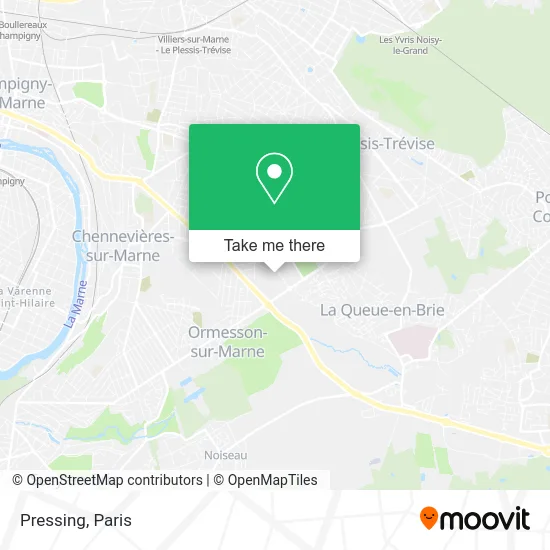
See Pressing, Chennevieres-Sur-Marne, on the map
Public Transit to Pressing in Chennevieres-Sur-Marne
Wondering how to get to Pressing in Chennevieres-Sur-Marne? Moovit helps you find the best way to get to Pressing with step-by-step directions from the nearest public transit station.
Moovit provides free maps and live directions to help you navigate through your city. View schedules, routes, timetables, and find out how long does it take to get to Pressing in real time.
Looking for the nearest stop or station to Pressing? Check out this list of stops closest to your destination: Centre Commercial de Pincevent; Lycée Champlain; Centre Commercial; Centre Commercial Pince Vent; Champlain - Pagnol.
Bus: 308, 437, 208, 438, 446, 448, 440.
Want to see if there’s another route that gets you there at an earlier time? Moovit helps you find alternative routes or times. Get directions from and directions to Pressing easily from the Moovit App or Website.
We make riding to Pressing easy, which is why over 1.5 million users, including users in Chennevieres-Sur-Marne, trust Moovit as the best app for public transit. You don’t need to download an individual bus app or train app, Moovit is your all-in-one transit app that helps you find the best bus time or train time available.
For information on prices of bus and RER, costs and ride fares to Pressing, please check the Moovit app.
Use the app to navigate to popular places including to the airport, hospital, stadium, grocery store, mall, coffee shop, school, college, and university.
Pressing Address: 94430 Chennevières-sur-Marne street in Chennevieres-Sur-Marne
- Ciné Pince-Vent,
- Cine Pince Vent,
- 85 Route de Provins,
- Castorama,
- Castorama Ormesson,
- Carrefour Ormesson,
- Centre Commercial de Pince Vent,
- Animalis Chennevieres,
- 7 Avenue de Pince Vent,
- 85 Route de Provins. Route Nationale 4,
- Lidl,
- Centre Commercial Pince Vent,
- Action,
- Conforama,
- Centre Commercial Pince-Vent,
- L'or et Vous,
- Etoile,
- Centre Commercial Pince-Vent,
- Carrefour,
- Cultura
Places Near Pressing (Chennevieres-Sur-Marne)
- Créteil Soleil, Creteil,
- Hôpital de la Pitié-Salpêtrière, Paris,
- Théâtre Mogador, Paris,
- Hôpital Saint-Joseph, Paris,
- Gare Routière Flixbus, Paris,
- Hopital Foch, Suresnes,
- Hôpital Cochin, Paris,
- Marché Saint-Pierre, Paris,
- Hopital Lariboisière, Paris,
- Galeries Lafayette Haussmann, Paris,
- Hôpital Necker, Paris,
- Fondation Louis Vuitton, Paris,
- Hôpital Henri Mondor, Creteil,
- Institut Curie, Paris,
- Centre Hospitalier des 15/20, Paris,
- Atelier Des Lumieres, Paris,
- Hôpital Beaujon, Clichy,
- Galeries Lafayette, Paris,
- Hôpital Pitié Salpêtrière, Paris,
- 29 Rue Manin, Paris
How to get to popular places in Paris with public transit
Get around Chennevieres-Sur-Marne by public transit!
Traveling around Chennevieres-Sur-Marne has never been so easy. See step by step directions as you travel to any attraction, street or major public transit station. View bus and train schedules, arrival times, service alerts and detailed routes on a map, so you know exactly how to get to anywhere in Chennevieres-Sur-Marne.
When traveling to any destination around Chennevieres-Sur-Marne use Moovit's Live Directions with Get Off Notifications to know exactly where and how far to walk, how long to wait for your line, and how many stops are left. Moovit will alert you when it's time to get off — no need to constantly re-check whether yours is the next stop.
Wondering how to use public transit in Chennevieres-Sur-Marne or how to pay for public transit in Chennevieres-Sur-Marne? Moovit public transit app can help you navigate your way with public transit easily, and at minimum cost. It includes public transit fees, ticket prices, and costs. Looking for a map of Chennevieres-Sur-Marne public transit lines? Moovit public transit app shows all public transit maps in Chennevieres-Sur-Marne with all Bus, Train, Metro, Light Rail, RER, Funicular and Gondola routes and stops on an interactive map.
Paris has 7 transit type(s), including: Bus, Train, Metro, Light Rail, RER, Funicular and Gondola, operated by several transit agencies, including RATP, RER, RER Bus de remplacement, Train, Train Bus de remplacement, Tramway Bus de remplacement, TER, ADP, Magical Shuttle, Argenteuil - Boucles de Seine, Autocars Dominique, Bièvre, Brie et 2 Morin, Le Bus - C.C. du Clermontois and Cœur d’Essonne