How to get to Prestige Cleaning Support by bus?
Click on the bus route to see step by step directions with maps, line arrival times and updated time schedules.
From Horseshoe Casino Baltimore, Baltimore
63 minFrom Sinai Hospital, Baltimore
66 minFrom Druid Hill Park, Baltimore
64 minFrom Guinness Open Gate Brewery & Barrel House, Baltimore County
62 minFrom Pigtown / Washington Village, Baltimore
59 minFrom Walmart, Baltimore
52 minFrom Baltimore Penn Station, Baltimore
39 minFrom B&O Railroad Museum, Baltimore
54 minFrom Walmart, Baltimore County
54 minFrom Social Security Administration, Baltimore
57 min
Bus stops near Prestige Cleaning Support in Baltimore County
Bus lines to Prestige Cleaning Support in Baltimore County
What are the closest stations to Prestige Cleaning Support?
The closest stations to Prestige Cleaning Support are:
- Crosby Rd & Chesworth Rd FS Eb is 33 yards away, 1 min walk.
- Craigmont Rd & Fordwood Cr Sb is 573 yards away, 7 min walk.
- Rolling Rd & Baltimore National Pike is 778 yards away, 10 min walk.
Which bus lines stop near Prestige Cleaning Support?
These bus lines stop near Prestige Cleaning Support: 32, 34, 77, 78.
What’s the nearest bus station to Prestige Cleaning Support in Baltimore County?
The nearest bus station to Prestige Cleaning Support in Baltimore County is Crosby Rd & Chesworth Rd FS Eb. It’s a 1 min walk away.
What time is the first bus to Prestige Cleaning Support in Baltimore County?
The 77 is the first bus that goes to Prestige Cleaning Support in Baltimore County. It stops nearby at 3:48 AM.
What time is the last bus to Prestige Cleaning Support in Baltimore County?
The 77 is the last bus that goes to Prestige Cleaning Support in Baltimore County. It stops nearby at 2:35 AM.
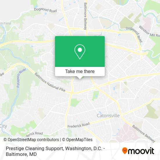
See Prestige Cleaning Support, Baltimore County, on the map
Public Transit to Prestige Cleaning Support in Baltimore County
Wondering how to get to Prestige Cleaning Support in Baltimore County? Moovit helps you find the best way to get to Prestige Cleaning Support with step-by-step directions from the nearest public transit station.
Moovit provides free maps and live directions to help you navigate through your city. View schedules, routes, timetables, and find out how long does it take to get to Prestige Cleaning Support in real time.
Looking for the nearest stop or station to Prestige Cleaning Support? Check out this list of stops closest to your destination: Crosby Rd & Chesworth Rd FS Eb; Craigmont Rd & Fordwood Cr Sb; Rolling Rd & Baltimore National Pike.
Bus: 32, 34, 77, 78, 37, 505, CITYLINK PURPLE, 150.
Want to see if there’s another route that gets you there at an earlier time? Moovit helps you find alternative routes or times. Get directions from and directions to Prestige Cleaning Support easily from the Moovit App or Website.
We make riding to Prestige Cleaning Support easy, which is why over 1.5 million users, including users in Baltimore County, trust Moovit as the best app for public transit. You don’t need to download an individual bus app or train app, Moovit is your all-in-one transit app that helps you find the best bus time or train time available.
For information on prices of bus, costs and ride fares to Prestige Cleaning Support, please check the Moovit app.
Use the app to navigate to popular places including to the airport, hospital, stadium, grocery store, mall, coffee shop, school, college, and university.
Location: Baltimore County, Washington, D.C. - Baltimore, MD
- Red Team Security Solutions,
- Concord Appraisal,
- Goodwill Towing,
- Mail Lees,
- Mirror Image Cosmetics Inc,
- Ivy Spring Terrace,
- MAACO,
- Salon Service,
- Adj Advertising,
- Home Depot,
- Lopez Gregory,
- Design & Furnishings Group,
- Royal Imaging Solutions,
- Rolling Meadows,
- Ethel Rolling Rd,
- ATM,
- Poursaeid Tannaz DDS,
- Tabu Social Club,
- William C Probst,
- Amazon Locker-Drop
Places Near Prestige Cleaning Support (Baltimore County)
- Museum Of The Bible, Washington,
- Basilica of the National Shrine, Washington,
- PG Mall, Prince George's County,
- Georgetown, Washington,
- Capital One Arena, Washington,
- Sibley Memorial Hospital, Washington,
- Washington DC VA Medical Center, Washington,
- Westfield Montgomery Mall, Montgomery County,
- Rock Creek Tennis Center, Washington,
- National Zoo, Washington,
- Camden Yards, Baltimore,
- Pennsylvania Ave NW (3rd st and pennsylvania), Washington,
- Warner Theatre, Washington,
- The Anthem, Washington,
- National Theatre, Washington,
- Marriott Marquis Washington, DC, Washington,
- M&T Bank Stadium, Baltimore,
- Amazon Hq2, Arlington County,
- Washington National Cathedral, Washington,
- National Museum of African American History and Culture, Washington
How to get to popular places in Washington, D.C. - Baltimore, MD with public transit
Get around Baltimore County by public transit!
Traveling around Baltimore County has never been so easy. See step by step directions as you travel to any attraction, street or major public transit station. View bus and train schedules, arrival times, service alerts and detailed routes on a map, so you know exactly how to get to anywhere in Baltimore County.
When traveling to any destination around Baltimore County use Moovit's Live Directions with Get Off Notifications to know exactly where and how far to walk, how long to wait for your line, and how many stops are left. Moovit will alert you when it's time to get off — no need to constantly re-check whether yours is the next stop.
Wondering how to use public transit in Baltimore County or how to pay for public transit in Baltimore County? Moovit public transit app can help you navigate your way with public transit easily, and at minimum cost. It includes public transit fees, ticket prices, and costs. Looking for a map of Baltimore County public transit lines? Moovit public transit app shows all public transit maps in Baltimore County with all Bus, Train, Metro, Light Rail and Ferry routes and stops on an interactive map.
Washington, D.C. - Baltimore, MD has 5 transit type(s), including: Bus, Train, Metro, Light Rail and Ferry, operated by several transit agencies, including WMATA, Montgomery County Ride On, Fairfax Connector, TheBus, PRTC, DASH - Alexandria, Arlington Transit (ART), RTA of Central Maryland, MDOT MTA, MDOT MTA Light RailLink, MDOT MTA Commuter Bus, MDOT MTA Local Bus, FXBGO!, Virginia Railway Express (VRE) and MARC