How to get to Prevent Cancer Foundation by bus?
Click on the bus route to see step by step directions with maps, line arrival times and updated time schedules.
From National Museum of African American History and Culture, Washington
102 minFrom Constitution Ave NW (17th street and constitution avenue nw), Washington
121 minFrom Smithsonian National Air And Space Museum, Washington
104 minFrom State Department, Washington
103 minFrom The Westin Arlington Gateway, Arlington County
53 minFrom West Potomac Park, Washington
117 minFrom St Elizabeths Hospital, Washington
78 minFrom Constitution Ave & 14th St, Washington
103 minFrom U.S. Department of Health and Human Services (HHS), Washington
87 minFrom Lincoln Memorial, Washington
123 min
How to get to Prevent Cancer Foundation by train?
Click on the train route to see step by step directions with maps, line arrival times and updated time schedules.
How to get to Prevent Cancer Foundation by metro?
Click on the metro route to see step by step directions with maps, line arrival times and updated time schedules.
From National Museum of African American History and Culture, Washington
42 minFrom Constitution Ave NW (17th street and constitution avenue nw), Washington
44 minFrom Smithsonian National Air And Space Museum, Washington
29 minFrom State Department, Washington
40 minFrom The Westin Arlington Gateway, Arlington County
41 minFrom West Potomac Park, Washington
55 minFrom St Elizabeths Hospital, Washington
52 minFrom Constitution Ave & 14th St, Washington
43 minFrom U.S. Department of Health and Human Services (HHS), Washington
35 minFrom Lincoln Memorial, Washington
43 min
Bus stops near Prevent Cancer Foundation in Alexandria
- King St-Old Town+Bay J, 1 min walk,VIEW
- King St-Old Town Station (Bay E), 1 min walk,VIEW
- King St-Old Town Station (Bay F), 1 min walk,VIEW
- King St-Old Town Station (Bay G), 2 min walk,VIEW
- King Street-Old Town+Bay C, 2 min walk,VIEW
- King St Metro Station - Bay B, 2 min walk,VIEW
- King St-Old Town+Bay A, 2 min walk,VIEW
- King Street-Old Town+Bay B, 2 min walk,VIEW
- Dulany St & Duke St, 3 min walk,VIEW
Metro station near Prevent Cancer Foundation in Alexandria
- Braddock Road Metro, 24 min walk,VIEW
Train station near Prevent Cancer Foundation in Alexandria
- Alexandria, 36 min walk,VIEW
Bus lines to Prevent Cancer Foundation in Alexandria
- P90, West To King St-Old Town,VIEW
- KST, City Hall/Market Square,VIEW
- 30, West Alexandria Transit Center (Short Trip),VIEW
- 31, King St-Old Town Station (Short Trip),VIEW
- 32, King St-Old Town Station,VIEW
- F20, East To King St-Old Town,VIEW
- 33, Potomac Yard Center,VIEW
- 102, King St-Old Town Station,VIEW
- A71, South To King St-Old Town,VIEW
- F23, Little River Tpk-George Mason,VIEW
- F24, Little River Tpk-Vienna,VIEW
- F1X, South To Ft Belvoir Hospital,VIEW
What are the closest stations to Prevent Cancer Foundation?
The closest stations to Prevent Cancer Foundation are:
- King St-Old Town+Bay J is 23 yards away, 1 min walk.
- King St-Old Town Station (Bay E) is 60 yards away, 1 min walk.
- King St-Old Town Station (Bay F) is 63 yards away, 1 min walk.
- King St-Old Town Station (Bay G) is 87 yards away, 2 min walk.
- King Street-Old Town+Bay C is 87 yards away, 2 min walk.
- King St Metro Station - Bay B is 92 yards away, 2 min walk.
- King St-Old Town+Bay A is 114 yards away, 2 min walk.
- King Street-Old Town+Bay B is 135 yards away, 2 min walk.
- Dulany St & Duke St is 243 yards away, 3 min walk.
- Braddock Road Metro is 2010 yards away, 24 min walk.
- Alexandria is 3000 yards away, 36 min walk.
Which bus lines stop near Prevent Cancer Foundation?
These bus lines stop near Prevent Cancer Foundation: A71, F20, P90.
Which train lines stop near Prevent Cancer Foundation?
These train lines stop near Prevent Cancer Foundation: MANASSAS LINE, PALMETTO.
Which metro lines stop near Prevent Cancer Foundation?
These metro lines stop near Prevent Cancer Foundation: BLUE, YELLOW.
What’s the nearest metro station to Prevent Cancer Foundation in Alexandria?
The nearest metro station to Prevent Cancer Foundation in Alexandria is Braddock Road Metro. It’s a 24 min walk away.
What’s the nearest bus station to Prevent Cancer Foundation in Alexandria?
The nearest bus stations to Prevent Cancer Foundation in Alexandria are King St-Old Town+Bay J, King St-Old Town Station (Bay E) and King St-Old Town Station (Bay F). The closest one is a 1 min walk away.
What time is the first metro to Prevent Cancer Foundation in Alexandria?
The YELLOW is the first metro that goes to Prevent Cancer Foundation in Alexandria. It stops nearby at 5:00 AM.
What time is the last metro to Prevent Cancer Foundation in Alexandria?
The YELLOW is the last metro that goes to Prevent Cancer Foundation in Alexandria. It stops nearby at 12:39 AM.
What time is the first train to Prevent Cancer Foundation in Alexandria?
The SILVER METEOR is the first train that goes to Prevent Cancer Foundation in Alexandria. It stops nearby at 5:54 AM.
What time is the last train to Prevent Cancer Foundation in Alexandria?
The SILVER METEOR is the last train that goes to Prevent Cancer Foundation in Alexandria. It stops nearby at 5:54 AM.
What time is the first bus to Prevent Cancer Foundation in Alexandria?
The F20 is the first bus that goes to Prevent Cancer Foundation in Alexandria. It stops nearby at 4:55 AM.
What time is the last bus to Prevent Cancer Foundation in Alexandria?
The F20 is the last bus that goes to Prevent Cancer Foundation in Alexandria. It stops nearby at 3:00 AM.
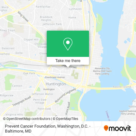
See Prevent Cancer Foundation, Alexandria, on the map
Public Transit to Prevent Cancer Foundation in Alexandria
Wondering how to get to Prevent Cancer Foundation in Alexandria? Moovit helps you find the best way to get to Prevent Cancer Foundation with step-by-step directions from the nearest public transit station.
Moovit provides free maps and live directions to help you navigate through your city. View schedules, routes, timetables, and find out how long does it take to get to Prevent Cancer Foundation in real time.
Looking for the nearest stop or station to Prevent Cancer Foundation? Check out this list of stops closest to your destination: King St-Old Town+Bay J; King St-Old Town Station (Bay E); King St-Old Town Station (Bay F); King St-Old Town Station (Bay G); King Street-Old Town+Bay C; King St Metro Station - Bay B; King St-Old Town+Bay A; King Street-Old Town+Bay B; Dulany St & Duke St; Braddock Road Metro; Alexandria.
Bus: A71, F20, P90, KST, 30, 31.Train: MANASSAS LINE, PALMETTO, CARDINAL, CAROLINIAN, CRESCENT, FLORIDIAN, NORTHEAST REGIONAL.Metro: BLUE, YELLOW.
Want to see if there’s another route that gets you there at an earlier time? Moovit helps you find alternative routes or times. Get directions from and directions to Prevent Cancer Foundation easily from the Moovit App or Website.
We make riding to Prevent Cancer Foundation easy, which is why over 1.5 million users, including users in Alexandria, trust Moovit as the best app for public transit. You don’t need to download an individual bus app or train app, Moovit is your all-in-one transit app that helps you find the best bus time or train time available.
For information on prices of metro, bus and train, costs and ride fares to Prevent Cancer Foundation, please check the Moovit app.
Use the app to navigate to popular places including to the airport, hospital, stadium, grocery store, mall, coffee shop, school, college, and university.
Prevent Cancer Foundation Address: 333 John Carlyle St Alexandria, VA 22314 street in Alexandria
- The John Carlyle Group - Morgan Stanley (Gerald Louis Fils - Morgan Stanley),
- Cotton & Company,
- The John Carlyle Group - Morgan Stanley,
- American Coalition-Clean Coal,
- Gianni Giordano - Morgan Stanley,
- John Carlyle Square Park,
- Ncua - Region 2 Office,
- Intelligent Data Inc,
- Decibel Management,
- Intellectual Property Research,
- Regus - Virginia, Alexandria - Carlyle Crescent,
- VTG Studio,
- Northern Virginia Health Foundation,
- Five Guys HQ,
- Repair Trane Hvac Systems Hvac,
- MSB A I,
- Accuro Consulting,
- Atlantic Services Group Location,
- Wells Fargo,
- Alexandria Holiday Market
Places Near Prevent Cancer Foundation (Alexandria)
- Basilica of the National Shrine, Washington,
- National Zoo, Washington,
- Washington DC VA Medical Center, Washington,
- Amazon Hq2, Arlington County,
- PG Mall, Prince George's County,
- Sibley Memorial Hospital, Washington,
- Warner Theatre, Washington,
- Georgetown, Washington,
- Capital One Arena, Washington,
- National Museum of African American History and Culture, Washington,
- Rock Creek Tennis Center, Washington,
- Camden Yards, Baltimore,
- Museum Of The Bible, Washington,
- Pennsylvania Ave NW (3rd st and pennsylvania), Washington,
- Marriott Marquis Washington, DC, Washington,
- National Theatre, Washington,
- Washington National Cathedral, Washington,
- Westfield Montgomery Mall, Montgomery County,
- M&T Bank Stadium, Baltimore,
- The Anthem, Washington
How to get to popular places in Washington, D.C. - Baltimore, MD with public transit
Get around Alexandria by public transit!
Traveling around Alexandria has never been so easy. See step by step directions as you travel to any attraction, street or major public transit station. View bus and train schedules, arrival times, service alerts and detailed routes on a map, so you know exactly how to get to anywhere in Alexandria.
When traveling to any destination around Alexandria use Moovit's Live Directions with Get Off Notifications to know exactly where and how far to walk, how long to wait for your line, and how many stops are left. Moovit will alert you when it's time to get off — no need to constantly re-check whether yours is the next stop.
Wondering how to use public transit in Alexandria or how to pay for public transit in Alexandria? Moovit public transit app can help you navigate your way with public transit easily, and at minimum cost. It includes public transit fees, ticket prices, and costs. Looking for a map of Alexandria public transit lines? Moovit public transit app shows all public transit maps in Alexandria with all Bus, Train, Metro, Light Rail and Ferry routes and stops on an interactive map.
Washington, D.C. - Baltimore, MD has 5 transit type(s), including: Bus, Train, Metro, Light Rail and Ferry, operated by several transit agencies, including WMATA, Montgomery County Ride On, Fairfax Connector, TheBus, PRTC, DASH - Alexandria, Arlington Transit (ART), RTA of Central Maryland, MDOT MTA, MDOT MTA Light RailLink, MDOT MTA Commuter Bus, MDOT MTA Local Bus, FXBGO!, Virginia Railway Express (VRE) and MARC