How to get to Prevention First by bus?
Click on the bus route to see step by step directions with maps, line arrival times and updated time schedules.
Bus stops near Prevention First in West Long Branch
Train station near Prevention First in West Long Branch
- Monmouth Park, 30 min walk,VIEW
Bus lines to Prevention First in West Long Branch
What are the closest stations to Prevention First?
The closest stations to Prevention First are:
- Oceanport (Northbound) is 595 yards away, 8 min walk.
- Rt-36 at Broadway# is 678 yards away, 9 min walk.
- Monmouth Park is 2501 yards away, 30 min walk.
Which bus lines stop near Prevention First?
These bus lines stop near Prevention First: 200, 831, 837.
Which train line stops near Prevention First?
NJCL (Bay Head)
What’s the nearest train station to Prevention First in West Long Branch?
The nearest train station to Prevention First in West Long Branch is Monmouth Park. It’s a 30 min walk away.
What’s the nearest bus station to Prevention First in West Long Branch?
The nearest bus station to Prevention First in West Long Branch is Oceanport (Northbound). It’s a 8 min walk away.
What time is the first train to Prevention First in West Long Branch?
The NJCL is the first train that goes to Prevention First in West Long Branch. It stops nearby at 3:56 AM.
What time is the last train to Prevention First in West Long Branch?
The NJCL is the last train that goes to Prevention First in West Long Branch. It stops nearby at 2:39 AM.
What time is the first bus to Prevention First in West Long Branch?
The 831 is the first bus that goes to Prevention First in West Long Branch. It stops nearby at 6:15 AM.
What time is the last bus to Prevention First in West Long Branch?
The 200 is the last bus that goes to Prevention First in West Long Branch. It stops nearby at 8:00 PM.
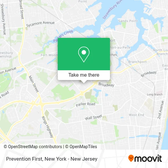
See Prevention First, West Long Branch, on the map
Public Transit to Prevention First in West Long Branch
Wondering how to get to Prevention First in West Long Branch? Moovit helps you find the best way to get to Prevention First with step-by-step directions from the nearest public transit station.
Moovit provides free maps and live directions to help you navigate through your city. View schedules, routes, timetables, and find out how long does it take to get to Prevention First in real time.
Looking for the nearest stop or station to Prevention First? Check out this list of stops closest to your destination: Oceanport (Northbound); Rt-36 at Broadway#; Monmouth Park.
Bus: 200, 831, 837.Train: NJCL.
Want to see if there’s another route that gets you there at an earlier time? Moovit helps you find alternative routes or times. Get directions from and directions to Prevention First easily from the Moovit App or Website.
We make riding to Prevention First easy, which is why over 1.5 million users, including users in West Long Branch, trust Moovit as the best app for public transit. You don’t need to download an individual bus app or train app, Moovit is your all-in-one transit app that helps you find the best bus time or train time available.
For information on prices of bus, subway and train, costs and ride fares to Prevention First, please check the Moovit app.
Use the app to navigate to popular places including to the airport, hospital, stadium, grocery store, mall, coffee shop, school, college, and university.
Prevention First Address: 185 State Route 36 street in West Long Branch
- Margaret Lambert, M.D.,
- Abigail Whetstone, D.O.,
- Advanced Clinical Institute,
- Monmouth University Center For Speech and Language Disorders,
- Just Play! Indoor Playground & Café,
- Marine Corps Recruit Depot - Paris Island Sc,
- Serenity Day Hab at Monmouth,
- Monmouth Cares Inc,
- Hq,
- Monmouth University Graduate School,
- Hackensack Meridian Health Primary Care,
- Adt Security Services,
- Western Union,
- E A I Landing Strip,
- Woodbine Cemetery and Mausoleum,
- Allied Digestive Health,
- Carvel,
- Aldi,
- 7 Presidents Beach, Long Branch NJ,
- The Squire
Places Near Prevention First (West Long Branch)
- 1 Police Plaza, Manhattan,
- Wall Street, Manhattan,
- 376 Hudson Street, Manhattan,
- 3 Stone St, Manhattan,
- Katz's Deli, Manhattan,
- 26 Federal Plaza, Manhattan,
- Mountainside Hospital, Glen Ridge,
- Queens Center Mall, Queens,
- Bellevue Hospital, Manhattan,
- SoHo, Manhattan,
- Pier 83, Manhattan,
- Hudson Yards, Manhattan,
- 66 John Street, Manhattan,
- 111 Centre New York City Supreme Court, Manhattan,
- Rockefeller Center, Manhattan,
- San Gennaro Feast, Manhattan,
- Chinatown, Manhattan,
- Times Square, Manhattan,
- 911 Memorial, Manhattan,
- qqqq, Manhattan
How to get to popular places in New York - New Jersey with public transit
Get around West Long Branch by public transit!
Traveling around West Long Branch has never been so easy. See step by step directions as you travel to any attraction, street or major public transit station. View bus and train schedules, arrival times, service alerts and detailed routes on a map, so you know exactly how to get to anywhere in West Long Branch.
When traveling to any destination around West Long Branch use Moovit's Live Directions with Get Off Notifications to know exactly where and how far to walk, how long to wait for your line, and how many stops are left. Moovit will alert you when it's time to get off — no need to constantly re-check whether yours is the next stop.
Wondering how to use public transit in West Long Branch or how to pay for public transit in West Long Branch? Moovit public transit app can help you navigate your way with public transit easily, and at minimum cost. It includes public transit fees, ticket prices, and costs. Looking for a map of West Long Branch public transit lines? Moovit public transit app shows all public transit maps in West Long Branch with all Bus, Train, Subway, Light Rail, Ferry and Cable Car routes and stops on an interactive map.
New York - New Jersey has 6 transit type(s), including: Bus, Train, Subway, Light Rail, Ferry and Cable Car, operated by several transit agencies, including MTA Subway, Metro-North Railroad, LIRR, PATH, MTA New York City Transit - Express routes, MTA Bus, NJ Transit, NYC Ferry, NICE bus, Bee-Line Bus, NJ Transit Rail, Norwalk Transit District, Hartford Line, River Valley Transit and HART