How to get to Prima Health Center by bus?
Click on the bus route to see step by step directions with maps, line arrival times and updated time schedules.
From Sensual Massage 4 Women, Miami Beach
65 minFrom North Bay Village, Miami Beach
64 minFrom Miami Northwestern Senior High School, Miami
50 minFrom NW 27th Ave / NW 79th St, Miami
56 minFrom Aventura Station (Brightline), Miami
64 minFrom Bal Harbour, Miami Beach
55 minFrom Opa-Locka Hialeah Flea Market, Miami
105 minFrom Gulfstream Park Racing & Casino, Miami
69 minFrom Tri-Rail - Hollywood Station, Hollywood
72 minFrom DoubleTree Resort by Hilton Hollywood Beach, Hollywood
72 min
Bus stops near Prima Health Center in Miami
Bus lines to Prima Health Center in Miami
What are the closest stations to Prima Health Center?
The closest stations to Prima Health Center are:
- Ne 167 St @ Ne 2 Av is 210 yards away, 3 min walk.
- Ne 168 St & N Miami Av is 385 yards away, 5 min walk.
- Ne 6 Av @ Ne 166 St is 1220 yards away, 15 min walk.
Which bus line stops near Prima Health Center?
75 (75a - Fiu Biscayne Campus)
What’s the nearest bus station to Prima Health Center in Miami?
The nearest bus station to Prima Health Center in Miami is Ne 167 St @ Ne 2 Av. It’s a 3 min walk away.
What time is the first bus to Prima Health Center in Miami?
The 401 is the first bus that goes to Prima Health Center in Miami. It stops nearby at 3:03 AM.
What time is the last bus to Prima Health Center in Miami?
The 401 is the last bus that goes to Prima Health Center in Miami. It stops nearby at 2:38 AM.
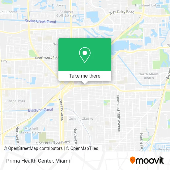
See Prima Health Center, Miami, on the map
Public Transit to Prima Health Center in Miami
Wondering how to get to Prima Health Center in Miami? Moovit helps you find the best way to get to Prima Health Center with step-by-step directions from the nearest public transit station.
Moovit provides free maps and live directions to help you navigate through your city. View schedules, routes, timetables, and find out how long does it take to get to Prima Health Center in real time.
Looking for the nearest stop or station to Prima Health Center? Check out this list of stops closest to your destination: Ne 167 St @ Ne 2 Av; Ne 168 St & N Miami Av; Ne 6 Av @ Ne 166 St.
Bus: 75, 401, NMBEACD, 9.
Want to see if there’s another route that gets you there at an earlier time? Moovit helps you find alternative routes or times. Get directions from and directions to Prima Health Center easily from the Moovit App or Website.
We make riding to Prima Health Center easy, which is why over 1.5 million users, including users in Miami, trust Moovit as the best app for public transit. You don’t need to download an individual bus app or train app, Moovit is your all-in-one transit app that helps you find the best bus time or train time available.
For information on prices of bus and train, costs and ride fares to Prima Health Center, please check the Moovit app.
Use the app to navigate to popular places including to the airport, hospital, stadium, grocery store, mall, coffee shop, school, college, and university.
Prima Health Center Address: 125 NE 167th St Miami, FL 33162 street in Miami
- FG Rapid Results,
- Miami Wings,
- Louis Gutierrez, MD,
- Albear,
- Outthebleau Printing,
- smart Tax,
- Out the Bleau Print Shop,
- Asian Massage,
- Black Pr Wire,
- Sonshine Communications,
- Locksmith Around The Clock,
- State Farm,
- Forever Love Puppies - North Miami,
- Aelion Group,
- The Law Offices of Scott Egleston,
- Morris Group,
- Type Specimen Book,
- Eighty Eight Runaway,
- HQD Smokeshop,
- Stacy Fleridor
Places Near Prima Health Center (Miami)
- Miami-Dade County Courthouse, Miami,
- Zoo Miami, Miami,
- Port of Miami Cruise Terminal, Miami,
- Dolphin Mall, Miami,
- Dolphin Mall Bus, Miami,
- Sawgrass mall ( FL ), Miami Beach,
- Aventura Mall, Miami Beach,
- Hard Rock Stadium, Miami Gardens,
- Miami Design District, Miami,
- Miami Freedom Park, Miami,
- Aventura Mall, Miami,
- Wynwood, Miami,
- Sawgrass Mall, Miami,
- Bayside Marketplace, Miami,
- Keiser University Flagship Campus, West Palm Beach,
- Brickell City Centre, Miami,
- Miami VA Hospital, Miami,
- Marlins Park, Miami,
- Little Havana, Miami,
- Richard E. Gerstein Justice Building, Miami
How to get to popular places in Miami with public transit
Get around Miami by public transit!
Traveling around Miami has never been so easy. See step by step directions as you travel to any attraction, street or major public transit station. View bus and train schedules, arrival times, service alerts and detailed routes on a map, so you know exactly how to get to anywhere in Miami.
When traveling to any destination around Miami use Moovit's Live Directions with Get Off Notifications to know exactly where and how far to walk, how long to wait for your line, and how many stops are left. Moovit will alert you when it's time to get off — no need to constantly re-check whether yours is the next stop.
Wondering how to use public transit in Miami or how to pay for public transit in Miami? Moovit public transit app can help you navigate your way with public transit easily, and at minimum cost. It includes public transit fees, ticket prices, and costs. Looking for a map of Miami public transit lines? Moovit public transit app shows all public transit maps in Miami with all Bus, Train, Light Rail and Ferry routes and stops on an interactive map.
Miami has 4 transit type(s), including: Bus, Train, Light Rail and Ferry, operated by several transit agencies, including Broward County Transit, Miami-Dade Transit, Metrorail, Palm Tran, Tri-Rail, Brightline, MARTY, City of Homestead Trolley, Key West Transit, Treasure Coast Connector, GoLine IRT, Amtrak, Greyhound-us, FlixBus-us and Aventura Express Shuttle Bus