How to get to Prime Eighty Two by bus?
Click on the bus route to see step by step directions with maps, line arrival times and updated time schedules.
Bus stops near Prime Eighty Two in Norwich
Bus lines to Prime Eighty Two in Norwich
What are the closest stations to Prime Eighty Two?
The closest stations to Prime Eighty Two are:
- W Town St/Courtyard (Ctdot) is 155 yards away, 3 min walk.
- Nordson Efd (Nb) is 866 yards away, 11 min walk.
Which bus lines stop near Prime Eighty Two?
These bus lines stop near Prime Eighty Two: 5, 991.
What’s the nearest bus station to Prime Eighty Two in Norwich?
The nearest bus station to Prime Eighty Two in Norwich is W Town St/Courtyard (Ctdot). It’s a 3 min walk away.
What time is the first bus to Prime Eighty Two in Norwich?
The 991 is the first bus that goes to Prime Eighty Two in Norwich. It stops nearby at 6:05 AM.
What time is the last bus to Prime Eighty Two in Norwich?
The 991 is the last bus that goes to Prime Eighty Two in Norwich. It stops nearby at 12:31 AM.
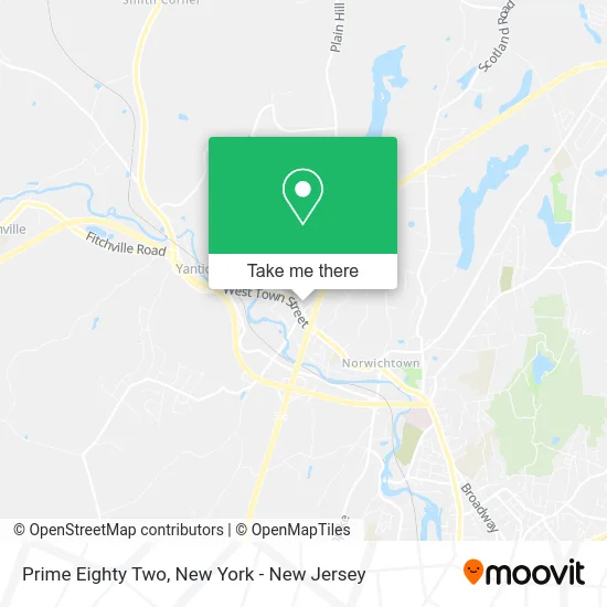
See Prime Eighty Two, Norwich, on the map
Public Transit to Prime Eighty Two in Norwich
Wondering how to get to Prime Eighty Two in Norwich? Moovit helps you find the best way to get to Prime Eighty Two with step-by-step directions from the nearest public transit station.
Moovit provides free maps and live directions to help you navigate through your city. View schedules, routes, timetables, and find out how long does it take to get to Prime Eighty Two in real time.
Looking for the nearest stop or station to Prime Eighty Two? Check out this list of stops closest to your destination: W Town St/Courtyard (Ctdot); Nordson Efd (Nb).
Bus: 5, 991.
Want to see if there’s another route that gets you there at an earlier time? Moovit helps you find alternative routes or times. Get directions from and directions to Prime Eighty Two easily from the Moovit App or Website.
We make riding to Prime Eighty Two easy, which is why over 1.5 million users, including users in Norwich, trust Moovit as the best app for public transit. You don’t need to download an individual bus app or train app, Moovit is your all-in-one transit app that helps you find the best bus time or train time available.
For information on prices of bus and train, costs and ride fares to Prime Eighty Two, please check the Moovit app.
Use the app to navigate to popular places including to the airport, hospital, stadium, grocery store, mall, coffee shop, school, college, and university.
Prime Eighty Two Address: 181 W Town St Norwich, CT 06360 street in Norwich
- Starbucks,
- Courtyard by Marriott,
- Cna Bootcamp Of Ct,
- Bean Hill Historic District,
- Eastern Ct Pain,
- Mahmoud Okasha,
- Comprehensive Research Center,
- Bean Hill,
- Comprehensive Psychiatric Care Of Connecticut,
- Aldi,
- Karen Lewis,
- Rodney L Campopiano - Financial Advisor, Ameriprise Financial Services,
- Next Street,
- Directv Norwich,
- Marvel Auto Body,
- The Next Street,
- West Town St Norwich Ct,
- Eastern Ct Foot Specialists Pc,
- Nail and Spa Connection,
- DUNKIN'
Places Near Prime Eighty Two (Norwich)
- 376 Hudson Street, Manhattan,
- Times Square, Manhattan,
- Rockefeller Center, Manhattan,
- 3 Stone St, Manhattan,
- 66 John Street, Manhattan,
- Hudson Yards, Manhattan,
- 1 Police Plaza, Manhattan,
- Mountainside Hospital, Glen Ridge,
- qqqq, Manhattan,
- Pier 83, Manhattan,
- 111 Centre New York City Supreme Court, Manhattan,
- 911 Memorial, Manhattan,
- Chinatown, Manhattan,
- SoHo, Manhattan,
- Queens Center Mall, Queens,
- Bellevue Hospital, Manhattan,
- 26 Federal Plaza, Manhattan,
- Wall Street, Manhattan,
- San Gennaro Feast, Manhattan,
- Katz's Deli, Manhattan
How to get to popular places in New York - New Jersey with public transit
Get around Norwich by public transit!
Traveling around Norwich has never been so easy. See step by step directions as you travel to any attraction, street or major public transit station. View bus and train schedules, arrival times, service alerts and detailed routes on a map, so you know exactly how to get to anywhere in Norwich.
When traveling to any destination around Norwich use Moovit's Live Directions with Get Off Notifications to know exactly where and how far to walk, how long to wait for your line, and how many stops are left. Moovit will alert you when it's time to get off — no need to constantly re-check whether yours is the next stop.
Wondering how to use public transit in Norwich or how to pay for public transit in Norwich? Moovit public transit app can help you navigate your way with public transit easily, and at minimum cost. It includes public transit fees, ticket prices, and costs. Looking for a map of Norwich public transit lines? Moovit public transit app shows all public transit maps in Norwich with all Bus, Train, Subway, Light Rail, Ferry and Cable Car routes and stops on an interactive map.
New York - New Jersey has 6 transit type(s), including: Bus, Train, Subway, Light Rail, Ferry and Cable Car, operated by several transit agencies, including MTA Subway, Metro-North Railroad, LIRR, PATH, MTA New York City Transit - Express routes, MTA Bus, NJ Transit, NYC Ferry, NICE bus, Bee-Line Bus, NJ Transit Rail, Norwalk Transit District, Hartford Line, River Valley Transit and HART