How to get to Prime One Services by bus?
Click on the bus route to see step by step directions with maps, line arrival times and updated time schedules.
From The Maryland Zoo In Baltimore, Baltimore
34 minFrom Walmart, Baltimore County
67 minFrom Baltimore Museum Of Art, Baltimore
63 minFrom Owings Mills, Maryland, Baltimore County
34 minFrom Saint Agnes Hospital, Baltimore
68 minFrom Lyric Theater, Baltimore
64 minFrom Maryland, Baltimore
63 minFrom Johns Hopkins University, Baltimore
56 minFrom Walters Art Museum, Baltimore
65 minFrom Joseph Meyerhoff Symphony Hall, Baltimore
63 min
How to get to Prime One Services by metro?
Click on the metro route to see step by step directions with maps, line arrival times and updated time schedules.
Metro station near Prime One Services in Baltimore County
- West Cold Spring Metro, 10 min walk,VIEW
Bus stops near Prime One Services in Baltimore County
Bus lines to Prime One Services in Baltimore County
What are the closest stations to Prime One Services?
The closest stations to Prime One Services are:
- West Cold Spring Metro is 756 yards away, 10 min walk.
- Reisterstown Rd & Fallstaff Rd Nb is 877 yards away, 11 min walk.
- Milford Mill Rd & Deerfield Rd FS is 1485 yards away, 18 min walk.
- Milford Mill Metro Station Bay 1 is 2395 yards away, 28 min walk.
Which bus lines stop near Prime One Services?
These bus lines stop near Prime One Services: 83, 89.
Which metro line stops near Prime One Services?
METRO (Towards Owing Mills)
What’s the nearest metro station to Prime One Services in Baltimore County?
The nearest metro station to Prime One Services in Baltimore County is West Cold Spring Metro. It’s a 10 min walk away.
What’s the nearest bus station to Prime One Services in Baltimore County?
The nearest bus station to Prime One Services in Baltimore County is Reisterstown Rd & Fallstaff Rd Nb. It’s a 11 min walk away.
What time is the first metro to Prime One Services in Baltimore County?
The METRO is the first metro that goes to Prime One Services in Baltimore County. It stops nearby at 3:45 AM.
What time is the last metro to Prime One Services in Baltimore County?
The METRO is the last metro that goes to Prime One Services in Baltimore County. It stops nearby at 12:26 AM.
What time is the first bus to Prime One Services in Baltimore County?
The 85 is the first bus that goes to Prime One Services in Baltimore County. It stops nearby at 4:00 AM.
What time is the last bus to Prime One Services in Baltimore County?
The 85 is the last bus that goes to Prime One Services in Baltimore County. It stops nearby at 2:29 AM.
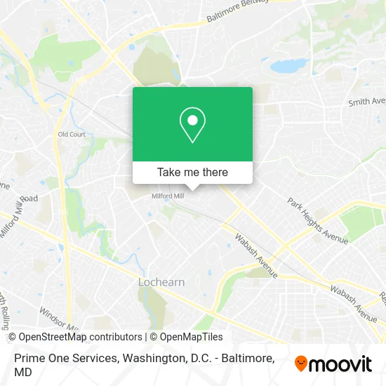
See Prime One Services, Baltimore County, on the map
Public Transit to Prime One Services in Baltimore County
Wondering how to get to Prime One Services in Baltimore County? Moovit helps you find the best way to get to Prime One Services with step-by-step directions from the nearest public transit station.
Moovit provides free maps and live directions to help you navigate through your city. View schedules, routes, timetables, and find out how long does it take to get to Prime One Services in real time.
Looking for the nearest stop or station to Prime One Services? Check out this list of stops closest to your destination: West Cold Spring Metro; Reisterstown Rd & Fallstaff Rd Nb; Milford Mill Rd & Deerfield Rd FS; Milford Mill Metro Station Bay 1.
Bus: 83, 89, 85, 81.Metro: METRO.
Want to see if there’s another route that gets you there at an earlier time? Moovit helps you find alternative routes or times. Get directions from and directions to Prime One Services easily from the Moovit App or Website.
We make riding to Prime One Services easy, which is why over 1.5 million users, including users in Baltimore County, trust Moovit as the best app for public transit. You don’t need to download an individual bus app or train app, Moovit is your all-in-one transit app that helps you find the best bus time or train time available.
For information on prices of bus and metro, costs and ride fares to Prime One Services, please check the Moovit app.
Use the app to navigate to popular places including to the airport, hospital, stadium, grocery store, mall, coffee shop, school, college, and university.
Prime One Services Address: 6942 Blanche Rd Baltimore, MD 21215 street in Baltimore County
- Chef on Call: Chef Dan Neuman,
- Isaiah Baptist Church,
- New Life Church of Deliverance,
- Gentle Care Assisted Living,
- Helping Hands Touching Hearts,
- Milbrooks,
- Celebration Boulevard,
- Baltimore Short Sale,
- Proud Moments,
- Dance Baltimore,
- CJS Midway Towing & Transporting,
- Rug Carpet Cleaning Carpet Cleaning,
- Reyna's Flowers & Gift,
- DUNKIN',
- Upholstery Cleaner Carpet Cleaning Carpet Cleaning,
- ATL Wings,
- Amazon Locker-Regina,
- Surrey Oaks Apartments,
- Restaurant Europa,
- Keeping It Clean Housekeeping
Places Near Prime One Services (Baltimore County)
- M&T Bank Stadium, Baltimore,
- National Museum of African American History and Culture, Washington,
- Marriott Marquis Washington, DC, Washington,
- Warner Theatre, Washington,
- National Theatre, Washington,
- Rock Creek Tennis Center, Washington,
- Georgetown, Washington,
- The Anthem, Washington,
- National Zoo, Washington,
- Museum Of The Bible, Washington,
- Westfield Montgomery Mall, Montgomery County,
- Washington DC VA Medical Center, Washington,
- Amazon Hq2, Arlington County,
- Basilica of the National Shrine, Washington,
- PG Mall, Prince George's County,
- Pennsylvania Ave NW (3rd st and pennsylvania), Washington,
- Capital One Arena, Washington,
- Camden Yards, Baltimore,
- Sibley Memorial Hospital, Washington,
- Washington National Cathedral, Washington
How to get to popular places in Washington, D.C. - Baltimore, MD with public transit
Get around Baltimore County by public transit!
Traveling around Baltimore County has never been so easy. See step by step directions as you travel to any attraction, street or major public transit station. View bus and train schedules, arrival times, service alerts and detailed routes on a map, so you know exactly how to get to anywhere in Baltimore County.
When traveling to any destination around Baltimore County use Moovit's Live Directions with Get Off Notifications to know exactly where and how far to walk, how long to wait for your line, and how many stops are left. Moovit will alert you when it's time to get off — no need to constantly re-check whether yours is the next stop.
Wondering how to use public transit in Baltimore County or how to pay for public transit in Baltimore County? Moovit public transit app can help you navigate your way with public transit easily, and at minimum cost. It includes public transit fees, ticket prices, and costs. Looking for a map of Baltimore County public transit lines? Moovit public transit app shows all public transit maps in Baltimore County with all Bus, Train, Metro, Light Rail and Ferry routes and stops on an interactive map.
Washington, D.C. - Baltimore, MD has 5 transit type(s), including: Bus, Train, Metro, Light Rail and Ferry, operated by several transit agencies, including WMATA, Montgomery County Ride On, Fairfax Connector, TheBus, PRTC, DASH - Alexandria, Arlington Transit (ART), RTA of Central Maryland, MDOT MTA, MDOT MTA Light RailLink, MDOT MTA Commuter Bus, MDOT MTA Local Bus, FXBGO!, Virginia Railway Express (VRE) and MARC