How to get to Primstaven by bus?
Click on the bus route to see step by step directions with maps, line arrival times and updated time schedules.
From Magic Hotel Apartments Kløverhuset Bergen, Bergen
44 minFrom Vannkanten, Bergen
64 minFrom Fish Market, Bergen
45 minFrom Parkbygget, Bergen
43 minFrom Hurtigruten Bergen, Bergen
43 minFrom Grieghallen, Bergen
36 minFrom Verftet, Bergen
50 minFrom Fløyen, Bergen
61 minFrom Scandic Neptun, Bergen
46 minFrom Bybanen Danmarksplass, Bergen
28 min
Light Rail stations near Primstaven in Bergen
- Skjold, 2 min walk,VIEW
Bus stops near Primstaven in Bergen
Bus lines to Primstaven in Bergen
What are the closest stations to Primstaven?
The closest stations to Primstaven are:
- Skjold is 92 meters away, 2 min walk.
- Skjold Skole is 170 meters away, 3 min walk.
- Søråsskiftet is 709 meters away, 10 min walk.
- Søråsbrotet is 717 meters away, 10 min walk.
- Apeltunvegen is 884 meters away, 12 min walk.
- Lagunen Terminal is 912 meters away, 12 min walk.
Which bus lines stop near Primstaven?
These bus lines stop near Primstaven: 600, FX652.
Which light rail line stops near Primstaven?
1 (Bergen Lufthavn)
What’s the nearest light rail station to Primstaven in Bergen?
The nearest light rail station to Primstaven in Bergen is Skjold. It’s a 2 min walk away.
What’s the nearest bus station to Primstaven in Bergen?
The nearest bus station to Primstaven in Bergen is Skjold Skole. It’s a 3 min walk away.
What time is the first light rail to Primstaven in Bergen?
The 1 is the first light rail that goes to Primstaven in Bergen. It stops nearby at 3:05 AM.
What time is the last light rail to Primstaven in Bergen?
The 1 is the last light rail that goes to Primstaven in Bergen. It stops nearby at 1:26 AM.
What time is the first bus to Primstaven in Bergen?
The 76 is the first bus that goes to Primstaven in Bergen. It stops nearby at 3:10 AM.
What time is the last bus to Primstaven in Bergen?
The 67 is the last bus that goes to Primstaven in Bergen. It stops nearby at 1:07 AM.
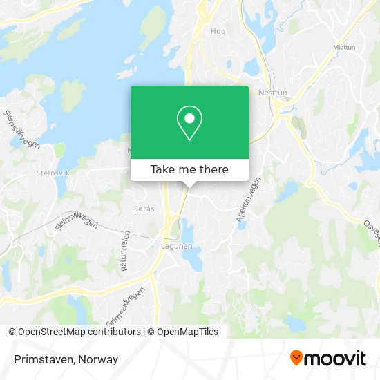
See Primstaven, Bergen, on the map
Public Transit to Primstaven in Bergen
Wondering how to get to Primstaven in Bergen? Moovit helps you find the best way to get to Primstaven with step-by-step directions from the nearest public transit station.
Moovit provides free maps and live directions to help you navigate through your city. View schedules, routes, timetables, and find out how long does it take to get to Primstaven in real time.
Looking for the nearest stop or station to Primstaven? Check out this list of stops closest to your destination: Skjold; Skjold Skole; Søråsskiftet; Søråsbrotet; Apeltunvegen; Lagunen Terminal.
Bus: 600, FX652, 99, 22, 67, 76.Light Rail: 1.
Want to see if there’s another route that gets you there at an earlier time? Moovit helps you find alternative routes or times. Get directions from and directions to Primstaven easily from the Moovit App or Website.
We make riding to Primstaven easy, which is why over 1.5 million users, including users in Bergen, trust Moovit as the best app for public transit. You don’t need to download an individual bus app or train app, Moovit is your all-in-one transit app that helps you find the best bus time or train time available.
For information on prices of light rail and bus, costs and ride fares to Primstaven, please check the Moovit app.
Use the app to navigate to popular places including to the airport, hospital, stadium, grocery store, mall, coffee shop, school, college, and university.
Primstaven Address: Sætervegen 4 5236 Rådal street in Bergen
- Skjold Restaurant&Pizzeria,
- Agnar Træet Rør & Varmesystemer - Baderomsbutikken Rør og Varmesystemer,
- Chutima Thaimassasje,
- Hobbykjelleren Sartor Storsenter,
- Skjold Kirke,
- Skjoldtun Barnepark,
- Skjold Menighetsbarnehage,
- Spar Skjoldtun,
- Kjellrun Holst Høyde,
- A Storheim Anngun Storheim Dybsland,
- Muskelterapeut & Thaimassør Siriratda Groenvold,
- Reko-Ringen Utlevering Fana,
- A & R Rune Urne,
- Irene Ellingsen,
- Skjold Lekeplass,
- Bohus,
- Gelco AS,
- Fv582 Fanavegen, Mot Nord,
- Navaren,
- Healeren Kjell Søvik
Places Near Primstaven (Bergen)
- DFDS Seaways, Oslo,
- Ikea Leangen, Trondheim,
- Vestby Outlet Store, Vestby,
- Jekta Storsenter, Tromsø,
- Nylandsbrua, Oslo,
- Radiumhospitalet, Oslo,
- Ullevål Stadion (T), Oslo,
- Oslo S spor 19 (Trelastgata), Oslo,
- Rikshospitalet (trikk), Oslo,
- Lovisenberg Diakonale Sykehus, Oslo,
- Color Line Terminal, Oslo,
- Ulriken, Bergen,
- Haukeland Universitetssjukehus, Bergen,
- Bjerke Travbane, Oslo,
- Voldsløkka, Oslo,
- Quality Hotel Edvard Grieg, Bergen,
- IKEA, Bergen,
- Drammen Sykehus, Drammen,
- Tyholttårnet, Trondheim,
- IKEA, Oslo
How to get to popular places in Norway with public transit
Get around Bergen by public transit!
Traveling around Bergen has never been so easy. See step by step directions as you travel to any attraction, street or major public transit station. View bus and train schedules, arrival times, service alerts and detailed routes on a map, so you know exactly how to get to anywhere in Bergen.
When traveling to any destination around Bergen use Moovit's Live Directions with Get Off Notifications to know exactly where and how far to walk, how long to wait for your line, and how many stops are left. Moovit will alert you when it's time to get off — no need to constantly re-check whether yours is the next stop.
Wondering how to use public transit in Bergen or how to pay for public transit in Bergen? Moovit public transit app can help you navigate your way with public transit easily, and at minimum cost. It includes public transit fees, ticket prices, and costs. Looking for a map of Bergen public transit lines? Moovit public transit app shows all public transit maps in Bergen with all Bus, Train, Subway, Light Rail, Ferry and Cable Car routes and stops on an interactive map.
Norway has 6 transit type(s), including: Bus, Train, Subway, Light Rail, Ferry and Cable Car, operated by several transit agencies, including Ruter, Skyss, AtB, Flytoget, Vy Tåg, SJ, Go-Ahead Norge AS, SJ Nord, Vestfold Kollektivtrafikk as, Snelandia, Innlandstrafikk, FRAM, FlixBus, Kolumbus and Brakar