Directions to Print Champs Nyc (Queens) with public transportation
The following transit lines have routes that pass near Print Champs Nyc
 Bus: Q10, Q54, Q55, Q56, Q80.
- Train: FAR ROCKAWAY BRANCH, LONG BEACH BRANCH, BABYLON BRANCH, CITY TERMINAL ZONE, HEMPSTEAD BRANCH.
- Subway: J, Z, E.
How to get to Print Champs Nyc by bus?
Click on the bus route to see step by step directions with maps, line arrival times and updated time schedules.
How to get to Print Champs Nyc by train?
Click on the train route to see step by step directions with maps, line arrival times and updated time schedules.
How to get to Print Champs Nyc by subway?
Click on the subway route to see step by step directions with maps, line arrival times and updated time schedules.
Bus stops near Print Champs Nyc in Queens
Subway stations near Print Champs Nyc in Queens
Train station near Print Champs Nyc in Queens
- Kew Gardens, 14 min walk,VIEW
Bus lines to Print Champs Nyc in Queens
What are the closest stations to Print Champs Nyc?
The closest stations to Print Champs Nyc are:
- Jamaica Av/Lefferts Blvd is 14 yards away, 1 min walk.
- Lefferts Blvd/Jamaica Av is 57 yards away, 1 min walk.
- Myrtle Av/Hillside Av is 200 yards away, 3 min walk.
- 111 St/86 Av is 605 yards away, 8 min walk.
- 104 St is 1115 yards away, 14 min walk.
- Kew Gardens is 1164 yards away, 14 min walk.
- Jamaica-Van Wyck is 1311 yards away, 16 min walk.
Which bus lines stop near Print Champs Nyc?
These bus lines stop near Print Champs Nyc: Q10, Q54, Q55, Q56, Q80.
Which train lines stop near Print Champs Nyc?
These train lines stop near Print Champs Nyc: FAR ROCKAWAY BRANCH, LONG BEACH BRANCH.
Which subway line stops near Print Champs Nyc?
J (Manhattan)
What’s the nearest subway station to Print Champs Nyc in Queens?
The nearest subway station to Print Champs Nyc in Queens is 104 St. It’s a 14 min walk away.
What’s the nearest train station to Print Champs Nyc in Queens?
The nearest train station to Print Champs Nyc in Queens is Kew Gardens. It’s a 14 min walk away.
What’s the nearest bus station to Print Champs Nyc in Queens?
The nearest bus stations to Print Champs Nyc in Queens are Jamaica Av/Lefferts Blvd and Lefferts Blvd/Jamaica Av. The closest one is a 1 min walk away.
What time is the first subway to Print Champs Nyc in Queens?
The E is the first subway that goes to Print Champs Nyc in Queens. It stops nearby at 3:00 AM.
What time is the last subway to Print Champs Nyc in Queens?
The J is the last subway that goes to Print Champs Nyc in Queens. It stops nearby at 3:44 AM.
What time is the first train to Print Champs Nyc in Queens?
The BABYLON BRANCH is the first train that goes to Print Champs Nyc in Queens. It stops nearby at 3:02 AM.
What time is the last train to Print Champs Nyc in Queens?
The BABYLON BRANCH is the last train that goes to Print Champs Nyc in Queens. It stops nearby at 3:02 AM.
What time is the first bus to Print Champs Nyc in Queens?
The Q80 is the first bus that goes to Print Champs Nyc in Queens. It stops nearby at 3:00 AM.
What time is the last bus to Print Champs Nyc in Queens?
The Q55 is the last bus that goes to Print Champs Nyc in Queens. It stops nearby at 3:07 AM.
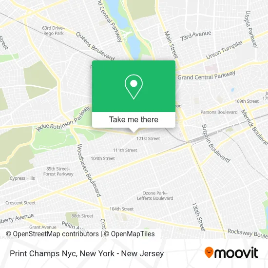
See Print Champs Nyc, Queens, on the map
Public Transit to Print Champs Nyc in Queens
Wondering how to get to Print Champs Nyc in Queens? Moovit helps you find the best way to get to Print Champs Nyc with step-by-step directions from the nearest public transit station.
Moovit provides free maps and live directions to help you navigate through your city. View schedules, routes, timetables, and find out how long does it take to get to Print Champs Nyc in real time.
Looking for the nearest stop or station to Print Champs Nyc? Check out this list of stops closest to your destination: Jamaica Av/Lefferts Blvd; Lefferts Blvd/Jamaica Av; Myrtle Av/Hillside Av; 111 St/86 Av; 104 St; Kew Gardens; Jamaica-Van Wyck.
Bus: Q10, Q54, Q55, Q56, Q80, QM18.Train: FAR ROCKAWAY BRANCH, LONG BEACH BRANCH, BABYLON BRANCH, CITY TERMINAL ZONE, HEMPSTEAD BRANCH.Subway: J, Z, E.
Want to see if there’s another route that gets you there at an earlier time? Moovit helps you find alternative routes or times. Get directions from and directions to Print Champs Nyc easily from the Moovit App or Website.
We make riding to Print Champs Nyc easy, which is why over 1.5 million users, including users in Queens, trust Moovit as the best app for public transit. You don’t need to download an individual bus app or train app, Moovit is your all-in-one transit app that helps you find the best bus time or train time available.
For information on prices of bus, subway and train, costs and ride fares to Print Champs Nyc, please check the Moovit app.
Use the app to navigate to popular places including to the airport, hospital, stadium, grocery store, mall, coffee shop, school, college, and university.
Print Champs Nyc Address: 116-11 Myrtle Ave street in Queens
- Eagle Tax Inc.,
- R-Rooter Plumbing & Water Cleanup,
- AM Drafting & Design Ser,
- Galaxy Event,
- Viscardi, Basner & Bigelow,
- Mexico and El Salvador Inc,
- Addus Homecare,
- Gym Tech (Nyc),
- Richmond Hill Bingo Hall,
- Myrtle Ave and Hillside Ave,
- Richmond Hill Flea Market,
- Richmond Hill Csa,
- Libertyx Bitcoin Atm,
- Quinlan Strategies Inc,
- Greater Miracle Ministries,
- MTA - Q55 Bus Stop (Myrtle & Hillside),
- Rehability Physical Therapy Services, Llc,
- Revaz Chachanashvili & Associates,
- Judy Nails Inc,
- M & D Capital Advisors Llc
Places Near Print Champs Nyc (Queens)
- SoHo, Manhattan,
- Wall Street, Manhattan,
- 26 Federal Plaza, Manhattan,
- 1 Police Plaza, Manhattan,
- Chinatown, Manhattan,
- 111 Centre New York City Supreme Court, Manhattan,
- Times Square, Manhattan,
- Queens Center Mall, Queens,
- 911 Memorial, Manhattan,
- 66 John Street, Manhattan,
- Mountainside Hospital, Glen Ridge,
- 376 Hudson Street, Manhattan,
- Pier 83, Manhattan,
- Rockefeller Center, Manhattan,
- Bellevue Hospital, Manhattan,
- San Gennaro Feast, Manhattan,
- qqqq, Manhattan,
- Katz's Deli, Manhattan,
- Hudson Yards, Manhattan,
- 3 Stone St, Manhattan
How to get to popular places in New York - New Jersey with public transit
Get around Queens by public transit!
Traveling around Queens has never been so easy. See step by step directions as you travel to any attraction, street or major public transit station. View bus and train schedules, arrival times, service alerts and detailed routes on a map, so you know exactly how to get to anywhere in Queens.
When traveling to any destination around Queens use Moovit's Live Directions with Get Off Notifications to know exactly where and how far to walk, how long to wait for your line, and how many stops are left. Moovit will alert you when it's time to get off — no need to constantly re-check whether yours is the next stop.
Wondering how to use public transit in Queens or how to pay for public transit in Queens? Moovit public transit app can help you navigate your way with public transit easily, and at minimum cost. It includes public transit fees, ticket prices, and costs. Looking for a map of Queens public transit lines? Moovit public transit app shows all public transit maps in Queens with all Bus, Train, Subway, Light Rail, Ferry and Cable Car routes and stops on an interactive map.
New York - New Jersey has 6 transit type(s), including: Bus, Train, Subway, Light Rail, Ferry and Cable Car, operated by several transit agencies, including MTA Subway, Metro-North Railroad, LIRR, PATH, MTA New York City Transit - Express routes, MTA Bus, NJ Transit, NYC Ferry, NICE bus, Bee-Line Bus, NJ Transit Rail, Norwalk Transit District, Hartford Line, River Valley Transit and HART