Directions to Printech Infor (Paulista) with public transportation
The following transit lines have routes that pass near Printech Infor
How to get to Printech Infor by bus?
Click on the bus route to see step by step directions with maps, line arrival times and updated time schedules.
From Mix Mateus, Olinda
60 minFrom Peixinhos, Olinda
55 minFrom Bairro Novo - Olinda, Olinda
34 minFrom Avenida Doutor José Augusto Moreira, Olinda
29 minFrom cotel, Abreu E Lima
64 minFrom Avenida Doutor Joaquim Nabuco, Olinda
50 minFrom Varadouro, Olinda
51 minFrom Hospital São Salvador, Olinda
34 minFrom Avenida Presidente Kennedy, Olinda
56 minFrom Terminal Integrado De Abreu E Lima, Paulista
49 min
Bus stops near Printech Infor in Paulista
Bus lines to Printech Infor in Paulista
- 1922 PAU AMARELO / TI PELÓPIDAS, Pau Amarelo / Ti Pelópidas,VIEW
- 1950 ENGENHO MARANGUAPE / VARADOURO, Engenho Maranguape / Varadouro,VIEW
- 1955 CONJUNTO PRAIA DO JANGA (ENGENHO MARANGUAPE) / TI PELÓPIDAS, Via Tururu,VIEW
- 1960 TI RIO DOCE / MARIA FARINHA (CASA CAIADA), Ti Rio Doce / Maria Farinha (Casa Caiada),VIEW
- 1982 CONJUNTO BEIRA MAR / DERBY, Conjunto Beira Mar / Derby,VIEW
- 1992 PAU AMARELO, Pau Amarelo,VIEW
- 1994 CONJUNTO BEIRA MAR, Via Prefeitura Do Recife,VIEW
- 1995 PAU AMARELO (BACURAU), Pau Amarelo (Bacurau),VIEW
- 1993 CONJUNTO PRAIA DO JANGA, Via Tururu Sentido Conjunto Praia Do Janga,VIEW
What are the closest stations to Printech Infor?
The closest stations to Printech Infor are:
- Rua Poeta João Neves, 661 is 508 meters away, 7 min walk.
- Av. Dr. Cláudio José Gueiros Leite (Pe-001), 275 is 701 meters away, 10 min walk.
- 160325 - Rua Altinho 1020 is 967 meters away, 13 min walk.
Which bus lines stop near Printech Infor?
These bus lines stop near Printech Infor: 1922 PAU AMARELO / TI PELÓPIDAS, 1992 PAU AMARELO, 1993 CONJUNTO PRAIA DO JANGA.
What’s the nearest bus station to Printech Infor in Paulista?
The nearest bus station to Printech Infor in Paulista is Rua Poeta João Neves, 661. It’s a 7 min walk away.
What time is the first bus to Printech Infor in Paulista?
The 1995 PAU AMARELO (BACURAU) is the first bus that goes to Printech Infor in Paulista. It stops nearby at 3:35 AM.
What time is the last bus to Printech Infor in Paulista?
The 1995 PAU AMARELO (BACURAU) is the last bus that goes to Printech Infor in Paulista. It stops nearby at 3:35 AM.
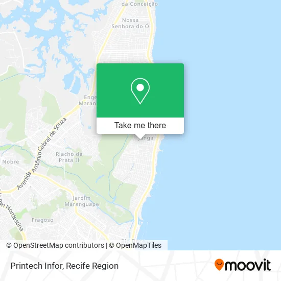
See Printech Infor, Paulista, on the map
Public Transit to Printech Infor in Paulista
Wondering how to get to Printech Infor in Paulista? Moovit helps you find the best way to get to Printech Infor with step-by-step directions from the nearest public transit station.
Moovit provides free maps and live directions to help you navigate through your city. View schedules, routes, timetables, and find out how long does it take to get to Printech Infor in real time.
Looking for the nearest stop or station to Printech Infor? Check out this list of stops closest to your destination: Rua Poeta João Neves; Av. Dr. Cláudio José Gueiros Leite (Pe-001); 160325 - Rua Altinho 1020.
Bus: 1922 PAU AMARELO / TI PELÓPIDAS, 1992 PAU AMARELO, 1993 CONJUNTO PRAIA DO JANGA, 1950 ENGENHO MARANGUAPE / VARADOURO, 1955 CONJUNTO PRAIA DO JANGA (ENGENHO MARANGUAPE) / TI PELÓPIDAS, 1960 TI RIO DOCE / MARIA FARINHA (CASA CAIADA), 1982 CONJUNTO BEIRA MAR / DERBY, 1994 CONJUNTO BEIRA MAR, 1995 PAU AMARELO (BACURAU).
Want to see if there’s another route that gets you there at an earlier time? Moovit helps you find alternative routes or times. Get directions from and directions to Printech Infor easily from the Moovit App or Website.
We make riding to Printech Infor easy, which is why over 1.5 million users, including users in Paulista, trust Moovit as the best app for public transit. You don’t need to download an individual bus app or train app, Moovit is your all-in-one transit app that helps you find the best bus time or train time available.
For information on prices of bus, costs and ride fares to Printech Infor, please check the Moovit app.
Use the app to navigate to popular places including to the airport, hospital, stadium, grocery store, mall, coffee shop, school, college, and university.
Printech Infor Address: Rua Glória de Goitá, 160 Janga Paulista-PE 53437-380 street in Paulista
- Brownie Arretado de Bom,
- R Vilela,
- Edificio Rio Amazonas,
- Wn Academia,
- Boteco Tropical,
- Espetinho Delícia,
- Price Racoes & Conveniências Pet,
- Residencial Londrina,
- piscina do clube da caixa,
- Indo Pra Dentista Amil,
- 1 Vara do Trabalho de Olinda,
- Barraca do Ailton,
- Edf Vindumar,
- Live Code,
- Ladijan Gomes da Silva,
- Careca Coxinha,
- Janga Beach ¥,
- Planet Paper,
- Associação Pessoal Caixa Econômica Federal PE,
- Clube da Caixa Pernambuco
Places Near Printech Infor (Paulista)
- Shopping RioMar Recife, Pina,
- Marco Zero, Bairro Do Recife,
- SHOPPING GUARARAPES, Jaboatão Dos Guararapes,
- Parque da Jaqueira, Jaqueira,
- Imip (Instituto Materno-Infantil De Pernambuco), Coelhos,
- SHOPPING TACARUNA, Santo Amaro,
- llll, Fundão,
- Hospital Universitário Oswaldo Cruz, Santo Amaro,
- Hospital Eduardo Campus Da Pessoa Idosa, Areias,
- Hospital Altino Ventura, Iputinga,
- Centro de Convenções de Pernambuco, Olinda,
- Shopping Patteo Olinda, Olinda,
- Hospital Agamenon Magalhães, Tamarineira,
- hospital otavio de freitas - UTI, Tejipió,
- Imbiribeira, Imbiribeira,
- Hospital Maria Lucinda, Parnamirim,
- Hospital Geral De Areias, Areias,
- tuuuuu, Olinda,
- Arena de Pernambuco, São Lourenço Da Mata,
- Shopping Recife, Boa Viagem
How to get to popular places in Recife Region with public transit
Get around Paulista by public transit!
Traveling around Paulista has never been so easy. See step by step directions as you travel to any attraction, street or major public transit station. View bus and train schedules, arrival times, service alerts and detailed routes on a map, so you know exactly how to get to anywhere in Paulista.
When traveling to any destination around Paulista use Moovit's Live Directions with Get Off Notifications to know exactly where and how far to walk, how long to wait for your line, and how many stops are left. Moovit will alert you when it's time to get off — no need to constantly re-check whether yours is the next stop.
Wondering how to use public transit in Paulista or how to pay for public transit in Paulista? Moovit public transit app can help you navigate your way with public transit easily, and at minimum cost. It includes public transit fees, ticket prices, and costs. Looking for a map of Paulista public transit lines? Moovit public transit app shows all public transit maps in Paulista with all Bus, Train and Subway routes and stops on an interactive map.
Recife Region has 3 transit type(s), including: Bus, Train and Subway, operated by several transit agencies, including CBTU (Metrorec), BRT (Via Livre), Grande Recife, BORBOREMA IMPERIAL (TIP), BORBOREMA IMPERIAL (B.V), RODOVIÁRIA POTENGY, EMPRESA METROPOLITANA, CONSÓRCIO RECIFE, SÃO JUDAS TADEU, Expresso 1002, Rodotur Turismo, Complementar Recife, Sistema Municipal - Jaboatão, Sistema Municipal - Cabo and Sistema Municipal - Ipojuca