Directions to Priority Std Testing Cedarhurst with public transportation
The following transit lines have routes that pass near Priority Std Testing Cedarhurst
 Bus: Q114, N31, N32.
- Train: FAR ROCKAWAY BRANCH.
- Subway: A.
How to get to Priority Std Testing Cedarhurst by bus?
Click on the bus route to see step by step directions with maps, line arrival times and updated time schedules.
From Resorts World Casino, Rockaway, NY
56 minFrom Springfield Gardens, NY
39 minFrom JFK Terminal 5/Air Train Station
74 minFrom Walmart
43 minFrom Howard Beach
99 minFrom Aqueduct Race Track
56 minFrom Resorts World Casino
69 minFrom Walmart
52 minFrom Resort World Casino New York City
56 minFrom JFK Building 141
75 min
How to get to Priority Std Testing Cedarhurst by train?
Click on the train route to see step by step directions with maps, line arrival times and updated time schedules.
How to get to Priority Std Testing Cedarhurst by subway?
Click on the subway route to see step by step directions with maps, line arrival times and updated time schedules.
Bus stops near Priority Std Testing Cedarhurst
Train station near Priority Std Testing Cedarhurst
- Woodmere, 2 min walk,VIEW
Bus lines to Priority Std Testing Cedarhurst
What are the closest stations to Priority Std Testing Cedarhurst?
The closest stations to Priority Std Testing Cedarhurst are:
- Mott Av /Rockaway Tpke is 2 yards away, 1 min walk.
- Woodmere is 103 yards away, 2 min walk.
- Rockaway Tpke & Pacific Ave is 182 yards away, 3 min walk.
- Central Ave + Rockaway Tpke is 366 yards away, 5 min walk.
Which bus line stops near Priority Std Testing Cedarhurst?
Q114 (Rush Far Rockaway Seagirt Bl Via Brewer Bl)
Which train line stops near Priority Std Testing Cedarhurst?
FAR ROCKAWAY BRANCH (Far Rockaway)
Which subway line stops near Priority Std Testing Cedarhurst?
A (Downtown & Far Rockaway)
What’s the nearest train station to Priority Std Testing Cedarhurst?
The nearest train station to Priority Std Testing Cedarhurst is Woodmere. It’s a 2 min walk away.
What’s the nearest bus station to Priority Std Testing Cedarhurst?
The nearest bus station to Priority Std Testing Cedarhurst is Mott Av /Rockaway Tpke. It’s a 1 min walk away.
What time is the first train to Priority Std Testing Cedarhurst?
The FAR ROCKAWAY BRANCH is the first train that goes to Priority Std Testing Cedarhurst. It stops nearby at 3:01 AM.
What time is the last train to Priority Std Testing Cedarhurst?
The FAR ROCKAWAY BRANCH is the last train that goes to Priority Std Testing Cedarhurst. It stops nearby at 3:20 AM.
What time is the first bus to Priority Std Testing Cedarhurst?
The Q114 is the first bus that goes to Priority Std Testing Cedarhurst. It stops nearby at 3:11 AM.
What time is the last bus to Priority Std Testing Cedarhurst?
The Q114 is the last bus that goes to Priority Std Testing Cedarhurst. It stops nearby at 3:13 AM.
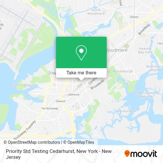
See Priority Std Testing Cedarhurst on the map
Public Transportation to Priority Std Testing Cedarhurst
Wondering how to get to Priority Std Testing Cedarhurst? Moovit helps you find the best way to get to Priority Std Testing Cedarhurst with step-by-step directions from the nearest public transit station.
Moovit provides free maps and live directions to help you navigate through your city. View schedules, routes, timetables, and find out how long does it take to get to Priority Std Testing Cedarhurst in real time.
Looking for the nearest stop or station to Priority Std Testing Cedarhurst? Check out this list of stops closest to your destination: Mott Av /Rockaway Tpke; Woodmere; Rockaway Tpke & Pacific Ave; Central Ave + Rockaway Tpke.
Bus: Q114, N31, N32.Train: FAR ROCKAWAY BRANCH.Subway: A.
Want to see if there’s another route that gets you there at an earlier time? Moovit helps you find alternative routes or times. Get directions from and directions to Priority Std Testing Cedarhurst easily from the Moovit App or Website.
We make riding to Priority Std Testing Cedarhurst easy, which is why over 1.5 million users, including users in Cedarhurst, trust Moovit as the best app for public transit. You don’t need to download an individual bus app or train app, Moovit is your all-in-one transit app that helps you find the best bus time or train time available.
For information on prices of bus, subway, train and light rail, costs and ride fares to Priority Std Testing Cedarhurst, please check the Moovit app.
Use the app to navigate to popular places including to the airport, hospital, stadium, grocery store, mall, coffee shop, school, college, and university.
Priority Std Testing Cedarhurst Address: 222 Rockaway Tpke #5 street in Cedarhurst
- Dominic Spera, Md,
- Weissman Realty Group Llc,
- Long Island 24 Hour Water Damage Restoration,
- Northwell Health Physician Partners Medicine at Lawrence,
- Matteo A Spera,
- Sam J Yee,
- Neil Theodore Smith, Md,
- Five Towns Marriage Initiative,
- Smiles Off Central Pediatric Dentistry,
- A & A Service Station,
- Talknsave,
- Telaway Usa Sims,
- Bogo Kosher Pizza,
- Crosscountry Mortgage, Llc - Nate Vogel,
- Electric & Beyond,
- And Beyond,
- St Marys Star-Sea Cemetery,
- Today's Kitchen,
- Namsco Trading,
- The Brick Room
Places Near Priority Std Testing Cedarhurst
- Katz's Deli, Manhattan,
- Queens Center Mall, Queens,
- Mountainside Hospital, Glen Ridge,
- Wall Street, Manhattan,
- 66 John Street, Manhattan,
- 111 Centre New York City Supreme Court, Manhattan,
- 1 Police Plaza, Manhattan,
- Bellevue Hospital, Manhattan,
- Times Square, Manhattan,
- SoHo, Manhattan,
- qqqq, Manhattan,
- 26 Federal Plaza, Manhattan,
- Chinatown, Manhattan,
- 911 Memorial, Manhattan,
- 376 Hudson Street, Manhattan,
- Rockefeller Center, Manhattan,
- Pier 83, Manhattan,
- 3 Stone St, Manhattan,
- San Gennaro Feast, Manhattan,
- Hudson Yards, Manhattan
How to get to popular places in New York - New Jersey with public transit
Get around Cedarhurst by public transit!
Traveling around Cedarhurst has never been so easy. See step by step directions as you travel to any attraction, street or major public transit station. View bus and train schedules, arrival times, service alerts and detailed routes on a map, so you know exactly how to get to anywhere in Cedarhurst.
When traveling to any destination around Cedarhurst use Moovit's Live Directions with Get Off Notifications to know exactly where and how far to walk, how long to wait for your line, and how many stops are left. Moovit will alert you when it's time to get off — no need to constantly re-check whether yours is the next stop.
Wondering how to use public transit in Cedarhurst or how to pay for public transit in Cedarhurst? Moovit public transit app can help you navigate your way with public transit easily, and at minimum cost. It includes public transit fees, ticket prices, and costs. Looking for a map of Cedarhurst public transit lines? Moovit public transit app shows all public transit maps in Cedarhurst with all Bus, Train, Subway, Light Rail, Ferry and Cable Car routes and stops on an interactive map.
New York - New Jersey has 6 transit type(s), including: Bus, Train, Subway, Light Rail, Ferry and Cable Car, operated by several transit agencies, including MTA Subway, Metro-North Railroad, LIRR, PATH, MTA New York City Transit - Express routes, MTA Bus, NJ Transit, NYC Ferry, NICE bus, Bee-Line Bus, NJ Transit Rail, Norwalk Transit District, Hartford Line, River Valley Transit and HART