How to get to Priority Std Testing Mount Vernon by bus?
Click on the bus route to see step by step directions with maps, line arrival times and updated time schedules.
How to get to Priority Std Testing Mount Vernon by train?
Click on the train route to see step by step directions with maps, line arrival times and updated time schedules.
How to get to Priority Std Testing Mount Vernon by subway?
Click on the subway route to see step by step directions with maps, line arrival times and updated time schedules.
Bus stops near Priority Std Testing Mount Vernon
Train stations near Priority Std Testing Mount Vernon
Subway station near Priority Std Testing Mount Vernon
- Wakefield-241 St, 27 min walk,VIEW
Bus lines to Priority Std Testing Mount Vernon
What are the closest stations to Priority Std Testing Mount Vernon?
The closest stations to Priority Std Testing Mount Vernon are:
- Stevens Ave @ N 5th Ave is 130 yards away, 2 min walk.
- W 1st St @ Wilson Pl is 153 yards away, 2 min walk.
- E Roosevelt Sq @ Stevens Ave is 176 yards away, 3 min walk.
- Fleetwood is 909 yards away, 11 min walk.
- Mount Vernon East is 1601 yards away, 19 min walk.
- Wakefield-241 St is 2240 yards away, 27 min walk.
Which bus lines stop near Priority Std Testing Mount Vernon?
These bus lines stop near Priority Std Testing Mount Vernon: 42, 52, 55, 7.
Which train lines stop near Priority Std Testing Mount Vernon?
These train lines stop near Priority Std Testing Mount Vernon: 2, 3.
Which subway line stops near Priority Std Testing Mount Vernon?
2 (Uptown & The Bronx)
What’s the nearest subway station to Priority Std Testing Mount Vernon?
The nearest subway station to Priority Std Testing Mount Vernon is Wakefield-241 St. It’s a 27 min walk away.
What’s the nearest train station to Priority Std Testing Mount Vernon?
The nearest train station to Priority Std Testing Mount Vernon is Fleetwood. It’s a 11 min walk away.
What’s the nearest bus station to Priority Std Testing Mount Vernon?
The nearest bus stations to Priority Std Testing Mount Vernon are Stevens Ave @ N 5th Ave and W 1st St @ Wilson Pl. The closest one is a 2 min walk away.
What time is the first subway to Priority Std Testing Mount Vernon?
The 2 is the first subway that goes to Priority Std Testing Mount Vernon. It stops nearby at 3:02 AM.
What time is the last subway to Priority Std Testing Mount Vernon?
The 2 is the last subway that goes to Priority Std Testing Mount Vernon. It stops nearby at 4:43 AM.
What time is the first train to Priority Std Testing Mount Vernon?
The 2 is the first train that goes to Priority Std Testing Mount Vernon. It stops nearby at 5:03 AM.
What time is the last train to Priority Std Testing Mount Vernon?
The 2 is the last train that goes to Priority Std Testing Mount Vernon. It stops nearby at 2:29 AM.
What time is the first bus to Priority Std Testing Mount Vernon?
The 42 is the first bus that goes to Priority Std Testing Mount Vernon. It stops nearby at 5:07 AM.
What time is the last bus to Priority Std Testing Mount Vernon?
The 7 is the last bus that goes to Priority Std Testing Mount Vernon. It stops nearby at 12:01 AM.
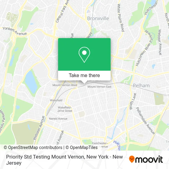
See Priority Std Testing Mount Vernon on the map
Public Transportation to Priority Std Testing Mount Vernon
Wondering how to get to Priority Std Testing Mount Vernon? Moovit helps you find the best way to get to Priority Std Testing Mount Vernon with step-by-step directions from the nearest public transit station.
Moovit provides free maps and live directions to help you navigate through your city. View schedules, routes, timetables, and find out how long does it take to get to Priority Std Testing Mount Vernon in real time.
Looking for the nearest stop or station to Priority Std Testing Mount Vernon? Check out this list of stops closest to your destination: Stevens Ave @ N 5th Ave; W 1st St @ Wilson Pl; E Roosevelt Sq @ Stevens Ave; Fleetwood; Mount Vernon East; Wakefield-241 St.
Bus: 42, 52, 55, 7, 40, 41, 43, 54, 53.Train: 2, 3, 4.Subway: 2.
Want to see if there’s another route that gets you there at an earlier time? Moovit helps you find alternative routes or times. Get directions from and directions to Priority Std Testing Mount Vernon easily from the Moovit App or Website.
We make riding to Priority Std Testing Mount Vernon easy, which is why over 1.5 million users, including users in Mount Vernon, trust Moovit as the best app for public transit. You don’t need to download an individual bus app or train app, Moovit is your all-in-one transit app that helps you find the best bus time or train time available.
For information on prices of bus, subway and train, costs and ride fares to Priority Std Testing Mount Vernon, please check the Moovit app.
Use the app to navigate to popular places including to the airport, hospital, stadium, grocery store, mall, coffee shop, school, college, and university.
Priority Std Testing Mount Vernon Address: 105 Stevens Ave 205 street in Mount Vernon
- Sheila Pongnon,
- Broadway Smiles,
- Mount Vernon Pediatrics,
- Mahichand Paryag: Primerica - Financial Services,
- Womens Medical Wellness,
- Lushiz Spa,
- Dr Marie-Micheline Lominy, Md,
- Brown Deborah,
- Dr. Maxine Dove,
- High Rollers Rental Party,
- Best,
- PIONEER SHOOTING CENTER,
- For Ever Beautiful by Doris,
- Mystic Pyramid Lodge 19 Building Fund,
- 1 Roosevelt Square N,
- Mount Vernon Department Of Public Works,
- The Beauty Zone - NY,
- M Hair Studio,
- Mount Vernon Veteran's Services Agency,
- Cmvny
Places Near Priority Std Testing Mount Vernon
- 111 Centre New York City Supreme Court, Manhattan,
- 3 Stone St, Manhattan,
- 1 Police Plaza, Manhattan,
- 911 Memorial, Manhattan,
- Chinatown, Manhattan,
- San Gennaro Feast, Manhattan,
- Pier 83, Manhattan,
- SoHo, Manhattan,
- qqqq, Manhattan,
- Times Square, Manhattan,
- 26 Federal Plaza, Manhattan,
- Rockefeller Center, Manhattan,
- 376 Hudson Street, Manhattan,
- 66 John Street, Manhattan,
- Katz's Deli, Manhattan,
- Mountainside Hospital, Glen Ridge,
- Wall Street, Manhattan,
- Hudson Yards, Manhattan,
- Queens Center Mall, Queens,
- Bellevue Hospital, Manhattan
How to get to popular places in New York - New Jersey with public transit
Get around Mount Vernon by public transit!
Traveling around Mount Vernon has never been so easy. See step by step directions as you travel to any attraction, street or major public transit station. View bus and train schedules, arrival times, service alerts and detailed routes on a map, so you know exactly how to get to anywhere in Mount Vernon.
When traveling to any destination around Mount Vernon use Moovit's Live Directions with Get Off Notifications to know exactly where and how far to walk, how long to wait for your line, and how many stops are left. Moovit will alert you when it's time to get off — no need to constantly re-check whether yours is the next stop.
Wondering how to use public transit in Mount Vernon or how to pay for public transit in Mount Vernon? Moovit public transit app can help you navigate your way with public transit easily, and at minimum cost. It includes public transit fees, ticket prices, and costs. Looking for a map of Mount Vernon public transit lines? Moovit public transit app shows all public transit maps in Mount Vernon with all Bus, Train, Subway, Light Rail, Ferry and Cable Car routes and stops on an interactive map.
New York - New Jersey has 6 transit type(s), including: Bus, Train, Subway, Light Rail, Ferry and Cable Car, operated by several transit agencies, including MTA Subway, Metro-North Railroad, LIRR, PATH, MTA New York City Transit - Express routes, MTA Bus, NJ Transit, NYC Ferry, NICE bus, Bee-Line Bus, NJ Transit Rail, Norwalk Transit District, Hartford Line, River Valley Transit and HART