Directions to Privilege Entertainment (Manhattan) with public transportation
The following transit lines have routes that pass near Privilege Entertainment
 Bus: 42ND ST, BM5, BXM8, M1, M101.
- Train: 2, BABYLON BRANCH, YEL, CITY TERMINAL ZONE, FAR ROCKAWAY BRANCH.
- Subway: 5, 6X, F, M, B.
How to get to Privilege Entertainment by bus?
Click on the bus route to see step by step directions with maps, line arrival times and updated time schedules.
From Glendale, NY, Queens
61 minFrom Aaaaa Aaaa, Bronx
101 minFrom Knockdown Center, Queens
53 minFrom 100 Gold Street, Manhattan
43 minFrom Rego Park, Queens
37 minFrom 1231 Lafayette Avenue, Bronx
85 minFrom MTA X80 - Manhattan to Randall's Island, Manhattan
52 minFrom Hudson County Courthouse, Jersey City
51 minFrom Newport Mall Bus, Jersey City
65 min
How to get to Privilege Entertainment by train?
Click on the train route to see step by step directions with maps, line arrival times and updated time schedules.
How to get to Privilege Entertainment by subway?
Click on the subway route to see step by step directions with maps, line arrival times and updated time schedules.
Bus stops near Privilege Entertainment in Manhattan
Subway stations near Privilege Entertainment in Manhattan
Train stations near Privilege Entertainment in Manhattan
Bus lines to Privilege Entertainment in Manhattan
- 42ND ST, E 42nd St & 3rd Ave,VIEW
- M42, East Side U N-1 Av Crosstown,VIEW
- X27, Bay Ridge - Manhattan Express,VIEW
- X28, Sea Gate / Bensonhurst - Manhattan Express,VIEW
- X37, Bay Ridge - Midtown Manhattan Express,VIEW
- X38, Sea Gate / Bensonhurst - Midtown Manhattan Express,VIEW
- SIM6, Eltingville - Midtown Manhattan Express,VIEW
- SIM11, New Dorp - Midtown Manhattan Express,VIEW
- SIM22, Eltingville Via Ar Kill Rd Via Richmond,VIEW
- SIM26, Tottenville Via Blmingdale Rd Via Amboy,VIEW
- M1, Limited Harlem 147 St Via Madison Av,VIEW
- M2, Washington Hts Bway-168 St Via Madison,VIEW
- Q32, Jackson Heights,VIEW
- BM1, Mill Basin - Downtown/Midtown,VIEW
- BM2, Canarsie/Spring Creek - Downtown/Midtown,VIEW
- BM3, Sheepshead Bay - Downtown/Midtown,VIEW
- BM4, Gerritsen Beach - Downtown/Midtown,VIEW
- BM5, Spring Creek - Midtown,VIEW
- SIM4C, Midtown Via Church St Via Madison Av,VIEW
- SIM31, Midtown Via 23 St Via Madison Av,VIEW
What are the closest stations to Privilege Entertainment?
The closest stations to Privilege Entertainment are:
- E 42nd St & Madison Ave is 4 yards away, 1 min walk.
- Madison Av/E 42 St is 48 yards away, 1 min walk.
- Madison Av/E 41 St is 80 yards away, 1 min walk.
- 42 St-Bryant Pk is 90 yards away, 2 min walk.
- E 42 St/Madison Av is 119 yards away, 2 min walk.
- Madison Av/E 43 St is 136 yards away, 2 min walk.
- Grand Central Madison is 221 yards away, 3 min walk.
- Grand Central is 398 yards away, 5 min walk.
- Grand Central-42 St is 959 yards away, 12 min walk.
Which bus lines stop near Privilege Entertainment?
These bus lines stop near Privilege Entertainment: 42ND ST, BM5, BXM8, M1, M101, M42, Q54, QM24, QM34.
Which train lines stop near Privilege Entertainment?
These train lines stop near Privilege Entertainment: 2, BABYLON BRANCH, YEL.
Which subway lines stop near Privilege Entertainment?
These subway lines stop near Privilege Entertainment: 5, 6X, F, M.
What’s the nearest subway station to Privilege Entertainment in Manhattan?
The nearest subway station to Privilege Entertainment in Manhattan is 42 St-Bryant Pk. It’s a 2 min walk away.
What’s the nearest train station to Privilege Entertainment in Manhattan?
The nearest train station to Privilege Entertainment in Manhattan is Grand Central Madison. It’s a 3 min walk away.
What’s the nearest bus station to Privilege Entertainment in Manhattan?
The nearest bus stations to Privilege Entertainment in Manhattan are E 42nd St & Madison Ave, Madison Av/E 42 St and Madison Av/E 41 St. The closest one is a 1 min walk away.
What time is the first subway to Privilege Entertainment in Manhattan?
The D is the first subway that goes to Privilege Entertainment in Manhattan. It stops nearby at 3:02 AM.
What time is the last subway to Privilege Entertainment in Manhattan?
The D is the last subway that goes to Privilege Entertainment in Manhattan. It stops nearby at 3:54 AM.
What time is the first train to Privilege Entertainment in Manhattan?
The 3 is the first train that goes to Privilege Entertainment in Manhattan. It stops nearby at 5:28 AM.
What time is the last train to Privilege Entertainment in Manhattan?
The 1 is the last train that goes to Privilege Entertainment in Manhattan. It stops nearby at 2:12 AM.
What time is the first bus to Privilege Entertainment in Manhattan?
The M2 is the first bus that goes to Privilege Entertainment in Manhattan. It stops nearby at 3:25 AM.
What time is the last bus to Privilege Entertainment in Manhattan?
The M42 is the last bus that goes to Privilege Entertainment in Manhattan. It stops nearby at 2:58 AM.
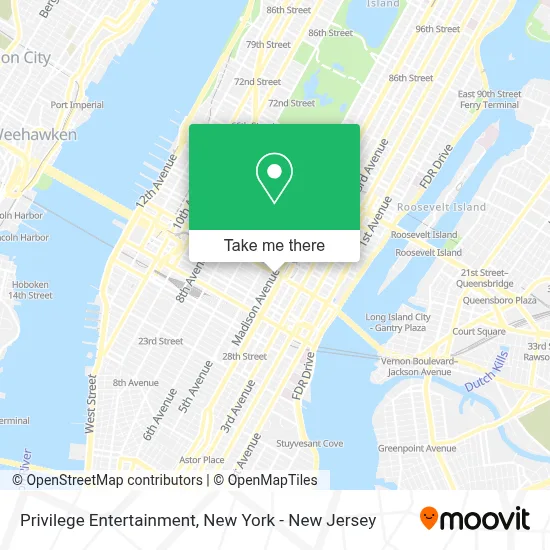
See Privilege Entertainment, Manhattan, on the map
Public Transit to Privilege Entertainment in Manhattan
Wondering how to get to Privilege Entertainment in Manhattan? Moovit helps you find the best way to get to Privilege Entertainment with step-by-step directions from the nearest public transit station.
Moovit provides free maps and live directions to help you navigate through your city. View schedules, routes, timetables, and find out how long does it take to get to Privilege Entertainment in real time.
Looking for the nearest stop or station to Privilege Entertainment? Check out this list of stops closest to your destination: E 42nd St & Madison Ave; Madison Av/E 42 St; Madison Av/E 41 St; 42 St-Bryant Pk; E 42 St/Madison Av; Madison Av/E 43 St; Grand Central Madison; Grand Central; Grand Central-42 St.
Bus: 42ND ST, BM5, BXM8, M1, M101, M42, Q54, QM24, QM34, X27, X28, X37, X38.Train: 2, BABYLON BRANCH, YEL, CITY TERMINAL ZONE, FAR ROCKAWAY BRANCH, HEMPSTEAD BRANCH, LONG BEACH BRANCH, 1, 3, 4, 5.Subway: 5, 6X, F, M, B, D, FX, S, 4, 6.
Want to see if there’s another route that gets you there at an earlier time? Moovit helps you find alternative routes or times. Get directions from and directions to Privilege Entertainment easily from the Moovit App or Website.
We make riding to Privilege Entertainment easy, which is why over 1.5 million users, including users in Manhattan, trust Moovit as the best app for public transit. You don’t need to download an individual bus app or train app, Moovit is your all-in-one transit app that helps you find the best bus time or train time available.
For information on prices of bus, subway and train, costs and ride fares to Privilege Entertainment, please check the Moovit app.
Use the app to navigate to popular places including to the airport, hospital, stadium, grocery store, mall, coffee shop, school, college, and university.
Privilege Entertainment Address: 315 Madison Ave street in Manhattan
- Aimco,
- Bca Marketing Communications,
- Harold Beeler Esq.,
- Beati Acupuncture Wellness Clinic - Madison,
- Adam Lamb,
- Knead Nyc,
- Village Thai Massage Nyc,
- Neuhaus Grand Central Station,
- Key International, Inc.,
- Kelly Qu Agency: Allstate Insurance,
- Kfc,
- Rrdd,
- Schortz Robert H Dds,
- Fern Thai Massage Nyc,
- Manhattan Center For Cognitive-Behavioral Therapy,
- NY Podiatric Medicine and Surgery,
- Strategy Media Services,
- Hola! Usa,
- Fairfield Maxwell Ltd,
- Cobbler Express
Places Near Privilege Entertainment (Manhattan)
- qqqq, Manhattan,
- SoHo, Manhattan,
- San Gennaro Feast, Manhattan,
- Queens Center Mall, Queens,
- Wall Street, Manhattan,
- Rockefeller Center, Manhattan,
- 911 Memorial, Manhattan,
- Mountainside Hospital, Glen Ridge,
- 1 Police Plaza, Manhattan,
- 3 Stone St, Manhattan,
- Hudson Yards, Manhattan,
- Bellevue Hospital, Manhattan,
- 376 Hudson Street, Manhattan,
- Times Square, Manhattan,
- Chinatown, Manhattan,
- 26 Federal Plaza, Manhattan,
- Pier 83, Manhattan,
- 111 Centre New York City Supreme Court, Manhattan,
- 66 John Street, Manhattan,
- Katz's Deli, Manhattan
How to get to popular places in New York - New Jersey with public transit
Get around Manhattan by public transit!
Traveling around Manhattan has never been so easy. See step by step directions as you travel to any attraction, street or major public transit station. View bus and train schedules, arrival times, service alerts and detailed routes on a map, so you know exactly how to get to anywhere in Manhattan.
When traveling to any destination around Manhattan use Moovit's Live Directions with Get Off Notifications to know exactly where and how far to walk, how long to wait for your line, and how many stops are left. Moovit will alert you when it's time to get off — no need to constantly re-check whether yours is the next stop.
Wondering how to use public transit in Manhattan or how to pay for public transit in Manhattan? Moovit public transit app can help you navigate your way with public transit easily, and at minimum cost. It includes public transit fees, ticket prices, and costs. Looking for a map of Manhattan public transit lines? Moovit public transit app shows all public transit maps in Manhattan with all Bus, Train, Subway, Light Rail, Ferry and Cable Car routes and stops on an interactive map.
New York - New Jersey has 6 transit type(s), including: Bus, Train, Subway, Light Rail, Ferry and Cable Car, operated by several transit agencies, including MTA Subway, Metro-North Railroad, LIRR, PATH, MTA New York City Transit - Express routes, MTA Bus, NJ Transit, NYC Ferry, NICE bus, Bee-Line Bus, NJ Transit Rail, Norwalk Transit District, Hartford Line, River Valley Transit and HART