How to get to Pro Shop a. de Sousa by bus?
Click on the bus route to see step by step directions with maps, line arrival times and updated time schedules.
From Ebnisee, Vereinbarte Verwaltungsgemeinschaft Der Stadt Welzheim
195 minFrom Kunsthalle Würth, Verwaltungsgemeinschaft Schwäbisch Hall
80 minFrom Wonnemar Backnang (Murrbader Backnang Wonnemar), Vereinbarte Verwaltungsgemeinschaft Der Stadt Backnang
145 minFrom Modepark Röther, Vereinbarte Verwaltungsgemeinschaft Der Stadt Backnang
112 minFrom Klinik Löwenstein, Verwaltungsgemeinschaft Obersulm
219 minFrom Schwaben Park, Vereinbarte Verwaltungsgemeinschaft Der Stadt Welzheim
150 minFrom McDonald's (McDrive), Vereinbarte Verwaltungsgemeinschaft Der Stadt Backnang
175 minFrom Großaspach, Vereinbarte Verwaltungsgemeinschaft Der Stadt Backnang
136 minFrom Kaufland Backnang Sulzbacher Str., Vereinbarte Verwaltungsgemeinschaft Der Stadt Backnang
112 minFrom Kaufland Schwäbisch Hall Hessental, Verwaltungsgemeinschaft Schwäbisch Hall
83 min
Bus stop near Pro Shop a. de Sousa in Verwaltungsverband Limpurger Land
- Marhördt Ort, 2 min walk,VIEW
Bus lines to Pro Shop a. de Sousa in Verwaltungsverband Limpurger Land
- 8A-3, Oberrot Schule,VIEW
What are the closest stations to Pro Shop a. de Sousa?
The closest stations to Pro Shop a. de Sousa are:
- Marhördt Ort is 89 meters away, 2 min walk.
Which bus lines stop near Pro Shop a. de Sousa?
These bus lines stop near Pro Shop a. de Sousa: 372, 8.
What’s the nearest bus station to Pro Shop a. de Sousa in Verwaltungsverband Limpurger Land?
The nearest bus station to Pro Shop a. de Sousa in Verwaltungsverband Limpurger Land is Marhördt Ort. It’s a 2 min walk away.
What time is the first bus to Pro Shop a. de Sousa in Verwaltungsverband Limpurger Land?
The 8A-3 is the first bus that goes to Pro Shop a. de Sousa in Verwaltungsverband Limpurger Land. It stops nearby at 6:29 AM.
What time is the last bus to Pro Shop a. de Sousa in Verwaltungsverband Limpurger Land?
The 8A-3 is the last bus that goes to Pro Shop a. de Sousa in Verwaltungsverband Limpurger Land. It stops nearby at 4:39 PM.
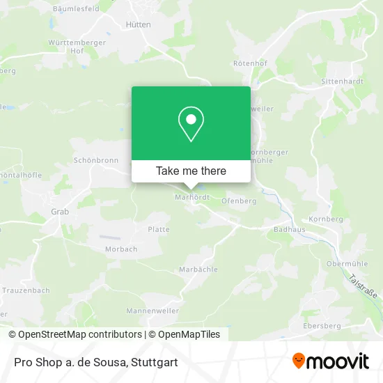
See Pro Shop a. de Sousa, Verwaltungsverband Limpurger Land, on the map
Public Transit to Pro Shop a. de Sousa in Verwaltungsverband Limpurger Land
Wondering how to get to Pro Shop a. de Sousa in Verwaltungsverband Limpurger Land? Moovit helps you find the best way to get to Pro Shop a. de Sousa with step-by-step directions from the nearest public transit station.
Moovit provides free maps and live directions to help you navigate through your city. View schedules, routes, timetables, and find out how long does it take to get to Pro Shop a. de Sousa in real time.
Looking for the nearest stop or station to Pro Shop a. de Sousa? Check out this list of stops closest to your destination: Marhördt Ort.
Bus: 372, 8, 8A-3.
Want to see if there’s another route that gets you there at an earlier time? Moovit helps you find alternative routes or times. Get directions from and directions to Pro Shop a. de Sousa easily from the Moovit App or Website.
We make riding to Pro Shop a. de Sousa easy, which is why over 1.5 million users, including users in Verwaltungsverband Limpurger Land, trust Moovit as the best app for public transit. You don’t need to download an individual bus app or train app, Moovit is your all-in-one transit app that helps you find the best bus time or train time available.
For information on prices of bus and train, costs and ride fares to Pro Shop a. de Sousa, please check the Moovit app.
Use the app to navigate to popular places including to the airport, hospital, stadium, grocery store, mall, coffee shop, school, college, and university.
Pro Shop a. de Sousa Address: Marhördt 18 74420 Oberrot street in Verwaltungsverband Limpurger Land
- Golfclub Marhördt Betriebsges. mbH & Co.,
- Golfclub Marhördt,
- S.A.R. Logistic,
- Holzwerke Bürk,
- Aerosol Verwaltungs,
- Güthner Werkzeug- und Formenbau,
- Kvapil Michael Zimmerei,
- Robert Wulf Raumausstatter,
- Rabe Gartenbau,
- K Dl Klumpp,
- Dulv,
- Yvonne Leadbetter,
- Peter Noller Landschaftspflege,
- Christine Stier Finanzdienstleistungen,
- Pbc Schwäbisch Hall 1,
- Brot und Kuchen Scholl,
- Gaststätte Sonne,
- Helmut Müller,
- Erich Nothdurft Zaun- U. Pfahlwerk,
- Bundesanstalt für Finanzdienstleistungsaufsicht
Places Near Pro Shop a. de Sousa (Verwaltungsverband Limpurger Land)
- Schleyerhalle, Bad Cannstatt,
- Pariser Platz Stuttgart, Stuttgart-Mitte,
- Mercedes-Benz Museum (Mercedes Museum Stuttgart), Bad Cannstatt,
- Geilhaus Haus 33a, Reutlingen-Betzingen,
- FlixBus Haltestelle, Stuttgart,
- Marmorsaal Im Weissenburgpark, Stuttgart-Süd,
- Gleis 101/102 (tief), Stuttgart-Mitte,
- Hanns-Martin-Schleyer-Halle, Bad Cannstatt,
- Klinikum Stuttgart - Katharinenhospital, Stuttgart-Mitte,
- Hauptbahnhof Stuttgart, Stuttgart-Mitte,
- Mettingen Eros-Center Puff Laufhaus, Esslingen Am Neckar,
- Porsche-Arena, Bad Cannstatt,
- SI-Centrum, Möhringen,
- Wilhelma (U-Bahn Wilhelma), Bad Cannstatt,
- Gasometer Pforzheim, Pforzheim,
- Porsche Museum, Zuffenhausen,
- Im Wizemann (Halle), Bad Cannstatt,
- Mercedes-Benz Museum, Bad Cannstatt,
- Hanns-Martin-Schleyer-Halle (Stuttgart Hans-Martin-Schleyerhalle), Bad Cannstatt,
- Waldfriedhof, Degerloch
How to get to popular places in Stuttgart with public transit
Get around Verwaltungsverband Limpurger Land by public transit!
Traveling around Verwaltungsverband Limpurger Land has never been so easy. See step by step directions as you travel to any attraction, street or major public transit station. View bus and train schedules, arrival times, service alerts and detailed routes on a map, so you know exactly how to get to anywhere in Verwaltungsverband Limpurger Land.
When traveling to any destination around Verwaltungsverband Limpurger Land use Moovit's Live Directions with Get Off Notifications to know exactly where and how far to walk, how long to wait for your line, and how many stops are left. Moovit will alert you when it's time to get off — no need to constantly re-check whether yours is the next stop.
Wondering how to use public transit in Verwaltungsverband Limpurger Land or how to pay for public transit in Verwaltungsverband Limpurger Land? Moovit public transit app can help you navigate your way with public transit easily, and at minimum cost. It includes public transit fees, ticket prices, and costs. Looking for a map of Verwaltungsverband Limpurger Land public transit lines? Moovit public transit app shows all public transit maps in Verwaltungsverband Limpurger Land with all Bus, Train, Subway, Light Rail, Ferry, S-Bahn and Funicular routes and stops on an interactive map.
Stuttgart has 7 transit type(s), including: Bus, Train, Subway, Light Rail, Ferry, S-Bahn and Funicular, operated by several transit agencies, including SSB - Stadtbahn, SSB, SSB - Seilbahn / Zacke, S-Bahn Stuttgart, Rhein-Neckar-Verkehr GmbH (rnv), Karlsruher Verkehrsverbund, DB AG, DB Regiobus BW, Arverio Baden-Württemberg GmbH, DB RegioNetz Verkehrs GmbH Westfrankenbahn, DB Regio AG Baden-Württemberg, Südwestdeutsche Verkehrs-AG, DB Regio AG Mitte Region Hessen, DB and Bodensee-Oberschwaben-Bahn