How to get to Pro-Tech by bus?
Click on the bus route to see step by step directions with maps, line arrival times and updated time schedules.
From E 87th St, Manhattan
24 minFrom 45th & Broadway, Manhattan
66 minFrom 391,E 149th St E 149th St, Bronx
76 minFrom The Jewish Museum, Manhattan
26 minFrom Glendale, NY, Queens
63 minFrom The Bronx Zoo, Bronx
83 minFrom Laguardia Airport, Queens
75 minFrom Gracie Mansion, Manhattan
38 minFrom Sojo Spa Club, Edgewater
54 minFrom Mitsuwa Shuttle Bus Stop, Edgewater
54 min
How to get to Pro-Tech by train?
Click on the train route to see step by step directions with maps, line arrival times and updated time schedules.
How to get to Pro-Tech by subway?
Click on the subway route to see step by step directions with maps, line arrival times and updated time schedules.
Bus stops near Pro-Tech in Manhattan
Subway stations near Pro-Tech in Manhattan
Train station near Pro-Tech in Manhattan
- 23rd Street, 9 min walk,VIEW
Bus lines to Pro-Tech in Manhattan
- SIM3, Midtown Via 23 St Via 6 Av,VIEW
- SIM10, Eltingville Trans Ctr Via Hylan Via Rich,VIEW
- SIM31, Eltingville Trans Ctr Via Forest Hill Rd,VIEW
- X37, Midtown 57 St Via Fdr-23 St Via Madison,VIEW
- X38, Bensonhurst Cropsey Av Via 23 St Via Fdr,VIEW
- BXM6, Parkchester - Midtown,VIEW
- BXM10, Williamsbridge/Morris Park - Midtown,VIEW
- BXM7, Co-Op City - Midtown,VIEW
- BXM8, Pelham Bay/City Island - Midtown,VIEW
- BXM9, Throgs Neck - Midtown Express,VIEW
- M1, Limited Harlem 147 St Via Madison Av,VIEW
- M2, Limited Washington Hts Broadway-168 St,VIEW
- M3, 125 St St. Nicholas Av,VIEW
- M23-SBS, Select Bus East Side Avenue C Crosstown,VIEW
- DOWNTOWN LOCAL, W Houston & Mercer St,VIEW
- SIM1C, Eltngvlle Trans Ctr Via Hylan Via Rich,VIEW
- SIM3C, Pt Rchmnd Via Narrows Rd N Via Watchogue,VIEW
- SIM4C, Huguenot Via Richmond Av Via Arthur Kill,VIEW
- SIM33C, Mariners Harbor Via N Gannon Av,VIEW
- BM1, Mill Basin - Downtown/Midtown,VIEW
What are the closest stations to Pro-Tech?
The closest stations to Pro-Tech are:
- E 23 St/Park Av South is 105 yards away, 2 min walk.
- Madison Av / E 24 St is 120 yards away, 2 min walk.
- Madison Av/E 23 St is 147 yards away, 3 min walk.
- Park Av South/E 23 St is 148 yards away, 3 min walk.
- Park Ave S & E 22nd St is 155 yards away, 2 min walk.
- E 23 St / Park Av South is 173 yards away, 3 min walk.
- E 23 St/Madison Av is 197 yards away, 3 min walk.
- 23 St-Baruch College is 222 yards away, 4 min walk.
- 23 St is 281 yards away, 4 min walk.
- 23rd Street is 694 yards away, 9 min walk.
Which bus lines stop near Pro-Tech?
These bus lines stop near Pro-Tech: 28, BXM4, M102, M2.
Which train line stops near Pro-Tech?
2 (324#| Grand Central)
Which subway lines stop near Pro-Tech?
These subway lines stop near Pro-Tech: 5, 6, 6X, M, R, W.
What’s the nearest subway station to Pro-Tech in Manhattan?
The nearest subway stations to Pro-Tech in Manhattan are 23 St-Baruch College and 23 St. The closest one is a 4 min walk away.
What’s the nearest train station to Pro-Tech in Manhattan?
The nearest train station to Pro-Tech in Manhattan is 23rd Street. It’s a 9 min walk away.
What’s the nearest bus station to Pro-Tech in Manhattan?
The nearest bus stations to Pro-Tech in Manhattan are E 23 St/Park Av South, Madison Av / E 24 St and Park Ave S & E 22nd St. The closest one is a 2 min walk away.
What time is the first subway to Pro-Tech in Manhattan?
The 4 is the first subway that goes to Pro-Tech in Manhattan. It stops nearby at 3:00 AM.
What time is the last subway to Pro-Tech in Manhattan?
The N is the last subway that goes to Pro-Tech in Manhattan. It stops nearby at 3:57 AM.
What time is the first train to Pro-Tech in Manhattan?
The ATW is the first train that goes to Pro-Tech in Manhattan. It stops nearby at 3:18 AM.
What time is the last train to Pro-Tech in Manhattan?
The ATW is the last train that goes to Pro-Tech in Manhattan. It stops nearby at 3:18 AM.
What time is the first bus to Pro-Tech in Manhattan?
The M23-SBS is the first bus that goes to Pro-Tech in Manhattan. It stops nearby at 3:07 AM.
What time is the last bus to Pro-Tech in Manhattan?
The M23-SBS is the last bus that goes to Pro-Tech in Manhattan. It stops nearby at 2:49 AM.
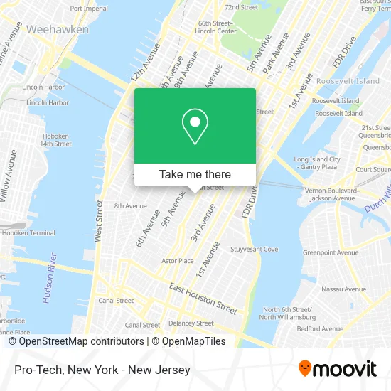
See Pro-Tech, Manhattan, on the map
Public Transit to Pro-Tech in Manhattan
Wondering how to get to Pro-Tech in Manhattan? Moovit helps you find the best way to get to Pro-Tech with step-by-step directions from the nearest public transit station.
Moovit provides free maps and live directions to help you navigate through your city. View schedules, routes, timetables, and find out how long does it take to get to Pro-Tech in real time.
Looking for the nearest stop or station to Pro-Tech? Check out this list of stops closest to your destination: E 23 St/Park Av South; Madison Av / E 24 St; Madison Av/E 23 St; Park Av South/E 23 St; Park Ave S & E 22nd St; E 23 St / Park Av South; E 23 St/Madison Av; 23 St-Baruch College; 23 St; 23rd Street.
Bus: 28, BXM4, M102, M2, SIM3, SIM10, SIM31, X37, X38.Train: 2, ATW, BLU, YEL.Subway: 5, 6, 6X, M, R, W, 4, N, Q, D, F, FX.
Want to see if there’s another route that gets you there at an earlier time? Moovit helps you find alternative routes or times. Get directions from and directions to Pro-Tech easily from the Moovit App or Website.
We make riding to Pro-Tech easy, which is why over 1.5 million users, including users in Manhattan, trust Moovit as the best app for public transit. You don’t need to download an individual bus app or train app, Moovit is your all-in-one transit app that helps you find the best bus time or train time available.
For information on prices of subway, bus and train, costs and ride fares to Pro-Tech, please check the Moovit app.
Use the app to navigate to popular places including to the airport, hospital, stadium, grocery store, mall, coffee shop, school, college, and university.
Pro-Tech Address: 304 Park Ave S street in Manhattan
- Naya,
- Abc Financial Advisors,
- Sevjet,
- The Law Office Of Christopher Moye,
- Sdme,
- Lic School Of Ballet,
- Gotham Limo In New York, NY,
- SPiN New York,
- 304 Park Ave S,
- Chicken Kitchen,
- Fake Love ,
- iAcquire,
- Krispy Kreme,
- Red Rooster Group Graphic Design,
- MTA-23rd St-6 Line,
- Shillington,
- Spin New York Flatiron,
- Chelsea Piers Fitness,
- Boston Clothing,
- Park Ave S (23rd st and park ave)
Places Near Pro-Tech (Manhattan)
- 66 John Street, Manhattan,
- qqqq, Manhattan,
- Chinatown, Manhattan,
- 1 Police Plaza, Manhattan,
- 911 Memorial, Manhattan,
- 3 Stone St, Manhattan,
- Queens Center Mall, Queens,
- Hudson Yards, Manhattan,
- Katz's Deli, Manhattan,
- Bellevue Hospital, Manhattan,
- San Gennaro Feast, Manhattan,
- Pier 83, Manhattan,
- Times Square, Manhattan,
- Wall Street, Manhattan,
- 26 Federal Plaza, Manhattan,
- 376 Hudson Street, Manhattan,
- 111 Centre New York City Supreme Court, Manhattan,
- SoHo, Manhattan,
- Mountainside Hospital, Glen Ridge,
- Rockefeller Center, Manhattan
How to get to popular places in New York - New Jersey with public transit
Get around Manhattan by public transit!
Traveling around Manhattan has never been so easy. See step by step directions as you travel to any attraction, street or major public transit station. View bus and train schedules, arrival times, service alerts and detailed routes on a map, so you know exactly how to get to anywhere in Manhattan.
When traveling to any destination around Manhattan use Moovit's Live Directions with Get Off Notifications to know exactly where and how far to walk, how long to wait for your line, and how many stops are left. Moovit will alert you when it's time to get off — no need to constantly re-check whether yours is the next stop.
Wondering how to use public transit in Manhattan or how to pay for public transit in Manhattan? Moovit public transit app can help you navigate your way with public transit easily, and at minimum cost. It includes public transit fees, ticket prices, and costs. Looking for a map of Manhattan public transit lines? Moovit public transit app shows all public transit maps in Manhattan with all Bus, Train, Subway, Light Rail, Ferry and Cable Car routes and stops on an interactive map.
New York - New Jersey has 6 transit type(s), including: Bus, Train, Subway, Light Rail, Ferry and Cable Car, operated by several transit agencies, including MTA Subway, Metro-North Railroad, LIRR, PATH, MTA New York City Transit - Express routes, MTA Bus, NJ Transit, NYC Ferry, NICE bus, Bee-Line Bus, NJ Transit Rail, Norwalk Transit District, Hartford Line, River Valley Transit and HART