How to get to Proactiv by bus?
Click on the bus route to see step by step directions with maps, line arrival times and updated time schedules.
From Holiday Inn Hotel & Suites Sawgrass Mills, Plantation
40 minFrom Walmart Supercenter, Fort Lauderdale
73 minFrom Walmart Supercenter, Pompano Beach
43 minFrom Bepxxx, Fort Lauderdale
89 minFrom Piper High School, Plantation
41 minFrom DRV PNK Stadium, Fort Lauderdale
87 minFrom Kamal Singh, Plantation
61 minFrom Quebec-Florida Chamber of Commerce, Fort Lauderdale
86 minFrom Inter Miami CF, Fort Lauderdale
88 minFrom The Red Light District, Fort Lauderdale
88 min
Bus stops near Proactiv in Coral Springs-Margate
Bus lines to Proactiv in Coral Springs-Margate
What are the closest stations to Proactiv?
The closest stations to Proactiv are:
- Atlantic Boulevard/Coral Square Mall - (Chase Bank) is 128 yards away, 2 min walk.
- University Drive/Atlantic Boulevard North is 706 yards away, 10 min walk.
Which bus lines stop near Proactiv?
These bus lines stop near Proactiv: 02, 42, 62.
What’s the nearest bus station to Proactiv in Coral Springs-Margate?
The nearest bus station to Proactiv in Coral Springs-Margate is Atlantic Boulevard/Coral Square Mall - (Chase Bank). It’s a 2 min walk away.
What time is the first bus to Proactiv in Coral Springs-Margate?
The 62 is the first bus that goes to Proactiv in Coral Springs-Margate. It stops nearby at 4:56 AM.
What time is the last bus to Proactiv in Coral Springs-Margate?
The 02 is the last bus that goes to Proactiv in Coral Springs-Margate. It stops nearby at 12:51 AM.
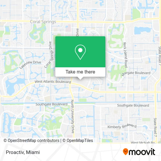
See Proactiv, Coral Springs-Margate, on the map
Public Transit to Proactiv in Coral Springs-Margate
Wondering how to get to Proactiv in Coral Springs-Margate? Moovit helps you find the best way to get to Proactiv with step-by-step directions from the nearest public transit station.
Moovit provides free maps and live directions to help you navigate through your city. View schedules, routes, timetables, and find out how long does it take to get to Proactiv in real time.
Looking for the nearest stop or station to Proactiv? Check out this list of stops closest to your destination: Atlantic Boulevard/Coral Square Mall - (Chase Bank); University Drive/Atlantic Boulevard North.
Bus: 02, 42, 62.
Want to see if there’s another route that gets you there at an earlier time? Moovit helps you find alternative routes or times. Get directions from and directions to Proactiv easily from the Moovit App or Website.
We make riding to Proactiv easy, which is why over 1.5 million users, including users in Coral Springs-Margate, trust Moovit as the best app for public transit. You don’t need to download an individual bus app or train app, Moovit is your all-in-one transit app that helps you find the best bus time or train time available.
For information on prices of bus, costs and ride fares to Proactiv, please check the Moovit app.
Use the app to navigate to popular places including to the airport, hospital, stadium, grocery store, mall, coffee shop, school, college, and university.
Proactiv Address: 9469 W Atlantic Blvd Coral Springs, FL 33071 street in Coral Springs-Margate
- Fresh Coconuts and Smoothies,
- EVgo,
- Best Buy,
- Lux Moda,
- Sparkle Beauty,
- Top Shelf Auto Detailing,
- Earthbound Trading Company,
- Chocondue Express,
- Wireless Link,
- Kykus Mediterranean Grill,
- Boynton Beach Mall,
- Don Pan,
- Gregorys Coffee,
- Beya,
- Lids,
- Right on Time,
- Miniso,
- Jewel Time,
- Lifenime,
- Cutie Toys
Places Near Proactiv (Coral Springs-Margate)
- Wynwood, Miami,
- Sawgrass Mall, Miami,
- Zoo Miami, Miami,
- Dolphin Mall, Miami,
- Miami Design District, Miami,
- Richard E. Gerstein Justice Building, Miami,
- Aventura Mall, Miami,
- Miami Freedom Park, Miami,
- Bayside Marketplace, Miami,
- Little Havana, Miami,
- Dolphin Mall Bus, Miami,
- Miami VA Hospital, Miami,
- Aventura Mall, Miami Beach,
- Sawgrass mall ( FL ), Miami Beach,
- Brickell City Centre, Miami,
- Miami-Dade County Courthouse, Miami,
- Hard Rock Stadium, Miami Gardens,
- Keiser University Flagship Campus, West Palm Beach,
- Marlins Park, Miami,
- Port of Miami Cruise Terminal, Miami
How to get to popular places in Miami with public transit
Get around Coral Springs-Margate by public transit!
Traveling around Coral Springs-Margate has never been so easy. See step by step directions as you travel to any attraction, street or major public transit station. View bus and train schedules, arrival times, service alerts and detailed routes on a map, so you know exactly how to get to anywhere in Coral Springs-Margate.
When traveling to any destination around Coral Springs-Margate use Moovit's Live Directions with Get Off Notifications to know exactly where and how far to walk, how long to wait for your line, and how many stops are left. Moovit will alert you when it's time to get off — no need to constantly re-check whether yours is the next stop.
Wondering how to use public transit in Coral Springs-Margate or how to pay for public transit in Coral Springs-Margate? Moovit public transit app can help you navigate your way with public transit easily, and at minimum cost. It includes public transit fees, ticket prices, and costs. Looking for a map of Coral Springs-Margate public transit lines? Moovit public transit app shows all public transit maps in Coral Springs-Margate with all Bus, Train, Light Rail and Ferry routes and stops on an interactive map.
Miami has 4 transit type(s), including: Bus, Train, Light Rail and Ferry, operated by several transit agencies, including Broward County Transit, Miami-Dade Transit, Metrorail, Palm Tran, Tri-Rail, Brightline, MARTY, City of Homestead Trolley, Key West Transit, Treasure Coast Connector, GoLine IRT, Amtrak, Greyhound-us, FlixBus-us and Aventura Express Shuttle Bus