How to get to Procura Finanz by bus?
Click on the bus route to see step by step directions with maps, line arrival times and updated time schedules.
From Klinik Löwenstein, Verwaltungsgemeinschaft Obersulm
106 minFrom Kunsthalle Würth, Verwaltungsgemeinschaft Schwäbisch Hall
26 minFrom Prooptik, Verwaltungsgemeinschaft Ellwangen (Jagst)
73 minFrom Bucher Stausee, Verwaltungsgemeinschaft Ellwangen (Jagst)
113 minFrom Syntegon Technology Gmbh, Verwaltungsverband Crailsheim
68 minFrom Himmelsgarten, Verwaltungsgemeinschaft Schwäbisch Gmünd
163 minFrom Schönblick Christliches Tagungszentrum, Verwaltungsgemeinschaft Schwäbisch Gmünd
156 min
Bus stops near Procura Finanz in Verwaltungsgemeinschaft Schwäbisch Hall
Bus lines to Procura Finanz in Verwaltungsgemeinschaft Schwäbisch Hall
What are the closest stations to Procura Finanz?
The closest stations to Procura Finanz are:
- Sulzdorf Mahläcker is 125 meters away, 2 min walk.
- Sulzdorf Kirche is 256 meters away, 4 min walk.
- Sulzdorf Hauptstraße is 551 meters away, 8 min walk.
Which bus lines stop near Procura Finanz?
These bus lines stop near Procura Finanz: 12, 13, 18, RB14.
What’s the nearest bus station to Procura Finanz in Verwaltungsgemeinschaft Schwäbisch Hall?
The nearest bus station to Procura Finanz in Verwaltungsgemeinschaft Schwäbisch Hall is Sulzdorf Mahläcker. It’s a 2 min walk away.
What time is the first bus to Procura Finanz in Verwaltungsgemeinschaft Schwäbisch Hall?
The 18 is the first bus that goes to Procura Finanz in Verwaltungsgemeinschaft Schwäbisch Hall. It stops nearby at 5:35 AM.
What time is the last bus to Procura Finanz in Verwaltungsgemeinschaft Schwäbisch Hall?
The RB14 is the last bus that goes to Procura Finanz in Verwaltungsgemeinschaft Schwäbisch Hall. It stops nearby at 12:20 AM.
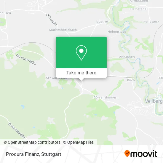
See Procura Finanz, Verwaltungsgemeinschaft Schwäbisch Hall, on the map
Public Transit to Procura Finanz in Verwaltungsgemeinschaft Schwäbisch Hall
Wondering how to get to Procura Finanz in Verwaltungsgemeinschaft Schwäbisch Hall? Moovit helps you find the best way to get to Procura Finanz with step-by-step directions from the nearest public transit station.
Moovit provides free maps and live directions to help you navigate through your city. View schedules, routes, timetables, and find out how long does it take to get to Procura Finanz in real time.
Looking for the nearest stop or station to Procura Finanz? Check out this list of stops closest to your destination: Sulzdorf Mahläcker; Sulzdorf Kirche; Sulzdorf Hauptstraße.
Bus: 12, 13, 18, RB14, 17, 5, 5E, 1.
Want to see if there’s another route that gets you there at an earlier time? Moovit helps you find alternative routes or times. Get directions from and directions to Procura Finanz easily from the Moovit App or Website.
We make riding to Procura Finanz easy, which is why over 1.5 million users, including users in Verwaltungsgemeinschaft Schwäbisch Hall, trust Moovit as the best app for public transit. You don’t need to download an individual bus app or train app, Moovit is your all-in-one transit app that helps you find the best bus time or train time available.
For information on prices of bus and train, costs and ride fares to Procura Finanz, please check the Moovit app.
Use the app to navigate to popular places including to the airport, hospital, stadium, grocery store, mall, coffee shop, school, college, and university.
Procura Finanz Address: Herdweg 40 Sulzdorf, 74523 Schwäbisch Hall street in Verwaltungsgemeinschaft Schwäbisch Hall
- P1 Racing Services,
- Systemaufstellungen,
- Ray Tiger,
- Gronbach Beton-Beteiligungen,
- Dialog,
- Amc,
- Avir Ihr Gebäudedienstleister,
- Thofe24,
- Trasmet Trading Handels,
- Steuerkanzlei Förch Daniel Förch,
- Hall-Versand,
- Wolfram Seifert Rechtsanwalt,
- Joachim Müller Rechtsanwalt,
- Ptm Professional Telemarketing,
- Scheib Baugruppe Verwaltungs,
- Agb Datenschutz Impressum,
- Naturheilpraxis Rahl,
- Systemaufstellung Familienaufstellung,
- Merando,
- Nachhilfe & Lernberatung Sven Ensinger
Places Near Procura Finanz (Verwaltungsgemeinschaft Schwäbisch Hall)
- Waldfriedhof, Degerloch,
- Hanns-Martin-Schleyer-Halle, Bad Cannstatt,
- Schleyerhalle, Bad Cannstatt,
- Wilhelma (U-Bahn Wilhelma), Bad Cannstatt,
- Mercedes-Benz Museum (Mercedes Museum Stuttgart), Bad Cannstatt,
- Im Wizemann (Halle), Bad Cannstatt,
- Mettingen Eros-Center Puff Laufhaus, Esslingen Am Neckar,
- SI-Centrum, Möhringen,
- Klinikum Stuttgart - Katharinenhospital, Stuttgart-Mitte,
- Porsche-Arena, Bad Cannstatt,
- Pariser Platz Stuttgart, Stuttgart-Mitte,
- Hauptbahnhof Stuttgart, Stuttgart-Mitte,
- FlixBus Haltestelle, Stuttgart,
- Marmorsaal Im Weissenburgpark, Stuttgart-Süd,
- Porsche Museum, Zuffenhausen,
- Mercedes-Benz Museum, Bad Cannstatt,
- Gleis 101/102 (tief), Stuttgart-Mitte,
- Geilhaus Haus 33a, Reutlingen-Betzingen,
- Hanns-Martin-Schleyer-Halle (Stuttgart Hans-Martin-Schleyerhalle), Bad Cannstatt,
- Gasometer Pforzheim, Pforzheim
How to get to popular places in Stuttgart with public transit
Get around Verwaltungsgemeinschaft Schwäbisch Hall by public transit!
Traveling around Verwaltungsgemeinschaft Schwäbisch Hall has never been so easy. See step by step directions as you travel to any attraction, street or major public transit station. View bus and train schedules, arrival times, service alerts and detailed routes on a map, so you know exactly how to get to anywhere in Verwaltungsgemeinschaft Schwäbisch Hall.
When traveling to any destination around Verwaltungsgemeinschaft Schwäbisch Hall use Moovit's Live Directions with Get Off Notifications to know exactly where and how far to walk, how long to wait for your line, and how many stops are left. Moovit will alert you when it's time to get off — no need to constantly re-check whether yours is the next stop.
Wondering how to use public transit in Verwaltungsgemeinschaft Schwäbisch Hall or how to pay for public transit in Verwaltungsgemeinschaft Schwäbisch Hall? Moovit public transit app can help you navigate your way with public transit easily, and at minimum cost. It includes public transit fees, ticket prices, and costs. Looking for a map of Verwaltungsgemeinschaft Schwäbisch Hall public transit lines? Moovit public transit app shows all public transit maps in Verwaltungsgemeinschaft Schwäbisch Hall with all Bus, Train, Subway, Light Rail, Ferry, S-Bahn and Funicular routes and stops on an interactive map.
Stuttgart has 7 transit type(s), including: Bus, Train, Subway, Light Rail, Ferry, S-Bahn and Funicular, operated by several transit agencies, including SSB - Stadtbahn, SSB, SSB - Seilbahn / Zacke, S-Bahn Stuttgart, Rhein-Neckar-Verkehr GmbH (rnv), Karlsruher Verkehrsverbund, DB AG, DB Regiobus BW, Arverio Baden-Württemberg GmbH, DB RegioNetz Verkehrs GmbH Westfrankenbahn, DB Regio AG Baden-Württemberg, Südwestdeutsche Verkehrs-AG, DB Regio AG Mitte Region Hessen, DB and Bodensee-Oberschwaben-Bahn