Directions to Produce Source Partners (Roanoke) with public transportation
The following transit lines have routes that pass near Produce Source Partners
 Bus: GREYHOUND US0600, 65, 11, 75, 12.
- Train: NORTHEAST REGIONAL.
How to get to Produce Source Partners by bus?
Click on the bus route to see step by step directions with maps, line arrival times and updated time schedules.
How to get to Produce Source Partners by train?
Click on the train route to see step by step directions with maps, line arrival times and updated time schedules.
Bus stops near Produce Source Partners in Roanoke
- Salem Avenue Wb at 6th, 1 min walk,VIEW
- Salem Avenue Wb at 5th, 4 min walk,VIEW
- 5th St at Moorman Ave, 4 min walk,VIEW
- 5th St at Gilmer Ave, 4 min walk,VIEW
- Salem Eb at 4th, 5 min walk,VIEW
- 3rd St Station Slip K, 7 min walk,VIEW
- 3rd St Station Slip L, 7 min walk,VIEW
- 3rd St Station Slip J, 7 min walk,VIEW
- 3rd St Station Slip M, 7 min walk,VIEW
- Roanoke Bus Stop, 7 min walk,VIEW
- 3rd St Station Slip I, 8 min walk,VIEW
Train station near Produce Source Partners in Roanoke
- Roanoke, 42 min walk,VIEW
Bus lines to Produce Source Partners in Roanoke
- 65, 65 - Third Street Station To Carlton & Grandin,VIEW
- 11, 11-Third Street Station To Valley View Mall,VIEW
- 75, 75 - Third Street Station To Veterans Hospital,VIEW
- 12, 12 - Valley View Mall To Third Street Station,VIEW
- 92, 3rd St Station Slip C,VIEW
- 91, East Main Wb at Lakeside Plaza (Goodwill),VIEW
- 66, 66 - Carlton & Grandin To Third Street Station,VIEW
- 76, 76 - Veterans Hospital To Third Street Station,VIEW
- 41, 11th Sb at Jamison,VIEW
- 42, 3rd St Station Slip K,VIEW
- 35, 35 - Third Street Station To Vinton,VIEW
- 36, 3rd St Station Slip L,VIEW
- 51, Tanglewood Mall (Barnes And Noble),VIEW
- 31, 31 - Third Street Station To Blue Hills,VIEW
- 32, Westbound,VIEW
- GREYHOUND US0600, Nashville Bus Station,VIEW
- 16, 16 - Valley View Mall To Third Street Station,VIEW
- 55, Tanglewood Mall (Barnes And Noble),VIEW
What are the closest stations to Produce Source Partners?
The closest stations to Produce Source Partners are:
- Salem Avenue Wb at 6th is 8 yards away, 1 min walk.
- Salem Avenue Wb at 5th is 249 yards away, 4 min walk.
- 5th St at Moorman Ave is 288 yards away, 4 min walk.
- 5th St at Gilmer Ave is 302 yards away, 4 min walk.
- Salem Eb at 4th is 326 yards away, 5 min walk.
- 3rd St Station Slip K is 541 yards away, 7 min walk.
- 3rd St Station Slip L is 558 yards away, 7 min walk.
- 3rd St Station Slip J is 568 yards away, 7 min walk.
- 3rd St Station Slip M is 570 yards away, 7 min walk.
- Roanoke Bus Stop is 584 yards away, 7 min walk.
- 3rd St Station Slip I is 629 yards away, 8 min walk.
- Roanoke is 3508 yards away, 42 min walk.
Which bus line stops near Produce Source Partners?
GREYHOUND US0600 (Nashville Bus Station)
Which train line stops near Produce Source Partners?
NORTHEAST REGIONAL (Roanoke)
What’s the nearest bus station to Produce Source Partners in Roanoke?
The nearest bus station to Produce Source Partners in Roanoke is Salem Avenue Wb at 6th. It’s a 1 min walk away.
What time is the first train to Produce Source Partners in Roanoke?
The NORTHEAST REGIONAL is the first train that goes to Produce Source Partners in Roanoke. It stops nearby at 9:35 AM.
What time is the last train to Produce Source Partners in Roanoke?
The NORTHEAST REGIONAL is the last train that goes to Produce Source Partners in Roanoke. It stops nearby at 10:13 PM.
What time is the first bus to Produce Source Partners in Roanoke?
The GREYHOUND US0600 is the first bus that goes to Produce Source Partners in Roanoke. It stops nearby at 4:35 AM.
What time is the last bus to Produce Source Partners in Roanoke?
The GREYHOUND US0600 is the last bus that goes to Produce Source Partners in Roanoke. It stops nearby at 4:35 AM.
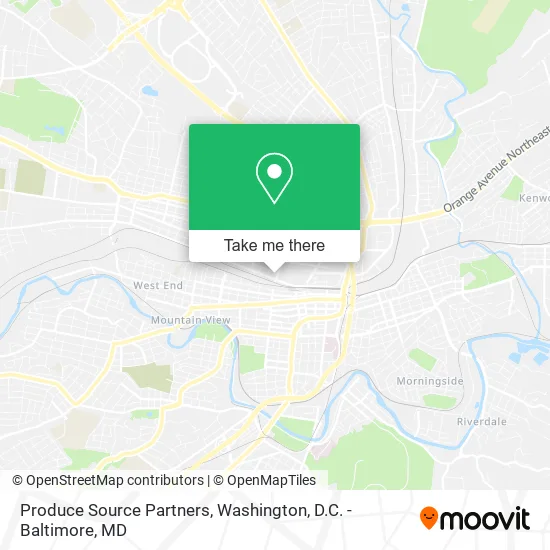
See Produce Source Partners, Roanoke, on the map
Public Transit to Produce Source Partners in Roanoke
Wondering how to get to Produce Source Partners in Roanoke? Moovit helps you find the best way to get to Produce Source Partners with step-by-step directions from the nearest public transit station.
Moovit provides free maps and live directions to help you navigate through your city. View schedules, routes, timetables, and find out how long does it take to get to Produce Source Partners in real time.
Looking for the nearest stop or station to Produce Source Partners? Check out this list of stops closest to your destination: Salem Avenue Wb at 6th; Salem Avenue Wb at 5th; 5th St at Moorman Ave; 5th St at Gilmer Ave; Salem Eb at 4th; 3rd St Station Slip K; 3rd St Station Slip L; 3rd St Station Slip J; 3rd St Station Slip M; Roanoke Bus Stop; 3rd St Station Slip I; Roanoke.
Bus: GREYHOUND US0600, 65, 11, 75, 12, 92, 91, 66, 76.Train: NORTHEAST REGIONAL.
Want to see if there’s another route that gets you there at an earlier time? Moovit helps you find alternative routes or times. Get directions from and directions to Produce Source Partners easily from the Moovit App or Website.
We make riding to Produce Source Partners easy, which is why over 1.5 million users, including users in Roanoke, trust Moovit as the best app for public transit. You don’t need to download an individual bus app or train app, Moovit is your all-in-one transit app that helps you find the best bus time or train time available.
For information on prices of bus and train, costs and ride fares to Produce Source Partners, please check the Moovit app.
Use the app to navigate to popular places including to the airport, hospital, stadium, grocery store, mall, coffee shop, school, college, and university.
Produce Source Partners Address: 116 5th St NW Roanoke, VA 24016 street in Roanoke
- Jeep Forge - Trail Forged,
- Mountain Roofing,
- Twisted Track Brewpub,
- Flowers Baking Company,
- Roanoke Craft Beer Tours,
- Mincon,
- Rexel,
- ABC Supply Co,
- Saint Pauls Memorial Methodist Episcopal Church,
- St Paul United Methodist Church,
- Advanced Metal Finishing Inc.,
- Salem Cab Service,
- Roanoke Paving,
- AS It Stands Home Improvements,
- Norfolk Southern,
- Big Lick Brewing Company,
- Beamer's 25,
- Total Action Against Poverty,
- Tap Head Start,
- Brand Hardin Sims Child DCC
Places Near Produce Source Partners (Roanoke)
- Westfield Montgomery Mall, Montgomery County,
- Warner Theatre, Washington,
- Marriott Marquis Washington, DC, Washington,
- National Zoo, Washington,
- The Anthem, Washington,
- National Museum of African American History and Culture, Washington,
- Amazon Hq2, Arlington County,
- Basilica of the National Shrine, Washington,
- Camden Yards, Baltimore,
- Washington National Cathedral, Washington,
- National Theatre, Washington,
- Washington DC VA Medical Center, Washington,
- PG Mall, Prince George's County,
- Rock Creek Tennis Center, Washington,
- Capital One Arena, Washington,
- Museum Of The Bible, Washington,
- Pennsylvania Ave NW (3rd st and pennsylvania), Washington,
- Sibley Memorial Hospital, Washington,
- M&T Bank Stadium, Baltimore,
- Georgetown, Washington
How to get to popular places in Washington, D.C. - Baltimore, MD with public transit
Get around Roanoke by public transit!
Traveling around Roanoke has never been so easy. See step by step directions as you travel to any attraction, street or major public transit station. View bus and train schedules, arrival times, service alerts and detailed routes on a map, so you know exactly how to get to anywhere in Roanoke.
When traveling to any destination around Roanoke use Moovit's Live Directions with Get Off Notifications to know exactly where and how far to walk, how long to wait for your line, and how many stops are left. Moovit will alert you when it's time to get off — no need to constantly re-check whether yours is the next stop.
Wondering how to use public transit in Roanoke or how to pay for public transit in Roanoke? Moovit public transit app can help you navigate your way with public transit easily, and at minimum cost. It includes public transit fees, ticket prices, and costs. Looking for a map of Roanoke public transit lines? Moovit public transit app shows all public transit maps in Roanoke with all Bus, Train, Metro, Light Rail and Ferry routes and stops on an interactive map.
Washington, D.C. - Baltimore, MD has 5 transit type(s), including: Bus, Train, Metro, Light Rail and Ferry, operated by several transit agencies, including WMATA, Montgomery County Ride On, Fairfax Connector, TheBus, PRTC, DASH - Alexandria, Arlington Transit (ART), RTA of Central Maryland, MDOT MTA, MDOT MTA Light RailLink, MDOT MTA Commuter Bus, MDOT MTA Local Bus, FXBGO!, Virginia Railway Express (VRE) and MARC