How to get to Professional Image by bus?
Click on the bus route to see step by step directions with maps, line arrival times and updated time schedules.
From Potomac Mills Mall, Prince William County
233 minFrom Lorton, VA - Amtrak Auto Train Station (LOR), Fairfax County
248 minFrom Rose Gaming Resort, Prince William County
258 minFrom Busch Gardens Williamsburg (Employee Parking Lot), James City County
174 minFrom Lorton, VA, Fairfax County
242 minFrom Amazon Fulfillment Center-Ric3, Richmond
67 minFrom Woodbridge, VA, Prince William County
177 minFrom UVA Hospital Medical Center, Charlottesville
322 min
Bus stop near Professional Image in Richmond
- Midlothian + Arcadia, 7 min walk,VIEW
Bus lines to Professional Image in Richmond
What are the closest stations to Professional Image?
The closest stations to Professional Image are:
- Midlothian + Arcadia is 507 yards away, 7 min walk.
Which bus line stops near Professional Image?
1A (Hull/Midlothian Via Southside Plaza)
What’s the nearest bus station to Professional Image in Richmond?
The nearest bus station to Professional Image in Richmond is Midlothian + Arcadia. It’s a 7 min walk away.
What time is the first bus to Professional Image in Richmond?
The 1A is the first bus that goes to Professional Image in Richmond. It stops nearby at 5:13 AM.
What time is the last bus to Professional Image in Richmond?
The 1A is the last bus that goes to Professional Image in Richmond. It stops nearby at 12:44 AM.
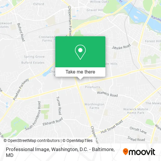
See Professional Image, Richmond, on the map
Public Transit to Professional Image in Richmond
Wondering how to get to Professional Image in Richmond? Moovit helps you find the best way to get to Professional Image with step-by-step directions from the nearest public transit station.
Moovit provides free maps and live directions to help you navigate through your city. View schedules, routes, timetables, and find out how long does it take to get to Professional Image in real time.
Looking for the nearest stop or station to Professional Image? Check out this list of stops closest to your destination: Midlothian + Arcadia.
Bus: 1A, 2B.
Want to see if there’s another route that gets you there at an earlier time? Moovit helps you find alternative routes or times. Get directions from and directions to Professional Image easily from the Moovit App or Website.
We make riding to Professional Image easy, which is why over 1.5 million users, including users in Richmond, trust Moovit as the best app for public transit. You don’t need to download an individual bus app or train app, Moovit is your all-in-one transit app that helps you find the best bus time or train time available.
For information on prices of bus and train, costs and ride fares to Professional Image, please check the Moovit app.
Use the app to navigate to popular places including to the airport, hospital, stadium, grocery store, mall, coffee shop, school, college, and university.
Professional Image Address: 121 Wyck St Richmond, VA 23225 street in Richmond
- Holisticoncepts,
- Richmond Captain Locks & Doors,
- Jesus Finest Christians,
- Dreamscape Transport,
- Information Management Solutions,
- Faith Harvest International Church,
- Romeo Branch,
- More Than Basic Hair Salon,
- VA Doc Headquarters,
- Virginia Department of Corrections,
- Commonwealth of Virginia Corrections Dept,
- My Father's House Christian Acade,
- Christian Tabernacle Bapt Church,
- Coleman Dental Studio,
- New Jerusalem Outreach,
- Wanya's Barber Shop,
- Church of Pentecost,
- Probation Parole District 1 Richmond,
- Chapel Valley Landscape Company,
- Phoenix Roofing Co.
Places Near Professional Image (Richmond)
- National Theatre, Washington,
- Marriott Marquis Washington, DC, Washington,
- M&T Bank Stadium, Baltimore,
- Warner Theatre, Washington,
- Washington National Cathedral, Washington,
- Georgetown, Washington,
- Sibley Memorial Hospital, Washington,
- National Zoo, Washington,
- Basilica of the National Shrine, Washington,
- Museum Of The Bible, Washington,
- Washington DC VA Medical Center, Washington,
- The Anthem, Washington,
- PG Mall, Prince George's County,
- Westfield Montgomery Mall, Montgomery County,
- Amazon Hq2, Arlington County,
- Capital One Arena, Washington,
- Camden Yards, Baltimore,
- Rock Creek Tennis Center, Washington,
- Pennsylvania Ave NW (3rd st and pennsylvania), Washington,
- National Museum of African American History and Culture, Washington
How to get to popular places in Washington, D.C. - Baltimore, MD with public transit
Get around Richmond by public transit!
Traveling around Richmond has never been so easy. See step by step directions as you travel to any attraction, street or major public transit station. View bus and train schedules, arrival times, service alerts and detailed routes on a map, so you know exactly how to get to anywhere in Richmond.
When traveling to any destination around Richmond use Moovit's Live Directions with Get Off Notifications to know exactly where and how far to walk, how long to wait for your line, and how many stops are left. Moovit will alert you when it's time to get off — no need to constantly re-check whether yours is the next stop.
Wondering how to use public transit in Richmond or how to pay for public transit in Richmond? Moovit public transit app can help you navigate your way with public transit easily, and at minimum cost. It includes public transit fees, ticket prices, and costs. Looking for a map of Richmond public transit lines? Moovit public transit app shows all public transit maps in Richmond with all Bus, Train, Metro, Light Rail and Ferry routes and stops on an interactive map.
Washington, D.C. - Baltimore, MD has 5 transit type(s), including: Bus, Train, Metro, Light Rail and Ferry, operated by several transit agencies, including WMATA, Montgomery County Ride On, Fairfax Connector, TheBus, PRTC, DASH - Alexandria, Arlington Transit (ART), RTA of Central Maryland, MDOT MTA, MDOT MTA Light RailLink, MDOT MTA Commuter Bus, MDOT MTA Local Bus, FXBGO!, Virginia Railway Express (VRE) and MARC