Directions to Progress-Index (Petersburg) with public transportation
The following transit lines have routes that pass near Progress-Index
 Bus: 3, 95, 4, 5, 6.
- Train: CAROLINIAN, NORTHEAST REGIONAL, PALMETTO, FLORIDIAN, SILVER METEOR.
How to get to Progress-Index by bus?
Click on the bus route to see step by step directions with maps, line arrival times and updated time schedules.
From Potomac Mills Mall, Prince William County
507 minFrom Lorton, VA, Fairfax County
516 minFrom Lorton, VA - Amtrak Auto Train Station (LOR), Fairfax County
522 minFrom Rose Gaming Resort, Prince William County
532 minFrom Busch Gardens Williamsburg (Employee Parking Lot), James City County
328 minFrom Amazon Fulfillment Center-Ric3, Richmond
183 minFrom Woodbridge, VA, Prince William County
263 minFrom UVA Hospital Medical Center, Charlottesville
596 min
How to get to Progress-Index by train?
Click on the train route to see step by step directions with maps, line arrival times and updated time schedules.
Bus stops near Progress-Index in Petersburg
Train station near Progress-Index in Petersburg
- Petersburg Amtrak Station, 44 min walk,VIEW
Bus lines to Progress-Index in Petersburg
- 4, Petersburg Station,VIEW
- 5, County Drive,VIEW
- 6, South Crater Road,VIEW
- 24, Blandford Puddledock,VIEW
- 25, South Crater/County Drive,VIEW
- 21, Richard Bland College,VIEW
- GREYHOUND US0670, Atlanta Bus Station,VIEW
- 3, Petersburg Station,VIEW
- 95, 95x Richmond-Petersburg Express (Pbg),VIEW
- DINWIDDIE EXPRESS, Edgehill Shopping Center,VIEW
- 22 - SOUTH PARK/ETTRICK, Southpark Circle (Regal 16 Cinema),VIEW
- 23, Petersburg Station,VIEW
What are the closest stations to Progress-Index?
The closest stations to Progress-Index are:
- Washington Street And Jefferson Street is 349 yards away, 5 min walk.
- Wythe Street And Adams Street is 400 yards away, 6 min walk.
- Sycamore Street And Surry Lane (Sycamore Towers) is 411 yards away, 6 min walk.
- Petersburg Transportation Center is 412 yards away, 6 min walk.
- Adams St And E Bank St is 449 yards away, 6 min walk.
- Petersburg Transit Center is 482 yards away, 7 min walk.
- Petersburg Amtrak Station is 3740 yards away, 44 min walk.
Which bus lines stop near Progress-Index?
These bus lines stop near Progress-Index: 3, 95.
Which train lines stop near Progress-Index?
These train lines stop near Progress-Index: CAROLINIAN, NORTHEAST REGIONAL, PALMETTO.
What’s the nearest bus station to Progress-Index in Petersburg?
The nearest bus station to Progress-Index in Petersburg is Washington Street And Jefferson Street. It’s a 5 min walk away.
What time is the first train to Progress-Index in Petersburg?
The NORTHEAST REGIONAL is the first train that goes to Progress-Index in Petersburg. It stops nearby at 10:25 AM.
What time is the last train to Progress-Index in Petersburg?
The SILVER METEOR is the last train that goes to Progress-Index in Petersburg. It stops nearby at 2:53 AM.
What time is the first bus to Progress-Index in Petersburg?
The 21 is the first bus that goes to Progress-Index in Petersburg. It stops nearby at 6:15 AM.
What time is the last bus to Progress-Index in Petersburg?
The GREYHOUND US0670 is the last bus that goes to Progress-Index in Petersburg. It stops nearby at 1:30 PM.
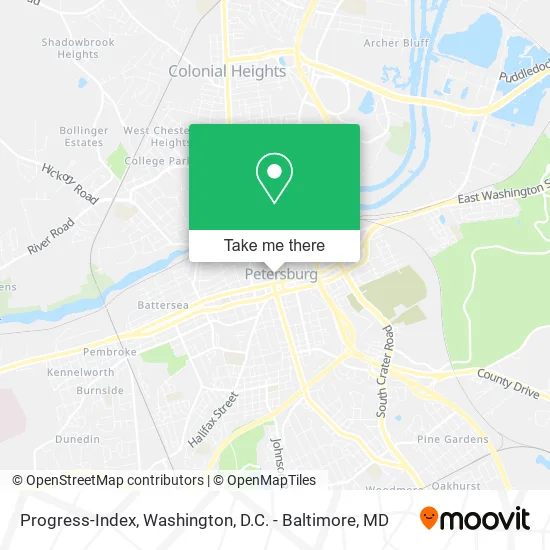
See Progress-Index, Petersburg, on the map
Public Transit to Progress-Index in Petersburg
Wondering how to get to Progress-Index in Petersburg? Moovit helps you find the best way to get to Progress-Index with step-by-step directions from the nearest public transit station.
Moovit provides free maps and live directions to help you navigate through your city. View schedules, routes, timetables, and find out how long does it take to get to Progress-Index in real time.
Looking for the nearest stop or station to Progress-Index? Check out this list of stops closest to your destination: Washington Street And Jefferson Street; Wythe Street And Adams Street; Sycamore Street And Surry Lane (Sycamore Towers); Petersburg Transportation Center; Adams St And E Bank St; Petersburg Transit Center; Petersburg Amtrak Station.
Bus: 3, 95, 4, 5, 6, 24, 25, GREYHOUND US0670, 21.Train: CAROLINIAN, NORTHEAST REGIONAL, PALMETTO, FLORIDIAN, SILVER METEOR.
Want to see if there’s another route that gets you there at an earlier time? Moovit helps you find alternative routes or times. Get directions from and directions to Progress-Index easily from the Moovit App or Website.
We make riding to Progress-Index easy, which is why over 1.5 million users, including users in Petersburg, trust Moovit as the best app for public transit. You don’t need to download an individual bus app or train app, Moovit is your all-in-one transit app that helps you find the best bus time or train time available.
For information on prices of bus, train and metro, costs and ride fares to Progress-Index, please check the Moovit app.
Use the app to navigate to popular places including to the airport, hospital, stadium, grocery store, mall, coffee shop, school, college, and university.
Progress-Index Address: 15 Franklin St Petersburg, VA 23803 street in Petersburg
- The Hip Hop Spot,
- Business,
- Sashae's Beauty Salon,
- Meet Your Needs Boutique,
- Sams Cleaners,
- KRC Solutions,
- Karen's House of Beauty,
- Glass Slipper Ballroom,
- Nicole's House of,
- Petersburg Post Office,
- Petersburg Electric,
- USPS,
- Post Office,
- Federal Employees Credit Union,
- FedEx Drop Box,
- Auto Repair Oil Change,
- Charles V. Hardenbergh, PC,
- Walton Gallery,
- New York Life Insurance Company,
- Alrod Enterprises
Places Near Progress-Index (Petersburg)
- Rock Creek Tennis Center, Washington,
- Westfield Montgomery Mall, Montgomery County,
- The Anthem, Washington,
- Washington DC VA Medical Center, Washington,
- Washington National Cathedral, Washington,
- Pennsylvania Ave NW (3rd st and pennsylvania), Washington,
- M&T Bank Stadium, Baltimore,
- Marriott Marquis Washington, DC, Washington,
- Georgetown, Washington,
- Basilica of the National Shrine, Washington,
- National Zoo, Washington,
- Museum Of The Bible, Washington,
- National Museum of African American History and Culture, Washington,
- Sibley Memorial Hospital, Washington,
- Warner Theatre, Washington,
- Capital One Arena, Washington,
- National Mall, Washington,
- PG Mall, Prince George's County,
- Camden Yards, Baltimore,
- Amazon Hq2, Arlington County
How to get to popular places in Washington, D.C. - Baltimore, MD with public transit
Get around Petersburg by public transit!
Traveling around Petersburg has never been so easy. See step by step directions as you travel to any attraction, street or major public transit station. View bus and train schedules, arrival times, service alerts and detailed routes on a map, so you know exactly how to get to anywhere in Petersburg.
When traveling to any destination around Petersburg use Moovit's Live Directions with Get Off Notifications to know exactly where and how far to walk, how long to wait for your line, and how many stops are left. Moovit will alert you when it's time to get off — no need to constantly re-check whether yours is the next stop.
Wondering how to use public transit in Petersburg or how to pay for public transit in Petersburg? Moovit public transit app can help you navigate your way with public transit easily, and at minimum cost. It includes public transit fees, ticket prices, and costs. Looking for a map of Petersburg public transit lines? Moovit public transit app shows all public transit maps in Petersburg with all Bus, Train, Metro, Light Rail and Ferry routes and stops on an interactive map.
Washington, D.C. - Baltimore, MD has 5 transit type(s), including: Bus, Train, Metro, Light Rail and Ferry, operated by several transit agencies, including WMATA, Montgomery County Ride On, Fairfax Connector, TheBus, PRTC, DASH - Alexandria, Arlington Transit (ART), RTA of Central Maryland, MDOT MTA, MDOT MTA Light RailLink, MDOT MTA Commuter Bus, MDOT MTA Local Bus, FXBGO!, Virginia Railway Express (VRE) and MARC