Directions to Progressive (Baltimore) with public transportation
The following transit lines have routes that pass near Progressive
 Bus: 34, 80, CITYLINK LIME, 38.
- Metro: METRO.
How to get to Progressive by bus?
Click on the bus route to see step by step directions with maps, line arrival times and updated time schedules.
From Maryland, Baltimore
32 minFrom Renaissance Baltimore Harborplace Hotel, Baltimore
32 minFrom Towson, MD, Baltimore County
56 minFrom Canton, Baltimore
57 minFrom Medstar Harbor Hospital, Baltimore
58 minFrom Walters Art Museum, Baltimore
30 minFrom Port of Baltimore - Cruise Maryland Terminal, Baltimore
64 minFrom Johns Hopkins Medicine at Green Spring Station, Baltimore County
55 minFrom Hilton Baltimore, Baltimore
32 minFrom Clarence M. Mitchell, Jr. Courthouse, Baltimore
40 min
How to get to Progressive by metro?
Click on the metro route to see step by step directions with maps, line arrival times and updated time schedules.
Bus stops near Progressive in Baltimore
Metro station near Progressive in Baltimore
- Mondawmin Metro, 36 min walk,VIEW
Light Rail stations near Progressive in Baltimore
- Woodberry, 64 min walk,VIEW
Bus lines to Progressive in Baltimore
What are the closest stations to Progressive?
The closest stations to Progressive are:
- Garrison Blvd & Dorchester Rd Nb is 144 yards away, 2 min walk.
- Liberty Heights Ave & Garrison Blvd Nwb is 202 yards away, 3 min walk.
- Liberty Heights & Ayrdale Ave FS Sb is 299 yards away, 4 min walk.
- Liberty Heights Ave & Carsdale Ave Wb is 454 yards away, 6 min walk.
- Mondawmin Metro is 3007 yards away, 36 min walk.
- Woodberry is 5447 yards away, 64 min walk.
Which bus lines stop near Progressive?
These bus lines stop near Progressive: 34, 80, CITYLINK LIME.
Which metro line stops near Progressive?
METRO (Towards Owing Mills)
What’s the nearest bus station to Progressive in Baltimore?
The nearest bus station to Progressive in Baltimore is Garrison Blvd & Dorchester Rd Nb. It’s a 2 min walk away.
What time is the first light rail to Progressive in Baltimore?
The LIGHT RAILLINK is the first light rail that goes to Progressive in Baltimore. It stops nearby at 4:26 AM.
What time is the last light rail to Progressive in Baltimore?
The LIGHT RAILLINK is the last light rail that goes to Progressive in Baltimore. It stops nearby at 12:47 AM.
What time is the first metro to Progressive in Baltimore?
The METRO is the first metro that goes to Progressive in Baltimore. It stops nearby at 3:45 AM.
What time is the last metro to Progressive in Baltimore?
The METRO is the last metro that goes to Progressive in Baltimore. It stops nearby at 12:21 AM.
What time is the first bus to Progressive in Baltimore?
The 80 is the first bus that goes to Progressive in Baltimore. It stops nearby at 3:04 AM.
What time is the last bus to Progressive in Baltimore?
The 80 is the last bus that goes to Progressive in Baltimore. It stops nearby at 3:17 AM.
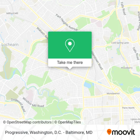
See Progressive, Baltimore, on the map
Public Transit to Progressive in Baltimore
Wondering how to get to Progressive in Baltimore? Moovit helps you find the best way to get to Progressive with step-by-step directions from the nearest public transit station.
Moovit provides free maps and live directions to help you navigate through your city. View schedules, routes, timetables, and find out how long does it take to get to Progressive in real time.
Looking for the nearest stop or station to Progressive? Check out this list of stops closest to your destination: Garrison Blvd & Dorchester Rd Nb; Liberty Heights Ave & Garrison Blvd Nwb; Liberty Heights & Ayrdale Ave FS Sb; Liberty Heights Ave & Carsdale Ave Wb; Mondawmin Metro; Woodberry.
Bus: 34, 80, CITYLINK LIME, 38.Metro: METRO.
Want to see if there’s another route that gets you there at an earlier time? Moovit helps you find alternative routes or times. Get directions from and directions to Progressive easily from the Moovit App or Website.
We make riding to Progressive easy, which is why over 1.5 million users, including users in Baltimore, trust Moovit as the best app for public transit. You don’t need to download an individual bus app or train app, Moovit is your all-in-one transit app that helps you find the best bus time or train time available.
For information on prices of bus and metro, costs and ride fares to Progressive, please check the Moovit app.
Use the app to navigate to popular places including to the airport, hospital, stadium, grocery store, mall, coffee shop, school, college, and university.
Progressive Address: 3810 Egerton Rd Baltimore, MD 21215 street in Baltimore
- Bright Lights Child Care,
- Total by Verizon,
- Rite Aid,
- Dollar Tree,
- Garrison and Liberty Heights,
- Liberty Heights Ave (liberty heights ave / garrison blvd),
- Liberty Heights Ave (garrison & liberty heights),
- Liberty Dollar Store,
- Liberty Deli & Grocery,
- Liberty Tobacco,
- BMO Harris Bank,
- Foi Baltimore,
- Muslimat al Nisaa,
- Atm,
- Epic Pharmacies,
- Aall Around Tow Pest Control,
- Bp,
- Dollar Fast Food,
- Rent A Room USA,
- Baltimore City
Places Near Progressive (Baltimore)
- M&T Bank Stadium, Baltimore,
- Warner Theatre, Washington,
- National Zoo, Washington,
- National Mall, Washington,
- Westfield Montgomery Mall, Montgomery County,
- Basilica of the National Shrine, Washington,
- Washington National Cathedral, Washington,
- Pennsylvania Ave NW (3rd st and pennsylvania), Washington,
- The Anthem, Washington,
- National Museum of African American History and Culture, Washington,
- Georgetown, Washington,
- Washington DC VA Medical Center, Washington,
- Rock Creek Tennis Center, Washington,
- Amazon Hq2, Arlington County,
- PG Mall, Prince George's County,
- Marriott Marquis Washington, DC, Washington,
- Capital One Arena, Washington,
- Camden Yards, Baltimore,
- Museum Of The Bible, Washington,
- Sibley Memorial Hospital, Washington
How to get to popular places in Washington, D.C. - Baltimore, MD with public transit
Get around Baltimore by public transit!
Traveling around Baltimore has never been so easy. See step by step directions as you travel to any attraction, street or major public transit station. View bus and train schedules, arrival times, service alerts and detailed routes on a map, so you know exactly how to get to anywhere in Baltimore.
When traveling to any destination around Baltimore use Moovit's Live Directions with Get Off Notifications to know exactly where and how far to walk, how long to wait for your line, and how many stops are left. Moovit will alert you when it's time to get off — no need to constantly re-check whether yours is the next stop.
Wondering how to use public transit in Baltimore or how to pay for public transit in Baltimore? Moovit public transit app can help you navigate your way with public transit easily, and at minimum cost. It includes public transit fees, ticket prices, and costs. Looking for a map of Baltimore public transit lines? Moovit public transit app shows all public transit maps in Baltimore with all Bus, Train, Metro, Light Rail and Ferry routes and stops on an interactive map.
Washington, D.C. - Baltimore, MD has 5 transit type(s), including: Bus, Train, Metro, Light Rail and Ferry, operated by several transit agencies, including WMATA, Montgomery County Ride On, Fairfax Connector, TheBus, PRTC, DASH - Alexandria, Arlington Transit (ART), RTA of Central Maryland, MDOT MTA, MDOT MTA Light RailLink, MDOT MTA Commuter Bus, MDOT MTA Local Bus, FXBGO!, Virginia Railway Express (VRE) and MARC