How to get to Progressive Insurance by bus?
Click on the bus route to see step by step directions with maps, line arrival times and updated time schedules.
From Redbox, Indianapolis City (Balance)
103 minFrom Allisonville Rd & 81st St, Indianapolis City (Balance)
107 minFrom Indianapolis Seo Company, Indianapolis City (Balance)
82 minFrom 2626 E 46th St, Indianapolis City (Balance)
75 minFrom Coinstar - Bitcoin ATM, Indianapolis City (Balance)
92 minFrom Insta Pro Construction, Indianapolis City (Balance)
91 minFrom I-65 and Michigan, Indianapolis City (Balance)
46 minFrom Randstad, Indianapolis City (Balance)
91 min
Bus stop near Progressive Insurance in Indianapolis City (Balance)
- Harcourt Rd & John Ambers, 4 min walk,VIEW
Bus lines to Progressive Insurance in Indianapolis City (Balance)
What are the closest stations to Progressive Insurance?
The closest stations to Progressive Insurance are:
- Harcourt Rd & John Ambers is 268 yards away, 4 min walk.
Which bus lines stop near Progressive Insurance?
These bus lines stop near Progressive Insurance: 28, 34.
What’s the nearest bus station to Progressive Insurance in Indianapolis City (Balance)?
The nearest bus station to Progressive Insurance in Indianapolis City (Balance) is Harcourt Rd & John Ambers. It’s a 4 min walk away.
What time is the first bus to Progressive Insurance in Indianapolis City (Balance)?
The 34 is the first bus that goes to Progressive Insurance in Indianapolis City (Balance). It stops nearby at 4:36 AM.
What time is the last bus to Progressive Insurance in Indianapolis City (Balance)?
The 34 is the last bus that goes to Progressive Insurance in Indianapolis City (Balance). It stops nearby at 11:24 PM.
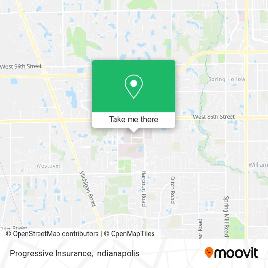
See Progressive Insurance, Indianapolis City (Balance), on the map
Public Transit to Progressive Insurance in Indianapolis City (Balance)
Wondering how to get to Progressive Insurance in Indianapolis City (Balance)? Moovit helps you find the best way to get to Progressive Insurance with step-by-step directions from the nearest public transit station.
Moovit provides free maps and live directions to help you navigate through your city. View schedules, routes, timetables, and find out how long does it take to get to Progressive Insurance in real time.
Looking for the nearest stop or station to Progressive Insurance? Check out this list of stops closest to your destination: Harcourt Rd & John Ambers.
Bus: 28, 34.
Want to see if there’s another route that gets you there at an earlier time? Moovit helps you find alternative routes or times. Get directions from and directions to Progressive Insurance easily from the Moovit App or Website.
We make riding to Progressive Insurance easy, which is why over 1.5 million users, including users in Indianapolis City (Balance), trust Moovit as the best app for public transit. You don’t need to download an individual bus app or train app, Moovit is your all-in-one transit app that helps you find the best bus time or train time available.
For information on prices of bus, costs and ride fares to Progressive Insurance, please check the Moovit app.
Use the app to navigate to popular places including to the airport, hospital, stadium, grocery store, mall, coffee shop, school, college, and university.
Progressive Insurance Address: 8333 Naab Rd Indianapolis, IN 46260 street in Indianapolis City (Balance)
- Indianapolis Neurosurg,
- Days Garage Door,
- Dr Steven M James, MD,
- St. Vincent Heart Center of Indiana,
- St Vincent Hospital Gift Shop,
- St. Vincent Indianapolis Hospital,
- Peyton Manning Children's Hospital at Ascension St. Vincent Evansville - Pediatric Emergency,
- Peyton Manning Children's Hospital at Ascension St. Vincent - Endocrinology & Diabetes Center,
- Peyton Manning Children's Hospital at Ascension St. Vincent - Pediatric Ear, Nose and Throat,
- Peyton Manning Children's Hospital at Ascension St. Vincent Evansville,
- St. Vincent Neuropsychology -7th floor,
- Peyton Manning Children's Hospital at St.Vincent,
- Heather L. Misra, MD,
- Metro Infusion Center,
- Hohman Laura - Pediatric Neurology Paton Manning,
- Anne M Adams MD,
- Natasha J. Tomlinson, MD (Donald J. Miller, do),
- Jennifer Helen Tobison Pharmd,
- Benjamin Elliot Lippincott,
- Skinner, Brian W
Places Near Progressive Insurance (Indianapolis City (Balance))
- Lucas Oil Stadium, Indianapolis City (Balance),
- St. Vincent entrance #1, Indianapolis City (Balance),
- Cotter's Massage Parlor With Happy Endings, Indianapolis City (Balance),
- Castleton Square Mall, Indianapolis,
- I U Health Methodist Hospital, Indianapolis City (Balance),
- St. Vincent Hospital - Indianapolis, Indianapolis City (Balance),
- Indiana Convention Center, Indianapolis City (Balance),
- I-465 / I-65 Interchange, Indianapolis City (Balance),
- Gainbridge Fieldhouse, Indianapolis City (Balance),
- Indianapolis Airport Zone 2, Indianapolis City (Balance),
- Indianapolis Motor Speedway, Speedway,
- Methodist Hospital of Indianapolis, Indianapolis City (Balance),
- Jersey Barn, Indianapolis City (Balance),
- Plainfield, IN, Plainfield,
- Lilly Corporate Center (Eli Lilly & Co), Indianapolis City (Balance),
- Train Ride At Castleton Mall, Indianapolis City (Balance),
- THE BALT, Indianapolis City (Balance),
- Indiana, Indianapolis City (Balance),
- 119 W 19th St Parking, Indianapolis City (Balance),
- Eskenazi Hospital, Indianapolis City (Balance)
How to get to popular places in Indianapolis with public transit
Get around Indianapolis City (Balance) by public transit!
Traveling around Indianapolis City (Balance) has never been so easy. See step by step directions as you travel to any attraction, street or major public transit station. View bus and train schedules, arrival times, service alerts and detailed routes on a map, so you know exactly how to get to anywhere in Indianapolis City (Balance).
When traveling to any destination around Indianapolis City (Balance) use Moovit's Live Directions with Get Off Notifications to know exactly where and how far to walk, how long to wait for your line, and how many stops are left. Moovit will alert you when it's time to get off — no need to constantly re-check whether yours is the next stop.
Wondering how to use public transit in Indianapolis City (Balance) or how to pay for public transit in Indianapolis City (Balance)? Moovit public transit app can help you navigate your way with public transit easily, and at minimum cost. It includes public transit fees, ticket prices, and costs. Looking for a map of Indianapolis City (Balance) public transit lines? Moovit public transit app shows all public transit maps in Indianapolis City (Balance) with all bus routes and stops on an interactive map.
Indianapolis has 1 transit type(s), including: bus, operated by several transit agencies, including IndyGo, FlixBus-us and Greyhound-us